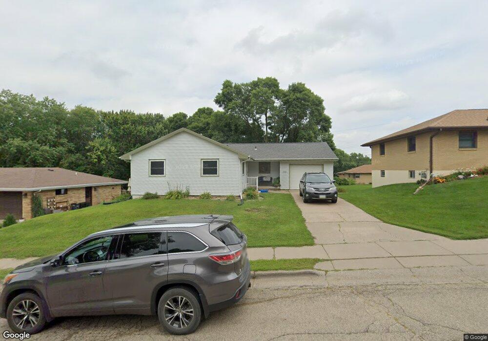
3085 Westmore Dr Dubuque, IA 52001
Estimated Value: $231,000 - $256,453
4
Beds
2
Baths
2,098
Sq Ft
$116/Sq Ft
Est. Value
About This Home
This home is located at 3085 Westmore Dr, Dubuque, IA 52001 and is currently estimated at $243,613, approximately $116 per square foot. 3085 Westmore Dr is a home located in Dubuque County with nearby schools including Eisenhower Elementary School, Eleanor Roosevelt Middle School, and Dubuque Senior High School.
Ownership History
Date
Name
Owned For
Owner Type
Purchase Details
Closed on
Dec 14, 2018
Sold by
Burchette Carol J
Bought by
Carol J Burchette Living Trust
Current Estimated Value
Purchase Details
Closed on
Nov 22, 2013
Sold by
Leonard Timothy M and Leonard Brooke M
Bought by
Burchette Carol J
Purchase Details
Closed on
May 28, 2010
Sold by
Daack Mark T and Daack Jessica M
Bought by
Leonard Timothy M and Leonard Brooke M
Home Financials for this Owner
Home Financials are based on the most recent Mortgage that was taken out on this home.
Original Mortgage
$130,150
Interest Rate
5.12%
Mortgage Type
New Conventional
Create a Home Valuation Report for This Property
The Home Valuation Report is an in-depth analysis detailing your home's value as well as a comparison with similar homes in the area
Purchase History
| Date | Buyer | Sale Price | Title Company |
|---|---|---|---|
| Carol J Burchette Living Trust | -- | None Available | |
| Burchette Carol J | $148,000 | None Available | |
| Leonard Timothy M | $137,000 | None Available |
Source: Public Records
Mortgage History
| Date | Status | Borrower | Loan Amount |
|---|---|---|---|
| Previous Owner | Leonard Timothy M | $130,150 |
Source: Public Records
Tax History
| Year | Tax Paid | Tax Assessment Tax Assessment Total Assessment is a certain percentage of the fair market value that is determined by local assessors to be the total taxable value of land and additions on the property. | Land | Improvement |
|---|---|---|---|---|
| 2025 | $2,544 | $216,000 | $41,900 | $174,100 |
| 2024 | $2,544 | $200,800 | $38,100 | $162,700 |
| 2023 | $2,560 | $200,800 | $38,100 | $162,700 |
| 2022 | $2,616 | $167,100 | $34,300 | $132,800 |
| 2021 | $2,616 | $167,100 | $34,300 | $132,800 |
| 2020 | $2,456 | $146,890 | $32,390 | $114,500 |
| 2019 | $2,472 | $146,890 | $32,390 | $114,500 |
| 2018 | $2,430 | $141,440 | $30,490 | $110,950 |
| 2017 | $2,376 | $141,440 | $30,490 | $110,950 |
| 2016 | $2,376 | $131,510 | $30,490 | $101,020 |
| 2015 | $2,322 | $131,510 | $30,490 | $101,020 |
| 2014 | $2,224 | $129,530 | $30,490 | $99,040 |
Source: Public Records
Map
Nearby Homes
- 2930 Kane #1 St
- 2330 Evergreen Dr
- 2665 Marywood Dr
- 2690 Renaissance Unit 4 Dr
- 2315 Pasadena Dr
- 2160 Avalon Rd
- 3463 Kimberly Dr
- 1610 Kane St
- 2035 Broadlawn Rd
- 2201 Del Monaco Dr
- 2204 Graham Cir
- 1930 Saint Anne Ct
- 2192 Fairway Dr
- 3470 Hillcrest Rd Unit 13
- Lot 16 Tiffany Ct Unit (Spiked Lemonade pla
- Lot 15 Tiffany Ct Unit (The Middle Child Fl
- Lot 3 Tiffany Ct Unit (The Middle Child Fl
- 2452 Tiffany Ct Unit (The 3 Year Old floo
- 2328 Tiffany Ct Unit (I'm Old But Still C
- 2470 Tiffany Ct Unit (The 2 Year Old floo
- 3095 Westmore Dr
- 3077 Westmore Dr
- 3070 Kane Ct
- 3066 Kane Ct
- 3105 Westmore Dr
- 3063 Westmore Dr
- 3082 Westmore Dr
- 3090 Westmore Dr
- 3058 Kane Ct
- 3098 Westmore Dr
- 3115 Westmore Dr
- 3057 Westmore Dr
- 3060 Westmore Dr
- 3074 Kane Ct
- 3052 Kane Ct
- 3110 Westmore Dr
- 3052 Westmore Dr
- 3125 Westmore Dr
- 3049 Westmore Dr
- 3061 Kane Ct
Your Personal Tour Guide
Ask me questions while you tour the home.