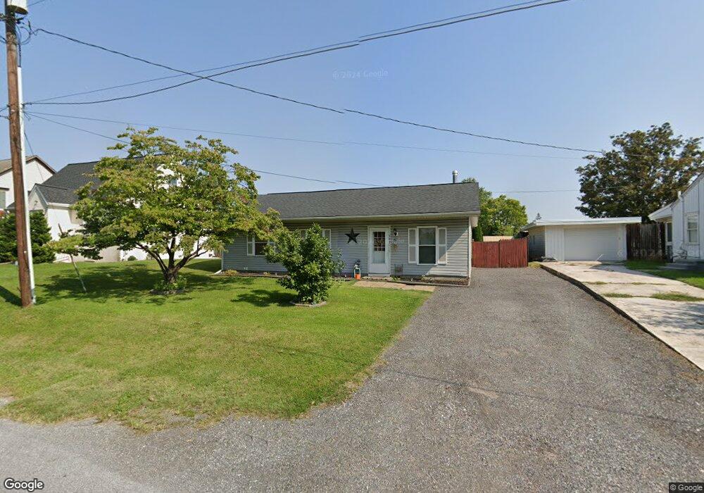
309 E Locust St Union Bridge, MD 21791
Estimated Value: $254,095 - $330,000
2
Beds
1
Bath
1,000
Sq Ft
$294/Sq Ft
Est. Value
About This Home
This home is located at 309 E Locust St, Union Bridge, MD 21791 and is currently estimated at $293,524, approximately $293 per square foot. 309 E Locust St is a home located in Carroll County with nearby schools including Elmer A. Wolfe Elementary School, Northwest Middle School, and Francis Scott Key High School.
Ownership History
Date
Name
Owned For
Owner Type
Purchase Details
Closed on
Apr 5, 2010
Sold by
Citimortgage Inc
Bought by
Summers James E and Summers Catherine
Current Estimated Value
Purchase Details
Closed on
Mar 10, 2010
Sold by
Spielman Dwight K
Bought by
Citimortgage Inc
Purchase Details
Closed on
Jun 18, 2004
Sold by
Fritsch Scott A
Bought by
Spielman Dwight K
Purchase Details
Closed on
Mar 1, 1996
Sold by
Ridgely Andrew J
Bought by
Myers Vicki J and Nitsch Frederick A
Create a Home Valuation Report for This Property
The Home Valuation Report is an in-depth analysis detailing your home's value as well as a comparison with similar homes in the area
Purchase History
| Date | Buyer | Sale Price | Title Company |
|---|---|---|---|
| Summers James E | $69,000 | -- | |
| Citimortgage Inc | $102,267 | -- | |
| Spielman Dwight K | $159,900 | -- | |
| Myers Vicki J | $160,000 | -- |
Source: Public Records
Tax History
| Year | Tax Paid | Tax Assessment Tax Assessment Total Assessment is a certain percentage of the fair market value that is determined by local assessors to be the total taxable value of land and additions on the property. | Land | Improvement |
|---|---|---|---|---|
| 2025 | $2,884 | $196,233 | $0 | $0 |
| 2024 | $2,651 | $180,367 | $0 | $0 |
| 2023 | $2,418 | $164,500 | $72,600 | $91,900 |
| 2022 | $2,391 | $162,700 | $0 | $0 |
| 2021 | $2,365 | $160,900 | $0 | $0 |
| 2020 | $2,338 | $159,100 | $72,600 | $86,500 |
| 2019 | $2,310 | $156,100 | $0 | $0 |
| 2018 | $2,250 | $153,100 | $0 | $0 |
| 2017 | $2,206 | $150,100 | $0 | $0 |
| 2016 | -- | $150,100 | $0 | $0 |
| 2015 | -- | $150,100 | $0 | $0 |
| 2014 | -- | $151,200 | $0 | $0 |
Source: Public Records
Map
Nearby Homes
- 312 E Broadway St
- 11420 Green Valley Rd
- 100 George St
- 244 Stem Rd
- 57B Hoff Rd
- 285 Stem Rd
- 0 Stem Rd
- 3875 Bark Hill Rd
- 101 Clear Ridge Rd
- 6200 Middleburg Rd
- 9630 B Clemsonville Rd
- 0 Crouse Mill Rd Unit MDCR2032650
- 0 Crouse Mill Rd Unit MDCR2032878
- 120 Water St
- 3348 Uniontown Rd
- 0 Crouse Mill
- 1038 Green Valley Rd
- 1309 Trevanion Rd
- 703 S Springdale Rd
- 107 S Springdale Ave
- 311 E Locust St
- 305 E Locust St
- 102 Bellvue St
- 314 E Thomas St
- 316 E Thomas St
- 308 Shriner Aly
- 318 E Thomas St
- 310 E Thomas St
- 308 E Thomas St
- 304 E Thomas St
- 301 E Locust St
- 313 E Thomas St
- 3 S Lightner St
- 309 E Thomas St
- 306 E Thomas St
- 315 E Thomas St
- 101 S Lightner St
- 103 S Lightner St
- 307 E Thomas St
- 401 Thomas St E
Your Personal Tour Guide
Ask me questions while you tour the home.