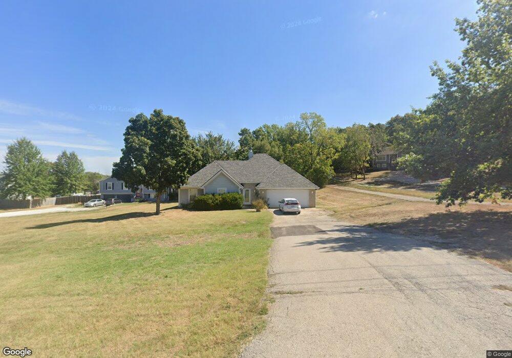
309 S Minter Rd Grain Valley, MO 64029
Estimated Value: $287,491 - $312,000
3
Beds
2
Baths
1,579
Sq Ft
$190/Sq Ft
Est. Value
About This Home
This home is located at 309 S Minter Rd, Grain Valley, MO 64029 and is currently estimated at $300,623, approximately $190 per square foot. 309 S Minter Rd is a home located in Jackson County with nearby schools including Grain Valley High School.
Ownership History
Date
Name
Owned For
Owner Type
Purchase Details
Closed on
Aug 19, 2004
Sold by
Herrschend Homes Inc
Bought by
Johnson Sharon M
Current Estimated Value
Home Financials for this Owner
Home Financials are based on the most recent Mortgage that was taken out on this home.
Original Mortgage
$83,000
Outstanding Balance
$41,213
Interest Rate
6.02%
Mortgage Type
Purchase Money Mortgage
Estimated Equity
$259,410
Purchase Details
Closed on
Mar 14, 2003
Sold by
Vogts Phillip L and Vogts Sherrie D
Bought by
Herrschend Homes Inc
Home Financials for this Owner
Home Financials are based on the most recent Mortgage that was taken out on this home.
Original Mortgage
$112,800
Interest Rate
5.83%
Create a Home Valuation Report for This Property
The Home Valuation Report is an in-depth analysis detailing your home's value as well as a comparison with similar homes in the area
Home Values in the Area
Average Home Value in this Area
Purchase History
| Date | Buyer | Sale Price | Title Company |
|---|---|---|---|
| Johnson Sharon M | -- | Metro One | |
| Herrschend Homes Inc | -- | Stewart Title Of Kansas City |
Source: Public Records
Mortgage History
| Date | Status | Borrower | Loan Amount |
|---|---|---|---|
| Open | Johnson Sharon M | $83,000 | |
| Previous Owner | Herrschend Homes Inc | $112,800 |
Source: Public Records
Tax History Compared to Growth
Tax History
| Year | Tax Paid | Tax Assessment Tax Assessment Total Assessment is a certain percentage of the fair market value that is determined by local assessors to be the total taxable value of land and additions on the property. | Land | Improvement |
|---|---|---|---|---|
| 2025 | $2,875 | $40,143 | $12,118 | $28,025 |
| 2024 | $2,768 | $34,909 | $4,511 | $30,398 |
| 2023 | $2,768 | $34,909 | $4,511 | $30,398 |
| 2022 | $2,876 | $31,730 | $1,530 | $30,200 |
| 2021 | $2,809 | $31,730 | $1,530 | $30,200 |
| 2020 | $2,503 | $27,888 | $1,530 | $26,358 |
| 2019 | $2,452 | $27,888 | $1,530 | $26,358 |
| 2018 | $2,494 | $26,507 | $9,820 | $16,687 |
| 2017 | $2,494 | $26,507 | $9,820 | $16,687 |
| 2016 | $2,430 | $25,842 | $2,464 | $23,378 |
| 2014 | $2,449 | $25,842 | $2,464 | $23,378 |
Source: Public Records
Map
Nearby Homes
- 401 S Minter Rd
- 1418 SW Blue Branch Dr
- 509 SW Joseph Ct
- 1402 NW Broadway Throughway
- 719 S Minter Rd
- 1024 Christie Ln
- 1215 SW Lone Star Ct
- 6205 Chiles Rd
- 29800 E 65th St
- 1214 SW Windcrest Ct
- 1309 SW Graystone Cir
- 1219 SW Windcrest Ct
- 636 SW Lakeview Dr
- 200 Cross Creek Ln
- 1235 NW Ashley Ln
- 1203 SW Lakeview Dr
- 209 SW Cross Creek Dr
- 1200 SW Foxtail Dr
- 207 Pebblebrook St
- 725 SW Tisha Ln
- 307 S Minter Rd
- 319 S Minter Rd
- 305 S Minter Rd
- 316 SW Blue Branch Ct
- 318 SW Blue Branch Ct
- 314 SW Blue Branch Ct
- 312 SW Blue Branch Ct
- 312 SW Blue Branch Ct
- 1427 SW Blue Branch Dr
- 1429 SW Blue Branch Dr Unit 1
- 1429 SW Blue Branch Dr
- 1423 SW Blue Branch Dr
- 315 S Minter Rd
- 1431 SW Blue Branch Dr
- 5910 S Minter Rd
- 317 SW Blue Branch Ct
- 1419 SW Blue Branch Dr
- 5916 S Minter Rd
- 1417 SW Blue Branch Dr
- 5906 S Minter Rd