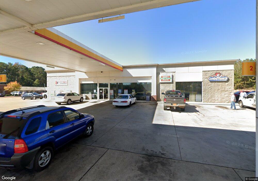
3097 Simpson Highway 13 Mendenhall, MS 39114
Estimated Value: $358,089
3
Beds
2
Baths
2,028
Sq Ft
$177/Sq Ft
Est. Value
About This Home
This home is located at 3097 Simpson Highway 13, Mendenhall, MS 39114 and is currently priced at $358,089, approximately $176 per square foot. 3097 Simpson Highway 13 is a home located in Simpson County with nearby schools including Mendenhall Elementary School, Mendenhall Junior High School, and Mendenhall High School.
Ownership History
Date
Name
Owned For
Owner Type
Purchase Details
Closed on
Jan 2, 2025
Sold by
Morris Real Estate No V Llc
Bought by
Mendenhall Depot Re Llc
Current Estimated Value
Purchase Details
Closed on
Apr 9, 2015
Sold by
Pace Oil Commpany Inc
Bought by
Morris Real Estate No Iv Llc
Home Financials for this Owner
Home Financials are based on the most recent Mortgage that was taken out on this home.
Original Mortgage
$1,950,200
Interest Rate
3.95%
Mortgage Type
Stand Alone Refi Refinance Of Original Loan
Create a Home Valuation Report for This Property
The Home Valuation Report is an in-depth analysis detailing your home's value as well as a comparison with similar homes in the area
Home Values in the Area
Average Home Value in this Area
Purchase History
| Date | Buyer | Sale Price | Title Company |
|---|---|---|---|
| Mendenhall Depot Re Llc | -- | None Listed On Document | |
| Mendenhall Hwy 13 Re Llc | -- | None Listed On Document | |
| Morris Real Estate No Iv Llc | -- | -- |
Source: Public Records
Mortgage History
| Date | Status | Borrower | Loan Amount |
|---|---|---|---|
| Previous Owner | Morris Real Estate No Iv Llc | $1,950,200 |
Source: Public Records
Tax History Compared to Growth
Tax History
| Year | Tax Paid | Tax Assessment Tax Assessment Total Assessment is a certain percentage of the fair market value that is determined by local assessors to be the total taxable value of land and additions on the property. | Land | Improvement |
|---|---|---|---|---|
| 2024 | $18,272 | $127,005 | $0 | $0 |
| 2023 | $18,272 | $101,247 | $0 | $0 |
| 2022 | $14,208 | $101,247 | $0 | $0 |
| 2021 | $13,987 | $101,247 | $0 | $0 |
| 2020 | $13,091 | $94,758 | $0 | $0 |
| 2019 | $12,793 | $95,717 | $0 | $0 |
| 2018 | $12,793 | $95,717 | $0 | $0 |
| 2017 | $12,793 | $95,717 | $0 | $0 |
| 2016 | $12,112 | $93,419 | $0 | $0 |
| 2015 | $7,323 | $58,047 | $0 | $0 |
| 2014 | $7,323 | $58,047 | $0 | $0 |
Source: Public Records
Map
Nearby Homes
- 000 Hwy 13 Hwy
- 0 Simpson Highway 13 Unit 4111635
- 0 Hwy 13 Hwy
- 149 Martin Cir
- 1002 Mark Dr
- 707 N West St
- 0 N East St
- 602 Circle Dr
- 619 Pittman Dr
- 00 Mississippi 13
- 211 W Maud Ave
- 428 Simpson Cir
- 306 E Court Ave
- 106 Edd Monk St
- 2794 Simpson Hwy 13
- 103 Johnny Rawls Rd
- 119 Ashwood Ln
- 810 N Maple Dr
- 0 0 U S 49
- 0 Hwy 49 Unit 4110472
- 0 Highway 13 Rd N Unit Hwy 13 198386
- 0 Highway 13 Rd N Unit 199752
- 0 Highway 13 Rd N Unit Hwy 13 1198386
- 0 Highway 13 Rd N Unit 1198386
- 0 Highway 13 Rd N Unit 1199752
- 3084 Simpson Highway 13
- 3080 Simpson Highway 13
- 3080 Simpson Highway 13
- 277 Smith Dr
- 205 Main St N
- 1727 Simpson Highway 149
- 1727 Simpson Highway 149
- 274 Smith Dr
- 0 Simpson Highway 13
- 0 Simpson Highway 13 Unit 1212039
- 0 Simpson Highway 13 Unit 1340445
- 0 Simpson Highway 13 Unit 1341368
- 130 Martin Cir
- 233 Smith Dr
- 3000 Simpson Highway 13
