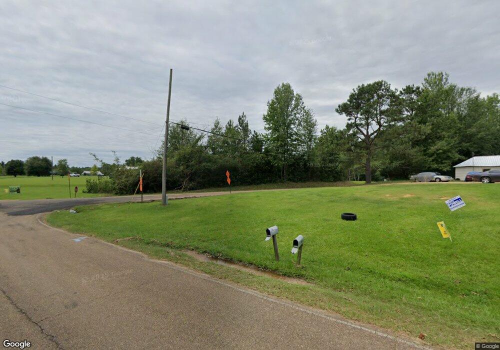
3097 Thomas Rd Crystal Springs, MS 39059
Estimated Value: $69,246 - $171,000
--
Bed
--
Bath
1,216
Sq Ft
$100/Sq Ft
Est. Value
About This Home
This home is located at 3097 Thomas Rd, Crystal Springs, MS 39059 and is currently estimated at $122,062, approximately $100 per square foot. 3097 Thomas Rd is a home with nearby schools including Crystal Springs Elementary School, Crystal Springs Middle School, and Crystal Springs High School.
Ownership History
Date
Name
Owned For
Owner Type
Purchase Details
Closed on
Nov 24, 2019
Sold by
Jones Crystal and Jones Zachary
Bought by
Jones Carolyn A
Current Estimated Value
Purchase Details
Closed on
Dec 7, 2006
Sold by
Jones Carrie J and Rhymes Carolyn Ann
Bought by
Jones Zachery T and Jones Crystal L
Home Financials for this Owner
Home Financials are based on the most recent Mortgage that was taken out on this home.
Original Mortgage
$26,563
Interest Rate
6.31%
Mortgage Type
Purchase Money Mortgage
Create a Home Valuation Report for This Property
The Home Valuation Report is an in-depth analysis detailing your home's value as well as a comparison with similar homes in the area
Home Values in the Area
Average Home Value in this Area
Purchase History
| Date | Buyer | Sale Price | Title Company |
|---|---|---|---|
| Jones Carolyn A | -- | -- | |
| Jones Zachery T | -- | -- |
Source: Public Records
Mortgage History
| Date | Status | Borrower | Loan Amount |
|---|---|---|---|
| Previous Owner | Jones Zachery T | $26,563 |
Source: Public Records
Tax History Compared to Growth
Tax History
| Year | Tax Paid | Tax Assessment Tax Assessment Total Assessment is a certain percentage of the fair market value that is determined by local assessors to be the total taxable value of land and additions on the property. | Land | Improvement |
|---|---|---|---|---|
| 2025 | $351 | $2,427 | $0 | $0 |
| 2024 | $351 | $2,273 | $0 | $0 |
| 2023 | $351 | $3,195 | $0 | $0 |
| 2022 | $351 | $3,195 | $0 | $0 |
| 2021 | $361 | $3,195 | $0 | $0 |
| 2020 | $361 | $3,155 | $0 | $0 |
| 2019 | $229 | $3,155 | $0 | $0 |
| 2018 | $224 | $3,155 | $0 | $0 |
| 2017 | $244 | $3,155 | $0 | $0 |
| 2016 | $244 | $3,508 | $0 | $0 |
| 2015 | -- | $3,508 | $0 | $0 |
| 2014 | -- | $3,508 | $0 | $0 |
Source: Public Records
Map
Nearby Homes
- 3114 Mathis Rd
- 00 Little Rock Rd
- 1035 Jasper Ln
- 23081 Highway 51
- 0 Little Rock Rd Unit 4111856
- 0 Burt Loop Rd
- 0 S Jackson St
- 402 Newton St
- 309 S Jackson St
- 2063 Bennett Rd
- 502 E Georgetown St
- 0 Bethesda Rd Unit 24909841
- 0 Bethesda Rd Unit 4126642
- 0 Bethesda Rd Unit 4126640
- 302 Horne St
- 115 Center St
- 103 Houston St
- 311 W Cayuga St
- 708 Lee Ave
- 1004 Bethesda Rd
- 3073 Thomas Rd
- 3028 E Gallman Rd
- 3067 Thomas Rd
- 3024 E Gallman Rd
- 3061 Thomas Rd
- 1012 Davenport Ln
- 3038 Thomas Rd
- 1033 Davenport Ln
- 1037 Davenport Ln
- 3174 Thomas Rd
- 3033 Thomas Rd
- 3175 Thomas Rd
- 3028 Thomas Rd
- 3025 Thomas Rd
- 4013 Thomas Rd
- 4010 Thomas Rd
- 1096 Carney Rd
- 4029 Thomas Rd
- 2175 Thomas Rd
- 1181 Mathis Rd
