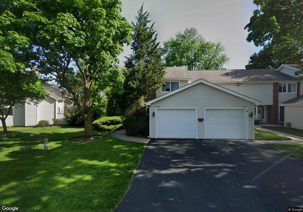
30W347 Oakmont Dr Unit 1 Naperville, IL 60563
Country Lakes NeighborhoodEstimated Value: $316,000 - $347,317
3
Beds
3
Baths
1,595
Sq Ft
$205/Sq Ft
Est. Value
About This Home
This home is located at 30W347 Oakmont Dr Unit 1, Naperville, IL 60563 and is currently estimated at $327,579, approximately $205 per square foot. 30W347 Oakmont Dr Unit 1 is a home located in DuPage County with nearby schools including Longwood Elementary School, Thayer J. Hill Middle School, and Metea Valley High School.
Ownership History
Date
Name
Owned For
Owner Type
Purchase Details
Closed on
Jun 8, 2000
Sold by
Baker Dorothy S
Bought by
Nelson Samuel T
Current Estimated Value
Home Financials for this Owner
Home Financials are based on the most recent Mortgage that was taken out on this home.
Original Mortgage
$126,000
Outstanding Balance
$45,495
Interest Rate
8.56%
Estimated Equity
$282,084
Create a Home Valuation Report for This Property
The Home Valuation Report is an in-depth analysis detailing your home's value as well as a comparison with similar homes in the area
Home Values in the Area
Average Home Value in this Area
Purchase History
| Date | Buyer | Sale Price | Title Company |
|---|---|---|---|
| Nelson Samuel T | $157,500 | -- |
Source: Public Records
Mortgage History
| Date | Status | Borrower | Loan Amount |
|---|---|---|---|
| Open | Nelson Samuel T | $126,000 | |
| Closed | Nelson Samuel T | $23,600 |
Source: Public Records
Tax History Compared to Growth
Tax History
| Year | Tax Paid | Tax Assessment Tax Assessment Total Assessment is a certain percentage of the fair market value that is determined by local assessors to be the total taxable value of land and additions on the property. | Land | Improvement |
|---|---|---|---|---|
| 2024 | $5,012 | $92,270 | $15,224 | $77,046 |
| 2023 | $4,769 | $82,910 | $13,680 | $69,230 |
| 2022 | $4,736 | $78,850 | $12,890 | $65,960 |
| 2021 | $4,564 | $76,040 | $12,430 | $63,610 |
| 2020 | $4,552 | $76,040 | $12,430 | $63,610 |
| 2019 | $4,370 | $72,320 | $11,820 | $60,500 |
| 2018 | $4,075 | $66,510 | $10,710 | $55,800 |
| 2017 | $3,963 | $64,260 | $10,350 | $53,910 |
| 2016 | $3,879 | $61,670 | $9,930 | $51,740 |
| 2015 | $3,827 | $58,560 | $9,430 | $49,130 |
| 2014 | $3,525 | $53,030 | $9,130 | $43,900 |
| 2013 | $3,526 | $53,390 | $9,190 | $44,200 |
Source: Public Records
Map
Nearby Homes
- 30W289 Pinehurst Dr Unit 289
- 30W539 Fairway Dr
- 1640 Hilton Head Dr
- 5S040 Pebblewood Ln Unit 406E
- 30W355 Claymore Ln
- 5S100 Pebblewood Ln Unit E4
- 4S365 Meadow Rd
- 1444 Bayou Path Dr
- 4S359 Meadow Rd
- 5S510 Scots Dr Unit G
- 2084 Maplewood Cir
- 2562 Golf Ridge Cir
- 2015 Yellow Daisy Ct
- 2365 Overlook Ct
- 1517 London Ct
- 1022 Neudearborn Ln Unit 19-1022
- 2755 Sheridan Ct Unit 270102
- 841 Genesee Dr
- 835 Genesee Dr
- 1628 Westminster Dr
- 30W351 Oakmont Dr
- 30W355 Oakmont Dr Unit 3
- 30W359 Oakmont Dr Unit 4
- 5S012 Saint Andrews Ct Unit 6
- 5S016 Saint Andrews Ct
- 5S020 Saint Andrews Ct
- 5S024 Saint Andrews Ct Unit 3
- 5S033 Firestone Ct
- 5S041 Firestone Ct
- 5S032 Saint Andrews Ct Unit 1
- 5S025 Firestone Ct Unit 1
- 55033 Firestone Ct
- 5S045 Firestone Ct Unit 6
- 5S029 Firestone Ct Unit 2
- 5S512 Innisbrook Dr Unit 1
- 5S508 Innisbrook Dr Unit 2
- 5S508 Innisbrook Dr
- 5S011 Saint Andrews Ct
- 5S015 Saint Andrews Ct Unit 2
- 5S019 Saint Andrews Ct