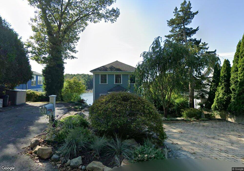
31 Dennison St Gloucester, MA 01930
Estimated Value: $1,319,000 - $1,678,000
3
Beds
2
Baths
2,200
Sq Ft
$707/Sq Ft
Est. Value
About This Home
This home is located at 31 Dennison St, Gloucester, MA 01930 and is currently estimated at $1,554,727, approximately $706 per square foot. 31 Dennison St is a home located in Essex County with nearby schools including Plum Cove School, Ralph B O'maley Middle School, and Gloucester High School.
Ownership History
Date
Name
Owned For
Owner Type
Purchase Details
Closed on
Aug 2, 2021
Sold by
Regensburg Paul P and Regensburg Robin L
Bought by
31 Dennison Street Llc
Current Estimated Value
Purchase Details
Closed on
Jan 6, 2016
Sold by
Gael D Meyer Lt
Bought by
Regensburg Paul P and Regensburg Robin L
Home Financials for this Owner
Home Financials are based on the most recent Mortgage that was taken out on this home.
Original Mortgage
$517,500
Interest Rate
3.96%
Mortgage Type
Purchase Money Mortgage
Purchase Details
Closed on
Dec 14, 2009
Sold by
Gael D Meyer Lt
Bought by
Meyer Tr Gael D
Purchase Details
Closed on
Jan 14, 2005
Sold by
Morrill Kathleen A
Bought by
Meyer Gael D
Purchase Details
Closed on
Jan 14, 2004
Sold by
Morrill 3Rd Douglas P
Bought by
Morrill Kathleen A
Create a Home Valuation Report for This Property
The Home Valuation Report is an in-depth analysis detailing your home's value as well as a comparison with similar homes in the area
Purchase History
| Date | Buyer | Sale Price | Title Company |
|---|---|---|---|
| 31 Dennison Street Llc | -- | None Available | |
| Regensburg Paul P | $1,018,000 | -- | |
| Meyer Tr Gael D | -- | -- | |
| Meyer Gael D | $537,500 | -- | |
| Morrill Kathleen A | -- | -- | |
| Morrill Kathleen A | -- | -- |
Source: Public Records
Mortgage History
| Date | Status | Borrower | Loan Amount |
|---|---|---|---|
| Previous Owner | Regensburg Paul P | $517,500 | |
| Previous Owner | Morrill Kathleen A | $200,000 | |
| Previous Owner | Morrill Kathleen A | $750,000 |
Source: Public Records
Tax History
| Year | Tax Paid | Tax Assessment Tax Assessment Total Assessment is a certain percentage of the fair market value that is determined by local assessors to be the total taxable value of land and additions on the property. | Land | Improvement |
|---|---|---|---|---|
| 2025 | $13,400 | $1,378,600 | $685,300 | $693,300 |
| 2024 | $13,094 | $1,345,700 | $652,400 | $693,300 |
| 2023 | $12,098 | $1,142,400 | $556,900 | $585,500 |
| 2022 | $11,701 | $997,500 | $484,200 | $513,300 |
| 2021 | $11,294 | $907,900 | $440,300 | $467,600 |
| 2020 | $11,177 | $906,500 | $440,300 | $466,200 |
| 2019 | $10,619 | $836,800 | $419,800 | $417,000 |
| 2018 | $10,242 | $792,100 | $409,500 | $382,600 |
| 2017 | $8,597 | $651,800 | $342,500 | $309,300 |
| 2016 | $8,336 | $612,500 | $327,500 | $285,000 |
| 2015 | $7,973 | $584,100 | $320,000 | $264,100 |
Source: Public Records
Map
Nearby Homes
- 672 Washington St
- 2 Breezy Point Rd
- 136 Leonard St
- 4 Ciaramitaro Ct
- 3 Deacon Farm Ln
- 226 Atlantic St
- 13 Honeysuckle Rd
- 31 Echo Ave
- 178 Atlantic St
- 167 Atlantic St
- 9 Hickory St
- 1030 Washington St
- 43 High St Unit B
- 13 Mystic Ave
- 8 Mystic Ave
- 3 Rockland St
- 98 Maplewood Ave
- 6 Monroe Ct
- 12 Arthur St
- 40 Sargent St
- 31 Dennison St
- 29 Dennison St
- 33 Dennison St
- 27 Dennison St Unit 29
- 27 Dennison St
- 35 Dennison St
- 28 Dennison St
- 37 Dennison St
- 34 Dennison St
- 39 Dennison St
- 19 Dennison St
- 42 Dennison St
- 42 Dennison St
- 1 Youngs Rd
- 45 Dennison St
- 44 Dennison St
- 3 Youngs Rd
- 11 Dennison St
- 11 Dennison St Unit SUMMER
- 11 Dennison St Winter Rental
Your Personal Tour Guide
Ask me questions while you tour the home.