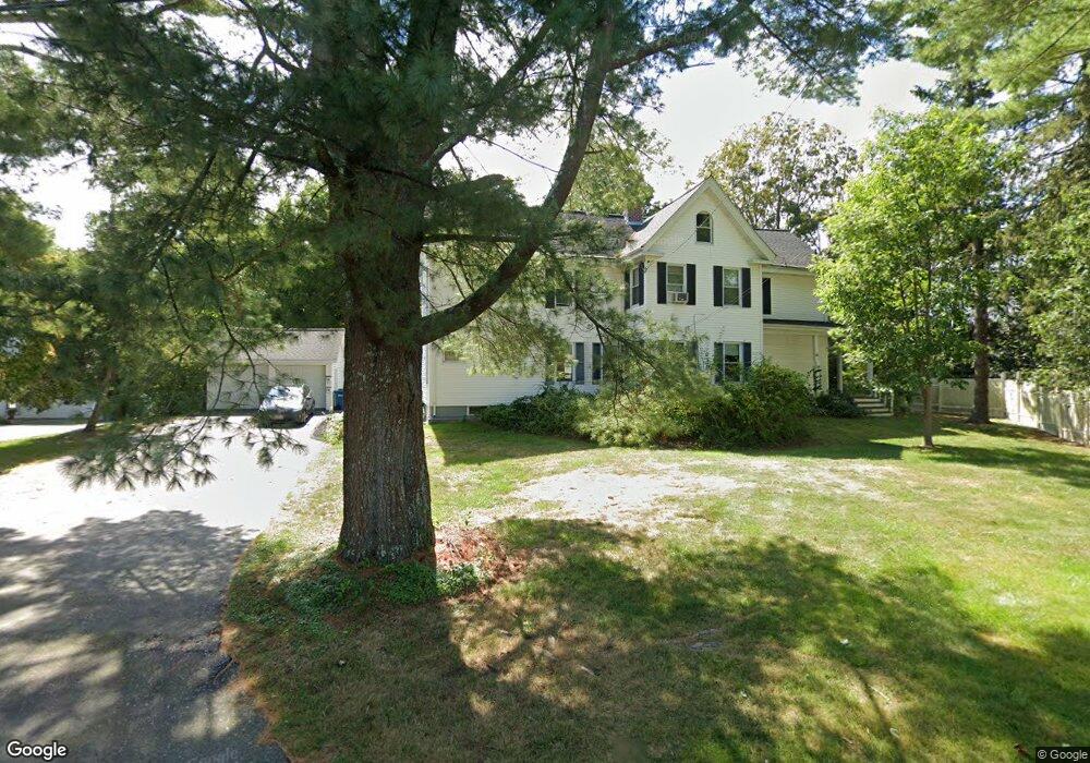
31 Dunbar St Unit 33 Canton, MA 02021
Estimated Value: $785,042 - $1,050,000
4
Beds
2
Baths
2,716
Sq Ft
$341/Sq Ft
Est. Value
About This Home
This home is located at 31 Dunbar St Unit 33, Canton, MA 02021 and is currently estimated at $925,011, approximately $340 per square foot. 31 Dunbar St Unit 33 is a home located in Norfolk County with nearby schools including Canton High School, St. John the Evangelist School, and Chabad Day School of School.
Ownership History
Date
Name
Owned For
Owner Type
Purchase Details
Closed on
Nov 30, 2009
Sold by
Sullivan Daniel S and Sullivan Madolyn A
Bought by
Fernandez Carlos A and Pulido Jacqueline C
Current Estimated Value
Purchase Details
Closed on
Dec 18, 1992
Sold by
Bryant Edwin F and Bryant Meredith R
Bought by
Sullivan Daniel S and Sullivan Madolyn A
Home Financials for this Owner
Home Financials are based on the most recent Mortgage that was taken out on this home.
Original Mortgage
$66,500
Interest Rate
8.3%
Mortgage Type
Purchase Money Mortgage
Create a Home Valuation Report for This Property
The Home Valuation Report is an in-depth analysis detailing your home's value as well as a comparison with similar homes in the area
Home Values in the Area
Average Home Value in this Area
Purchase History
| Date | Buyer | Sale Price | Title Company |
|---|---|---|---|
| Fernandez Carlos A | $409,000 | -- | |
| Sullivan Daniel S | $186,500 | -- |
Source: Public Records
Mortgage History
| Date | Status | Borrower | Loan Amount |
|---|---|---|---|
| Previous Owner | Sullivan Daniel S | $66,500 |
Source: Public Records
Tax History Compared to Growth
Tax History
| Year | Tax Paid | Tax Assessment Tax Assessment Total Assessment is a certain percentage of the fair market value that is determined by local assessors to be the total taxable value of land and additions on the property. | Land | Improvement |
|---|---|---|---|---|
| 2025 | $6,888 | $696,500 | $297,800 | $398,700 |
| 2024 | $6,678 | $669,800 | $286,400 | $383,400 |
| 2023 | $6,474 | $612,500 | $286,400 | $326,100 |
| 2022 | $6,216 | $547,700 | $272,700 | $275,000 |
| 2021 | $6,056 | $496,400 | $247,900 | $248,500 |
| 2020 | $5,785 | $473,000 | $236,100 | $236,900 |
| 2019 | $5,672 | $457,400 | $214,600 | $242,800 |
| 2018 | $5,465 | $440,000 | $206,300 | $233,700 |
| 2017 | $5,521 | $431,700 | $202,300 | $229,400 |
| 2016 | $5,388 | $421,300 | $197,400 | $223,900 |
| 2015 | $5,220 | $407,200 | $191,700 | $215,500 |
Source: Public Records
Map
Nearby Homes
- 212 Washington St
- 194 Washington St Unit J
- 29-31 Pond St
- 19 Walnut Knolls
- 185 Bailey St
- 189 Bailey St
- 71 High St
- 111 Ethyl Way Unit E
- 80 Walnut St Unit 405
- 8 Patricia Dr
- 41 Bayberry Dr Unit 4
- 398 Erin Rd Unit 398
- 380 N Main St
- 17 Patricia Dr
- 74 Ethyl Way
- 16 Jessica Dr Unit E
- 3 Donald Rd
- 17 Neponset St Unit A
- 90 Charles Cir
- 21 Wall St Unit D
- 31 Dunbar St Unit 1
- 33 Dunbar St Unit 33
- 33 Dunbar St Unit 2
- 33 Dunbar St
- 35 Dunbar St
- 147 Washington St
- 137 Washington St
- 20 Dunbar St
- 183 Washington St
- 39 Dunbar St
- 1 Greenwood Rd
- 16 Dunbar St
- 142 Washington St
- 28 Dunbar St
- 123 Washington St
- 185 Washington St
- 158 Washington St
- 174 Washington St
- 30 Dunbar St
- 63 Dunbar St