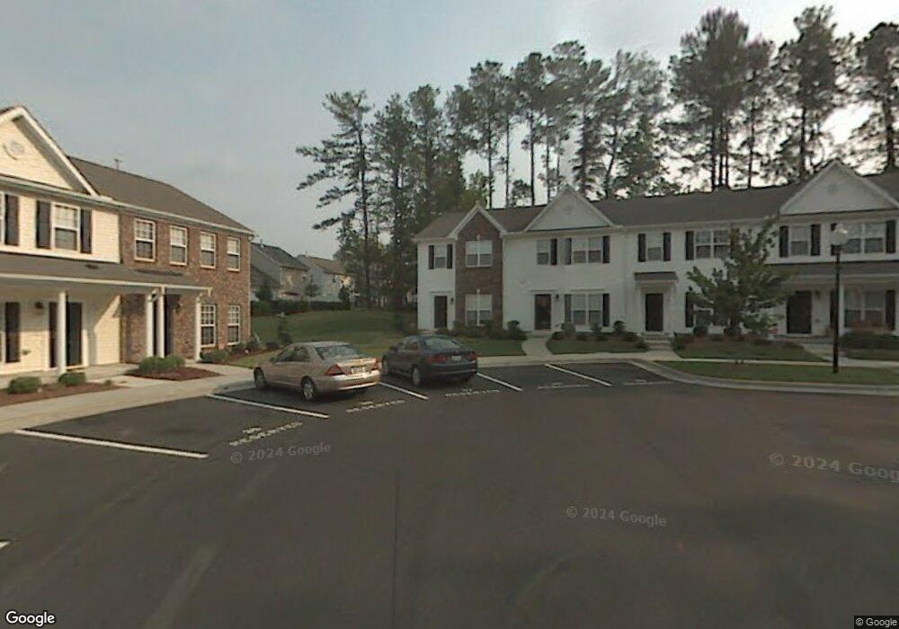
31 Sharpstone Ln Durham, NC 27703
Bethesda NeighborhoodEstimated Value: $277,000 - $308,000
2
Beds
3
Baths
1,440
Sq Ft
$203/Sq Ft
Est. Value
About This Home
This home is located at 31 Sharpstone Ln, Durham, NC 27703 and is currently estimated at $292,787, approximately $203 per square foot. 31 Sharpstone Ln is a home located in Durham County with nearby schools including Bethesda Elementary School, John W Neal Middle School, and Southern School of Energy & Sustainability.
Ownership History
Date
Name
Owned For
Owner Type
Purchase Details
Closed on
Jan 9, 2023
Sold by
Wilson Joseph P
Bought by
Cook Matthew S
Current Estimated Value
Purchase Details
Closed on
Oct 3, 2017
Sold by
Cook Matthew S and Cook Simon H
Bought by
Cook Matthew S and Wilson Joseph P
Home Financials for this Owner
Home Financials are based on the most recent Mortgage that was taken out on this home.
Original Mortgage
$91,700
Interest Rate
3.86%
Mortgage Type
New Conventional
Purchase Details
Closed on
Nov 21, 2013
Sold by
Cook Donna R
Bought by
Cook Matthew S
Purchase Details
Closed on
May 26, 2005
Sold by
K Hovnanian Homes Of North Carolina Inc
Bought by
Cook Matthew S and Cook Simon H
Home Financials for this Owner
Home Financials are based on the most recent Mortgage that was taken out on this home.
Original Mortgage
$115,000
Interest Rate
5.8%
Mortgage Type
Fannie Mae Freddie Mac
Create a Home Valuation Report for This Property
The Home Valuation Report is an in-depth analysis detailing your home's value as well as a comparison with similar homes in the area
Home Values in the Area
Average Home Value in this Area
Purchase History
| Date | Buyer | Sale Price | Title Company |
|---|---|---|---|
| Cook Matthew S | -- | -- | |
| Cook Matthew S | -- | None Available | |
| Cook Matthew S | -- | None Available | |
| Cook Matthew S | $130,000 | -- |
Source: Public Records
Mortgage History
| Date | Status | Borrower | Loan Amount |
|---|---|---|---|
| Previous Owner | Cook Matthew S | $91,700 | |
| Previous Owner | Cook Matthew S | $115,000 |
Source: Public Records
Tax History
| Year | Tax Paid | Tax Assessment Tax Assessment Total Assessment is a certain percentage of the fair market value that is determined by local assessors to be the total taxable value of land and additions on the property. | Land | Improvement |
|---|---|---|---|---|
| 2025 | $2,949 | $297,479 | $75,000 | $222,479 |
| 2024 | $2,290 | $164,136 | $40,000 | $124,136 |
| 2023 | $2,150 | $164,136 | $40,000 | $124,136 |
| 2022 | $2,101 | $164,136 | $40,000 | $124,136 |
| 2021 | $2,091 | $164,136 | $40,000 | $124,136 |
| 2020 | $2,042 | $164,136 | $40,000 | $124,136 |
| 2019 | $2,042 | $164,136 | $40,000 | $124,136 |
| 2018 | $1,877 | $138,353 | $32,000 | $106,353 |
| 2017 | $1,863 | $138,353 | $32,000 | $106,353 |
| 2016 | $1,800 | $138,353 | $32,000 | $106,353 |
| 2015 | $1,948 | $140,711 | $33,000 | $107,711 |
| 2014 | $1,948 | $140,711 | $33,000 | $107,711 |
Source: Public Records
Map
Nearby Homes
- 31 Edgebrook Cir
- 2217 S Miami Blvd
- 1118 Commack Dr
- 3908 Cash Rd
- 1042 Commack Dr
- 1116 Freeport Dr Unit 156
- 2520 Rolling Pines Ave
- 2524 Rolling Pines Ave
- 1923 Hinesley Dr
- 111 Lang St
- 1200 Bluewater Way
- 3112 Ranger Dr
- 4213 Congleton Place
- 1222 Flyfish Ave
- 3105 Ranger Dr
- 909 Wood Chapel Ln
- 1017 Depot Dr
- 1936 Hinesley Dr
- 1940 Hinesley Dr
- 1938 Hinesley Dr
- 29 Sharpstone Ln
- 33 Sharpstone Ln
- 35 Sharpstone Ln
- 37 Sharpstone Ln
- 25 Sharpstone Ln
- 23 Sharpstone Ln
- 21 Sharpstone Ln
- 19 Sharpstone Ln
- 117 Hidden Springs Dr
- 36 Sharpstone Ln
- 119 Hidden Springs Dr
- 17 Sharpstone Ln
- 121 Hidden Springs Dr
- 115 Hidden Springs Dr
- 34 Sharpstone Ln
- 15 Sharpstone Ln
- 32 Sharpstone Ln
- 30 Sharpstone Ln
- 111 Hidden Springs Dr
- 28 Sharpstone Ln
Your Personal Tour Guide
Ask me questions while you tour the home.