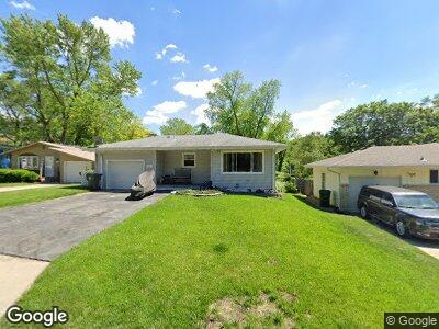
31 Spencer Cir Council Bluffs, IA 51503
East View Loop NeighborhoodEstimated Value: $199,774 - $257,000
3
Beds
2
Baths
936
Sq Ft
$242/Sq Ft
Est. Value
About This Home
This home is located at 31 Spencer Cir, Council Bluffs, IA 51503 and is currently estimated at $226,944, approximately $242 per square foot. 31 Spencer Cir is a home located in Pottawattamie County with nearby schools including College View Elementary School, Gerald W. Kirn Middle School, and Abraham Lincoln High School.
Ownership History
Date
Name
Owned For
Owner Type
Purchase Details
Closed on
Apr 30, 2016
Sold by
Smith Vicki and Smuth Tony
Bought by
Smith Vicki and Smith Tony
Current Estimated Value
Home Financials for this Owner
Home Financials are based on the most recent Mortgage that was taken out on this home.
Original Mortgage
$101,750
Interest Rate
3.71%
Mortgage Type
FHA
Purchase Details
Closed on
Oct 17, 2006
Sold by
Katzenstein Clifford Rollen and Katzenstein Vicki
Bought by
Katzenstein Vicki
Create a Home Valuation Report for This Property
The Home Valuation Report is an in-depth analysis detailing your home's value as well as a comparison with similar homes in the area
Home Values in the Area
Average Home Value in this Area
Purchase History
| Date | Buyer | Sale Price | Title Company |
|---|---|---|---|
| Smith Vicki | $500 | Wfg Lender Services Llc |
Source: Public Records
Mortgage History
| Date | Status | Borrower | Loan Amount |
|---|---|---|---|
| Closed | Smith Vicki | $101,000 | |
| Closed | Smith Vicki | $93,800 | |
| Closed | Smith Vicki | $99,500 | |
| Closed | Smith Vicki | $101,750 | |
| Closed | Katzenstein Vicki A | $16,069 |
Source: Public Records
Tax History Compared to Growth
Tax History
| Year | Tax Paid | Tax Assessment Tax Assessment Total Assessment is a certain percentage of the fair market value that is determined by local assessors to be the total taxable value of land and additions on the property. | Land | Improvement |
|---|---|---|---|---|
| 2024 | $2,866 | $161,200 | $22,400 | $138,800 |
| 2023 | $2,866 | $161,200 | $22,400 | $138,800 |
| 2022 | $2,822 | $129,200 | $21,300 | $107,900 |
| 2021 | $4,328 | $129,200 | $21,300 | $107,900 |
| 2020 | $2,990 | $129,200 | $21,300 | $107,900 |
| 2019 | $2,922 | $129,200 | $21,300 | $107,900 |
| 2018 | $2,862 | $122,200 | $14,300 | $107,900 |
| 2017 | $2,648 | $112,391 | $14,296 | $98,095 |
| 2015 | $2,586 | $112,391 | $14,296 | $98,095 |
| 2014 | $2,590 | $112,391 | $14,296 | $98,095 |
Source: Public Records
Map
Nearby Homes
- 1116 Simms Ave
- 643 Simms Ave
- 4 Prairie Hills Ln
- 619 Simms Ave
- 19002 Cathy Ln
- 250 Highland Dr
- 118 Midland Dr
- 129 Sunny Ridge Dr
- 316 Elmwood Dr
- 1611 N Broadway
- 137 Zenith Dr
- 225 Zenith Dr
- 126 Happy Hollow Blvd
- 201 Locust Lodge Ave
- 19711 Birdsley Rd
- 324 Warren St
- 317 Mount Vernon St
- 1204 N Broadway
- 1309 Mcpherson Ave
- 442 Houston Ave