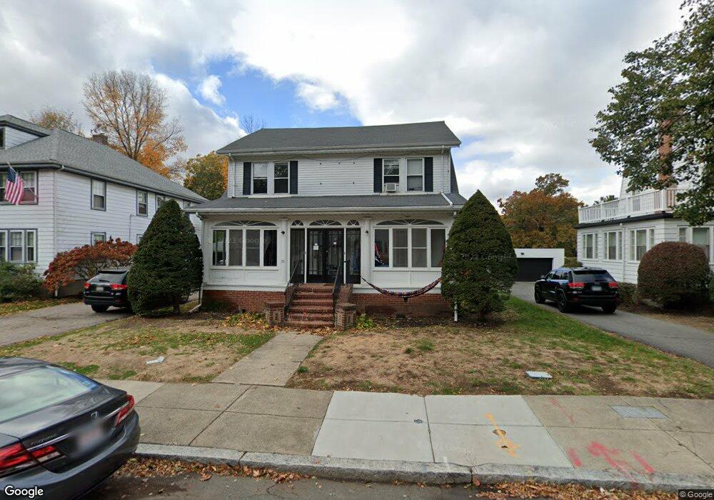
31 Wade St Brighton, MA 02135
Commonwealth NeighborhoodEstimated Value: $1,227,673 - $1,507,000
4
Beds
3
Baths
2,048
Sq Ft
$656/Sq Ft
Est. Value
About This Home
This home is located at 31 Wade St, Brighton, MA 02135 and is currently estimated at $1,343,168, approximately $655 per square foot. 31 Wade St is a home located in Suffolk County with nearby schools including Shaloh House Jewish Day School, St Columbkille Partnership School, and Bais Yaakov Of Boston High School.
Ownership History
Date
Name
Owned For
Owner Type
Purchase Details
Closed on
Jun 27, 2011
Sold by
Levine Avrohom
Bought by
Pal Re Llc
Current Estimated Value
Purchase Details
Closed on
Oct 27, 2003
Sold by
Breau James L and Breau Edward P
Bought by
Levine Avrohom
Home Financials for this Owner
Home Financials are based on the most recent Mortgage that was taken out on this home.
Original Mortgage
$512,800
Interest Rate
6.15%
Mortgage Type
Purchase Money Mortgage
Create a Home Valuation Report for This Property
The Home Valuation Report is an in-depth analysis detailing your home's value as well as a comparison with similar homes in the area
Home Values in the Area
Average Home Value in this Area
Purchase History
| Date | Buyer | Sale Price | Title Company |
|---|---|---|---|
| Pal Re Llc | $120,000 | -- | |
| Levine Avrohom | $641,000 | -- |
Source: Public Records
Mortgage History
| Date | Status | Borrower | Loan Amount |
|---|---|---|---|
| Previous Owner | Levine Avrohom | $512,800 |
Source: Public Records
Tax History Compared to Growth
Tax History
| Year | Tax Paid | Tax Assessment Tax Assessment Total Assessment is a certain percentage of the fair market value that is determined by local assessors to be the total taxable value of land and additions on the property. | Land | Improvement |
|---|---|---|---|---|
| 2025 | $12,240 | $1,057,000 | $410,500 | $646,500 |
| 2024 | $11,334 | $1,039,800 | $359,100 | $680,700 |
| 2023 | $11,167 | $1,039,800 | $359,100 | $680,700 |
| 2022 | $10,982 | $1,009,400 | $348,600 | $660,800 |
| 2021 | $10,770 | $1,009,400 | $348,600 | $660,800 |
| 2020 | $10,508 | $995,100 | $319,000 | $676,100 |
| 2019 | $9,821 | $931,800 | $261,500 | $670,300 |
| 2018 | $9,575 | $913,600 | $261,500 | $652,100 |
| 2017 | $9,390 | $886,700 | $261,500 | $625,200 |
| 2016 | $8,709 | $791,700 | $261,500 | $530,200 |
| 2015 | $7,456 | $615,700 | $240,500 | $375,200 |
| 2014 | $6,727 | $534,700 | $240,500 | $294,200 |
Source: Public Records
Map
Nearby Homes
- 2021 Commonwealth Ave Unit B
- 5 Radnor Rd
- 25 South St Unit B1
- 19 South St Unit 11
- 66 Kirkwood Rd
- 185 Chestnut Hill Ave Unit 18
- 27-29 Commonwealth Ave Unit 9
- 27-29 Commonwealth Ave Unit 5
- 155 Strathmore Rd Unit 12A
- 29 Undine Rd
- 129 Chiswick Rd Unit 6
- 5 Braemore Rd Unit 10
- 9 Braemore Rd Unit 5
- 137 Englewood Ave Unit 32
- 99 Chestnut Hill Ave Unit 212
- 26 Chiswick Rd Unit 6
- 97 Strathmore Rd Unit 4
- 6 Sutherland Rd Unit 41
- 12 Mina Way
- 10 Mina Way