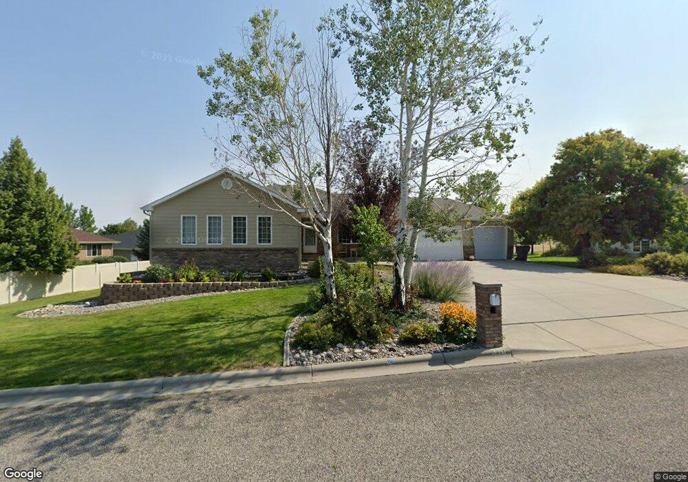
310 Burning Tree Dr Billings, MT 59105
Billings Heights NeighborhoodEstimated Value: $498,000 - $591,000
5
Beds
3
Baths
3,320
Sq Ft
$167/Sq Ft
Est. Value
About This Home
This home is located at 310 Burning Tree Dr, Billings, MT 59105 and is currently estimated at $555,764, approximately $167 per square foot. 310 Burning Tree Dr is a home located in Yellowstone County with nearby schools including Sandstone School, Castle Rock Junior High School, and Skyview High School.
Ownership History
Date
Name
Owned For
Owner Type
Purchase Details
Closed on
Nov 21, 2012
Sold by
Prosenick Wesley E and Prosenick Sabrina A
Bought by
Daugherdy Dale and Daugherdy Tanith J
Current Estimated Value
Home Financials for this Owner
Home Financials are based on the most recent Mortgage that was taken out on this home.
Original Mortgage
$256,000
Outstanding Balance
$176,649
Interest Rate
3.36%
Mortgage Type
New Conventional
Estimated Equity
$379,115
Purchase Details
Closed on
Nov 16, 2005
Sold by
Sinclair Norman D
Bought by
Prosenick Wesley E and Prosenick Sabrina A
Home Financials for this Owner
Home Financials are based on the most recent Mortgage that was taken out on this home.
Original Mortgage
$222,800
Interest Rate
5.93%
Mortgage Type
New Conventional
Create a Home Valuation Report for This Property
The Home Valuation Report is an in-depth analysis detailing your home's value as well as a comparison with similar homes in the area
Home Values in the Area
Average Home Value in this Area
Purchase History
| Date | Buyer | Sale Price | Title Company |
|---|---|---|---|
| Daugherdy Dale | -- | None Available | |
| Prosenick Wesley E | -- | None Available |
Source: Public Records
Mortgage History
| Date | Status | Borrower | Loan Amount |
|---|---|---|---|
| Open | Daugherdy Dale | $256,000 | |
| Previous Owner | Prosenick Wesley E | $222,800 |
Source: Public Records
Tax History Compared to Growth
Tax History
| Year | Tax Paid | Tax Assessment Tax Assessment Total Assessment is a certain percentage of the fair market value that is determined by local assessors to be the total taxable value of land and additions on the property. | Land | Improvement |
|---|---|---|---|---|
| 2025 | $5,469 | $578,700 | $111,588 | $467,112 |
| 2024 | $5,469 | $522,100 | $104,399 | $417,701 |
| 2023 | $5,465 | $522,100 | $104,399 | $417,701 |
| 2022 | $3,575 | $378,700 | $0 | $0 |
| 2021 | $4,314 | $378,700 | $0 | $0 |
| 2020 | $4,319 | $362,900 | $0 | $0 |
| 2019 | $4,137 | $362,900 | $0 | $0 |
| 2018 | $4,116 | $354,700 | $0 | $0 |
| 2017 | $3,984 | $354,700 | $0 | $0 |
| 2016 | $3,768 | $335,900 | $0 | $0 |
| 2015 | $3,692 | $335,900 | $0 | $0 |
| 2014 | $3,541 | $170,713 | $0 | $0 |
Source: Public Records
Map
Nearby Homes
- 2043 Cypress Point
- 2164 Greenbriar Rd
- 2115 Saint Andrews Dr
- Lot 1, Block 1 Greenbriar Rd
- 00 Winged Foot Drive Lot 10
- 0 Winged Foot Dr
- 0 Clubhouse Way
- LOT 3 Clubhouse Way
- LOT 4 Clubhouse Way
- 2049 Saint Andrews Dr
- 00
- 0 Greenbriar Rd
- 2032 Clubhouse Way
- 2029 Ridgeview Dr
- 1949 St Andrews Dr
- 650 Pinehurst Rd
- 2143 Interlachen Dr
- 0 Greenbriar Block 12 Lot 5 Rd Unit 352965
- 2030 Gleneagles Blvd
- 2435 Lake Heights Dr
- 322 Burning Tree Dr
- 2018 Wentworth Dr
- 2010 Wentworth Dr
- 2020 Wentworth Dr
- 334 Burning Tree Dr
- 2004 Wentworth Dr
- 2017 Wentworth Dr
- 2013 Wentworth Dr
- 425 Tamarisk Dr
- 2021 Wentworth Dr
- 2026 Wentworth Dr
- 2000 Wentworth Dr
- 2011 Wentworth Dr
- 2025 Wentworth Dr
- 411 Tamarisk Dr
- 407 Tamarisk Dr
- 2030 Wentworth Dr
- 359 Burning Tree Dr
- 2031 Wentworth Dr
- 362 Burning Tree Dr