Estimated Value: $45,000 - $82,000
3
Beds
2
Baths
1,575
Sq Ft
$43/Sq Ft
Est. Value
About This Home
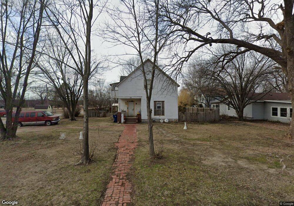
This home is located at 310 S Fawn St, Caney, KS 67333 and is currently estimated at $67,306, approximately $42 per square foot. 310 S Fawn St is a home located in Montgomery County with nearby schools including Lincoln Memorial Elementary School, Caney Valley High School, and Caney Valley Charter Academy.
Ownership History
Date
Name
Owned For
Owner Type
Purchase Details
Closed on
Nov 26, 2013
Sold by
Jpmorgan Chase Bank National Association
Bought by
Martin Robert D
Current Estimated Value
Purchase Details
Closed on
May 20, 2008
Sold by
Crowe Jason L and Crowe Kelli
Bought by
Sanders Joshua S and Sanders Jessie L
Home Financials for this Owner
Home Financials are based on the most recent Mortgage that was taken out on this home.
Original Mortgage
$68,136
Interest Rate
6.07%
Purchase Details
Closed on
Dec 1, 2006
Sold by
Mayo Matthew Douglas and Mayo Larissa Anne
Bought by
Crowe Jason and Crowe Kelli
Create a Home Valuation Report for This Property
The Home Valuation Report is an in-depth analysis detailing your home's value as well as a comparison with similar homes in the area
Home Values in the Area
Average Home Value in this Area
Purchase History
| Date | Buyer | Sale Price | Title Company |
|---|---|---|---|
| Martin Robert D | $7,000 | -- | |
| Sanders Joshua S | -- | -- | |
| Crowe Jason | -- | -- |
Source: Public Records
Mortgage History
| Date | Status | Borrower | Loan Amount |
|---|---|---|---|
| Previous Owner | Sanders Joshua S | $68,136 |
Source: Public Records
Tax History Compared to Growth
Tax History
| Year | Tax Paid | Tax Assessment Tax Assessment Total Assessment is a certain percentage of the fair market value that is determined by local assessors to be the total taxable value of land and additions on the property. | Land | Improvement |
|---|---|---|---|---|
| 2024 | $6 | $3,633 | $1,179 | $2,454 |
| 2023 | $601 | $3,427 | $1,181 | $2,246 |
| 2022 | $601 | $3,135 | $1,101 | $2,034 |
| 2021 | $0 | $2,725 | $545 | $2,180 |
| 2020 | $0 | $2,974 | $552 | $2,422 |
| 2019 | $597 | $3,001 | $570 | $2,431 |
| 2018 | $832 | $4,324 | $483 | $3,841 |
| 2017 | $817 | $4,424 | $483 | $3,941 |
| 2016 | $932 | $4,919 | $342 | $4,577 |
| 2015 | -- | $5,477 | $273 | $5,204 |
| 2014 | -- | $5,693 | $273 | $5,420 |
Source: Public Records
Map
Nearby Homes
- 301 S Fawn St
- 106 N Wood St
- 102 102 E 6th Ave
- 400 N Foreman St
- 301 E 6th Ave
- 519 N Wood St
- 800 N State St
- 204 N McGee St
- 601 E 3rd Ave
- 1005 N Main St
- 600 N East St
- 1347 County Road 1600
- 220 Overlook Dr
- 703.92 W 200 Rd
- 2342 Highway 166
- 1550 Cr 2400
- 1121 Cr 2440
- W 200 Rd
- 0 Rural Route Unit 24764392
- 1 N Dalton Rd