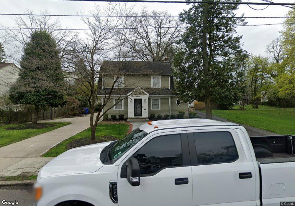
310 W 2nd St Moorestown, NJ 08057
Estimated Value: $625,877 - $936,000
--
Bed
--
Bath
2,612
Sq Ft
$286/Sq Ft
Est. Value
About This Home
This home is located at 310 W 2nd St, Moorestown, NJ 08057 and is currently estimated at $746,719, approximately $285 per square foot. 310 W 2nd St is a home located in Burlington County with nearby schools including George C. Baker Elementary School, Moorestown Upper Elementary School, and William Allen Middle School.
Ownership History
Date
Name
Owned For
Owner Type
Purchase Details
Closed on
Mar 2, 1994
Sold by
Weinfled Carmela
Bought by
Musgnug Robert and Musgnug Jill
Current Estimated Value
Home Financials for this Owner
Home Financials are based on the most recent Mortgage that was taken out on this home.
Original Mortgage
$120,000
Interest Rate
7.01%
Create a Home Valuation Report for This Property
The Home Valuation Report is an in-depth analysis detailing your home's value as well as a comparison with similar homes in the area
Home Values in the Area
Average Home Value in this Area
Purchase History
| Date | Buyer | Sale Price | Title Company |
|---|---|---|---|
| Musgnug Robert | $137,000 | -- |
Source: Public Records
Mortgage History
| Date | Status | Borrower | Loan Amount |
|---|---|---|---|
| Open | Musgnug Robert | $270,000 | |
| Closed | Musgnug Robert | $120,000 |
Source: Public Records
Tax History Compared to Growth
Tax History
| Year | Tax Paid | Tax Assessment Tax Assessment Total Assessment is a certain percentage of the fair market value that is determined by local assessors to be the total taxable value of land and additions on the property. | Land | Improvement |
|---|---|---|---|---|
| 2025 | $9,007 | $317,500 | $114,900 | $202,600 |
| 2024 | $8,734 | $317,500 | $114,900 | $202,600 |
| 2023 | $8,734 | $317,500 | $114,900 | $202,600 |
| 2022 | $8,646 | $317,500 | $114,900 | $202,600 |
| 2021 | $8,531 | $317,500 | $114,900 | $202,600 |
| 2020 | $8,477 | $317,500 | $114,900 | $202,600 |
| 2019 | $8,328 | $317,500 | $114,900 | $202,600 |
| 2018 | $8,103 | $317,500 | $114,900 | $202,600 |
| 2017 | $8,172 | $317,500 | $114,900 | $202,600 |
| 2016 | $8,144 | $317,500 | $114,900 | $202,600 |
| 2015 | $8,045 | $317,500 | $114,900 | $202,600 |
| 2014 | $7,639 | $317,500 | $114,900 | $202,600 |
Source: Public Records
Map
Nearby Homes
- 304 W 2nd St
- 315 W Main St
- 300 W 2nd St
- 305 W Main St
- 309 W 2nd St
- 305 W 2nd St
- 301 W Main St
- 321 323 W Main St
- 307 W 2nd St
- 303 W 2nd St
- 321 W Main St Unit 323
- 325 W Main St
- 205 Mannion Ave Unit 207
- 200 Locust St
- 209 Mannion Ave Unit 211
- 101 Locust St
- 208 Locust St
- 320 W Main St
- 322 W Main St
- 308 W Main St