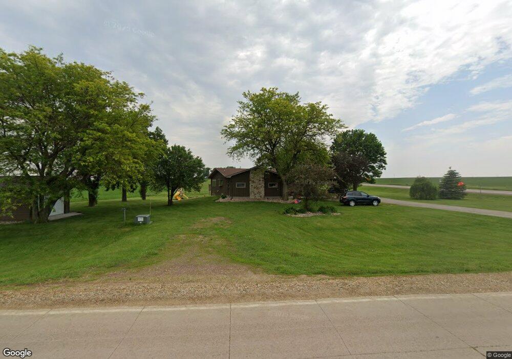
3101 170th St Rock Rapids, IA 51246
Estimated Value: $410,630 - $486,000
--
Bed
1
Bath
1,798
Sq Ft
$248/Sq Ft
Est. Value
About This Home
This home is located at 3101 170th St, Rock Rapids, IA 51246 and is currently estimated at $445,408, approximately $247 per square foot. 3101 170th St is a home located in Lyon County with nearby schools including Central Lyon Elementary School, Central Lyon Senior High School, and Ignite Christian Academy.
Ownership History
Date
Name
Owned For
Owner Type
Purchase Details
Closed on
May 28, 2021
Sold by
Top Eugene A Van Den and Top Karen R
Bought by
Buiter Ryan David and Buiter Joni Beth
Current Estimated Value
Purchase Details
Closed on
Sep 11, 2012
Sold by
Teeselink Brooke
Bought by
Teeselink Daniel and Teeselink Brooke
Home Financials for this Owner
Home Financials are based on the most recent Mortgage that was taken out on this home.
Original Mortgage
$142,400
Interest Rate
3.58%
Mortgage Type
New Conventional
Create a Home Valuation Report for This Property
The Home Valuation Report is an in-depth analysis detailing your home's value as well as a comparison with similar homes in the area
Home Values in the Area
Average Home Value in this Area
Purchase History
| Date | Buyer | Sale Price | Title Company |
|---|---|---|---|
| Buiter Ryan David | $142,500 | None Available | |
| Teeselink Daniel | -- | None Available |
Source: Public Records
Mortgage History
| Date | Status | Borrower | Loan Amount |
|---|---|---|---|
| Previous Owner | Teeselink Daniel | $142,400 |
Source: Public Records
Tax History Compared to Growth
Tax History
| Year | Tax Paid | Tax Assessment Tax Assessment Total Assessment is a certain percentage of the fair market value that is determined by local assessors to be the total taxable value of land and additions on the property. | Land | Improvement |
|---|---|---|---|---|
| 2025 | $3,398 | $402,230 | $24,250 | $377,980 |
| 2024 | $3,398 | $389,070 | $24,250 | $364,820 |
| 2023 | $3,350 | $389,770 | $24,250 | $365,520 |
| 2022 | $3,314 | $304,090 | $24,250 | $279,840 |
| 2021 | $3,314 | $304,090 | $24,250 | $279,840 |
| 2020 | $3,088 | $241,610 | $24,250 | $217,360 |
| 2019 | $2,960 | $227,752 | $0 | $0 |
| 2018 | $2,824 | $224,577 | $0 | $0 |
| 2017 | $2,432 | $190,013 | $0 | $0 |
| 2016 | $2,446 | $190,013 | $0 | $0 |
| 2015 | $2,446 | $192,043 | $0 | $0 |
| 2014 | $1,912 | $156,611 | $0 | $0 |
Source: Public Records
Map
Nearby Homes
- 106 S 15th Ave Unit 1
- 204 S 15th Ave
- 104 Cedar Ln
- 1037 Highway 75
- 603 Mill Pond Rd
- 505 Mill Pond Rd Unit 2
- 505 Mill Pond Rd Unit 1
- 805 Mill Pond Rd
- 803 Mill Pond Rd
- 801 Mill Pond Rd
- 707 Mill Pond Rd
- 501 Mill Pond Rd
- 405 Mill Pond Rd
- 804 Mill Pond Rd
- 802 Mill Pond Rd
- 800 Mill Pond Rd
- 604 Mill Pond Rd
- 602 Mill Pond Rd
- 600 Mill Pond Rd
- 506 Mill Pond Rd
- 1689 Us Highway 75
- 1734 Us Highway 75
- 1664 Us Highway 75
- 1658 Us Highway 75
- 1655 Us Highway 75
- 3155 170th St
- 1725 S Tama St
- 1653 Grackle Ave
- 1510 S Carroll St
- 1501 S Carroll St
- 202 S 15th Ave
- 206B S 15th Ave
- 206 S 15th Ave Unit 2
- 0 S 15th Ave
- New Lots S 15th Ave
- 1,2,3,15,16,17 S 15th Ave
- 601 S 15th Ave
- 1406 S Carroll St
- 505 S 15th Ave
- 1509 S Tama St