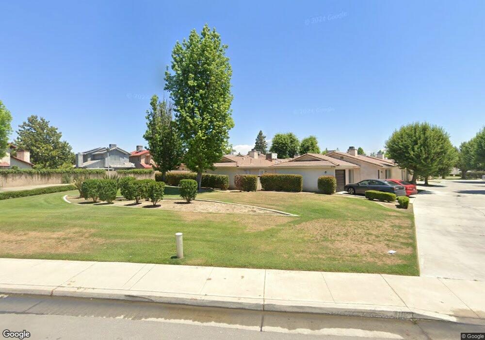
3102 Brookside Dr Bakersfield, CA 93311
The Oaks NeighborhoodEstimated Value: $717,000 - $1,074,000
4
Beds
4
Baths
3,432
Sq Ft
$261/Sq Ft
Est. Value
About This Home
This home is located at 3102 Brookside Dr, Bakersfield, CA 93311 and is currently estimated at $897,323, approximately $261 per square foot. 3102 Brookside Dr is a home located in Kern County with nearby schools including Christa McAuliffe Elementary School, Tevis Junior High School, and Stockdale High School.
Ownership History
Date
Name
Owned For
Owner Type
Purchase Details
Closed on
Jun 5, 2000
Sold by
Parker Frick Management Realty Ptp
Bought by
Renar Jerome W
Current Estimated Value
Home Financials for this Owner
Home Financials are based on the most recent Mortgage that was taken out on this home.
Original Mortgage
$189,600
Interest Rate
8.59%
Purchase Details
Closed on
May 2, 1996
Sold by
Amhurst 88 Corp
Bought by
Parker Frick Management Realty Prtnrshp
Create a Home Valuation Report for This Property
The Home Valuation Report is an in-depth analysis detailing your home's value as well as a comparison with similar homes in the area
Home Values in the Area
Average Home Value in this Area
Purchase History
| Date | Buyer | Sale Price | Title Company |
|---|---|---|---|
| Renar Jerome W | $237,000 | American Title Co | |
| Parker Frick Management Realty Prtnrshp | $220,000 | American Title Ins Co |
Source: Public Records
Mortgage History
| Date | Status | Borrower | Loan Amount |
|---|---|---|---|
| Previous Owner | Renar Jerome W | $189,600 |
Source: Public Records
Tax History
| Year | Tax Paid | Tax Assessment Tax Assessment Total Assessment is a certain percentage of the fair market value that is determined by local assessors to be the total taxable value of land and additions on the property. | Land | Improvement |
|---|---|---|---|---|
| 2025 | $6,871 | $357,097 | $60,260 | $296,837 |
| 2024 | $6,744 | $350,096 | $59,079 | $291,017 |
| 2023 | $6,744 | $343,232 | $57,921 | $285,311 |
| 2022 | $6,461 | $336,503 | $56,786 | $279,717 |
| 2021 | $6,074 | $329,906 | $55,673 | $274,233 |
| 2020 | $5,914 | $326,525 | $55,103 | $271,422 |
| 2019 | $5,836 | $326,525 | $55,103 | $271,422 |
| 2018 | $5,613 | $313,847 | $52,964 | $260,883 |
| 2017 | $5,534 | $307,694 | $51,926 | $255,768 |
| 2016 | $5,241 | $301,661 | $50,908 | $250,753 |
| 2015 | $5,187 | $297,131 | $50,144 | $246,987 |
| 2014 | $5,062 | $291,311 | $49,162 | $242,149 |
Source: Public Records
Map
Nearby Homes
- 8213 Birch St
- 2909 Woodglen Dr
- 3000 Victoria Way
- 7713 Kamloops Dr
- 8909 Summer Creek Rd
- 2704 El Portal Dr
- 3901 Boswellia Dr
- 3313 Colony Oak St
- 3009 Buford Way
- 8832 Sierra Oak Dr
- 9101 Broad Oak Ave
- 3612 Sonoita Dr
- 7504 Deming Ct
- 7321 Alamosa Ln
- 3105 Loveland Way
- 7512 Lordsburg Dr
- 2601 Manitou Way
- 7517 Hachita Ct
- 7501 Hachita Ct
- 7108 Wilford Ct
- 3106 Brookside Dr
- 8217 Woodside St
- 3110 Brookside Dr
- 8213 Woodside St
- 8209 Woodside St
- 8205 Woodside St
- 3114 Brookside Dr
- 8201 Woodside St
- 3021 Woodglen Dr
- 8125 Woodside St
- 8121 Woodside St Unit B
- 3017 Woodglen Dr
- 8212 Woodside St
- 8208 Woodside St Unit A
- 3122 Brookside Dr
- 8204 Woodside St
- 8117 Woodside St
- 8200 Woodside St
- 3013 Woodglen Dr
- 8116 Woodside St
Your Personal Tour Guide
Ask me questions while you tour the home.