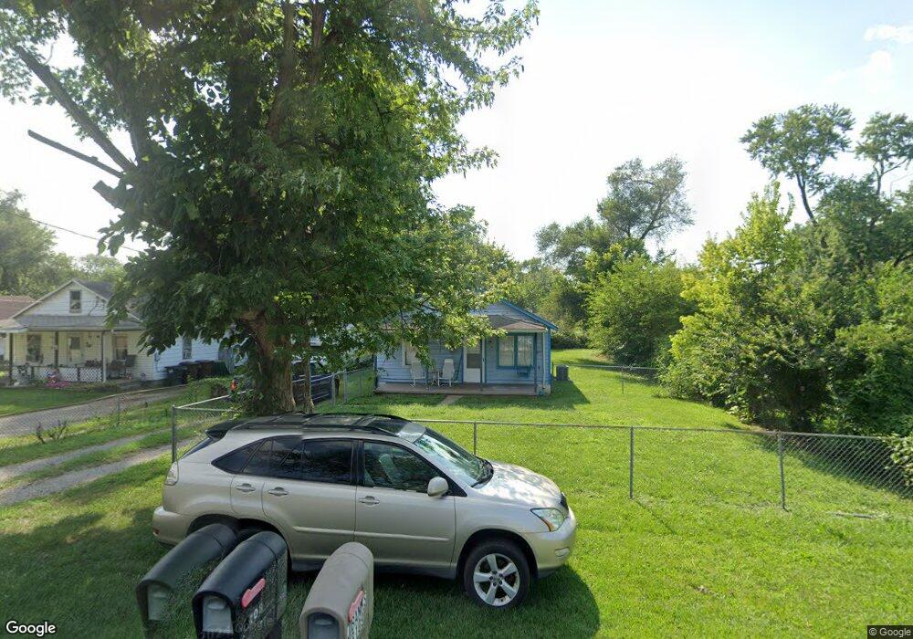
3108 Andrew St Middletown, OH 45044
Amanda-Oneida NeighborhoodEstimated Value: $79,417 - $156,000
3
Beds
1
Bath
780
Sq Ft
$153/Sq Ft
Est. Value
About This Home
This home is located at 3108 Andrew St, Middletown, OH 45044 and is currently estimated at $119,104, approximately $152 per square foot. 3108 Andrew St is a home located in Butler County with nearby schools including Amanda Elementary School, Highview 6th Grade Center, and Middletown Middle School.
Ownership History
Date
Name
Owned For
Owner Type
Purchase Details
Closed on
Jul 21, 2022
Sold by
Perkins Charles D and Perkins Ann Sheryl
Bought by
Ballard Earl and Ballard Amy M
Current Estimated Value
Purchase Details
Closed on
Jun 20, 2016
Sold by
Brown Myrtle L
Bought by
Charles D Perkins
Home Financials for this Owner
Home Financials are based on the most recent Mortgage that was taken out on this home.
Interest Rate
3.54%
Purchase Details
Closed on
May 1, 1993
Purchase Details
Closed on
Jan 1, 1990
Create a Home Valuation Report for This Property
The Home Valuation Report is an in-depth analysis detailing your home's value as well as a comparison with similar homes in the area
Home Values in the Area
Average Home Value in this Area
Purchase History
| Date | Buyer | Sale Price | Title Company |
|---|---|---|---|
| Ballard Earl | -- | Carlson Timothy W | |
| Ballard Earl | -- | Carlson Timothy W | |
| Charles D Perkins | -- | -- | |
| -- | $34,500 | -- | |
| -- | $18,000 | -- |
Source: Public Records
Mortgage History
| Date | Status | Borrower | Loan Amount |
|---|---|---|---|
| Previous Owner | Charles D Perkins | -- |
Source: Public Records
Tax History
| Year | Tax Paid | Tax Assessment Tax Assessment Total Assessment is a certain percentage of the fair market value that is determined by local assessors to be the total taxable value of land and additions on the property. | Land | Improvement |
|---|---|---|---|---|
| 2025 | $3,386 | $17,360 | $5,220 | $12,140 |
| 2024 | $3,386 | $17,360 | $5,220 | $12,140 |
| 2023 | $915 | $21,120 | $5,220 | $15,900 |
| 2022 | $762 | $12,780 | $5,220 | $7,560 |
| 2021 | $733 | $12,780 | $5,220 | $7,560 |
| 2020 | $764 | $12,780 | $5,220 | $7,560 |
| 2019 | $736 | $10,160 | $5,340 | $4,820 |
| 2018 | $658 | $10,160 | $5,340 | $4,820 |
| 2017 | $659 | $10,160 | $5,340 | $4,820 |
| 2016 | $623 | $9,200 | $5,340 | $3,860 |
| 2015 | $29 | $9,200 | $5,340 | $3,860 |
| 2014 | $381 | $11,660 | $5,340 | $6,320 |
| 2013 | $381 | $15,130 | $5,340 | $9,790 |
Source: Public Records
Map
Nearby Homes
- 3113 Rufus St
- 3209 Rufus St
- 1505 Pershing Ave
- 1507 Pershing Ave
- 3210 Finley St
- 1408 Hood Ave
- 1401 Hood Ave
- 2804 Yankee Rd
- 1321 Oxford State Rd
- 3003 Judy Dr
- 1309 Oxford State Rd
- 2012 Oneka Ave
- 3102 Omaha St
- 3222 Mohawk St
- 3111 Omaha St
- 2924 Seneca St
- 1507 Meadow Ave
- 1808 Meadow Ave
- 2220 Yankee Rd
- 1619 Lafayette Ave
- 3110 Andrew St
- 3104 Andrew St
- 3112 Andrew St
- 3109 Morgan St
- 3111 Morgan St
- 3107 Morgan St
- 3114 Andrew St
- 3102 Andrew St
- 3113 Morgan St
- 3105 Morgan St
- 3107 Andrew St
- 3111 Andrew St
- 3115 Morgan St
- 3116 Andrew St
- 3103 Morgan St
- 3105 Andrew St
- 3100 Bernice St
- 3113 Andrew St
- 3103 Andrew St
- 3115 Andrew St
Your Personal Tour Guide
Ask me questions while you tour the home.