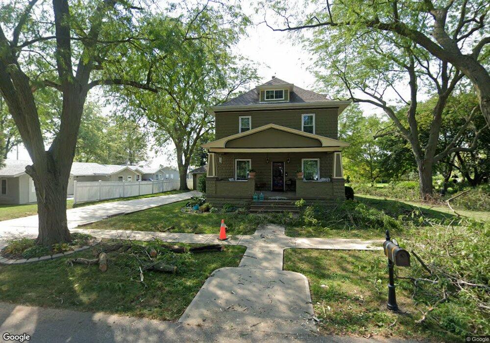
311 E Linn St Lone Tree, IA 52755
Estimated Value: $193,000 - $254,000
3
Beds
1
Bath
1,682
Sq Ft
$134/Sq Ft
Est. Value
About This Home
This home is located at 311 E Linn St, Lone Tree, IA 52755 and is currently estimated at $226,146, approximately $134 per square foot. 311 E Linn St is a home located in Johnson County with nearby schools including Lone Tree Elementary School and Lone Tree Junior/Senior High School.
Ownership History
Date
Name
Owned For
Owner Type
Purchase Details
Closed on
Oct 14, 2010
Sold by
Reavis Shannon T and Mcmahon David R
Bought by
Bopp James H and Bopp Heather R
Current Estimated Value
Home Financials for this Owner
Home Financials are based on the most recent Mortgage that was taken out on this home.
Original Mortgage
$109,650
Outstanding Balance
$72,626
Interest Rate
4.5%
Mortgage Type
New Conventional
Estimated Equity
$153,520
Create a Home Valuation Report for This Property
The Home Valuation Report is an in-depth analysis detailing your home's value as well as a comparison with similar homes in the area
Home Values in the Area
Average Home Value in this Area
Purchase History
| Date | Buyer | Sale Price | Title Company |
|---|---|---|---|
| Bopp James H | $129,000 | None Available |
Source: Public Records
Mortgage History
| Date | Status | Borrower | Loan Amount |
|---|---|---|---|
| Open | Bopp James H | $109,650 |
Source: Public Records
Tax History Compared to Growth
Tax History
| Year | Tax Paid | Tax Assessment Tax Assessment Total Assessment is a certain percentage of the fair market value that is determined by local assessors to be the total taxable value of land and additions on the property. | Land | Improvement |
|---|---|---|---|---|
| 2025 | $2,770 | $241,100 | $56,300 | $184,800 |
| 2024 | $2,688 | $210,700 | $56,300 | $154,400 |
| 2023 | $2,286 | $210,700 | $56,300 | $154,400 |
| 2022 | $2,286 | $154,000 | $44,500 | $109,500 |
| 2021 | $2,260 | $154,000 | $44,500 | $109,500 |
| 2020 | $2,228 | $145,200 | $44,500 | $100,700 |
| 2019 | $1,994 | $141,600 | $44,500 | $97,100 |
| 2018 | $1,956 | $128,600 | $44,500 | $84,100 |
| 2017 | $1,956 | $128,600 | $44,500 | $84,100 |
| 2016 | $1,910 | $123,400 | $44,500 | $78,900 |
| 2015 | $1,910 | $123,400 | $44,500 | $78,900 |
| 2014 | $2,050 | $142,400 | $44,500 | $97,900 |
Source: Public Records
Map
Nearby Homes
- 407 E Elm St
- 500 S Center St
- 201 N Devoe St
- 221 W Commercial St
- 106 Dorothy Ln
- 745 N Perkins St
- 25840 Golden Oak Ln Lot 1
- 25838 Golden Oak Ln Lot 7
- 25836 Golden Oak Ln Lot 8
- 25832 Golden Oak Ln Lot 12
- 25736 Golden Pond Ln Se Lot 17
- 25738 Golden Pond Ln Se Lot 16
- 25824 Golden Oak Ln Lot 9
- 5888 Sand Rd SE
- 1092 Walnut Ave Unit 209
- 1092 Walnut Ave Unit 114 Bld D
- Lot 2 116th Cir
- Lot 39 Walter Mapp Dr
- 2 Commercial Dr
- 1436 Vine Ave