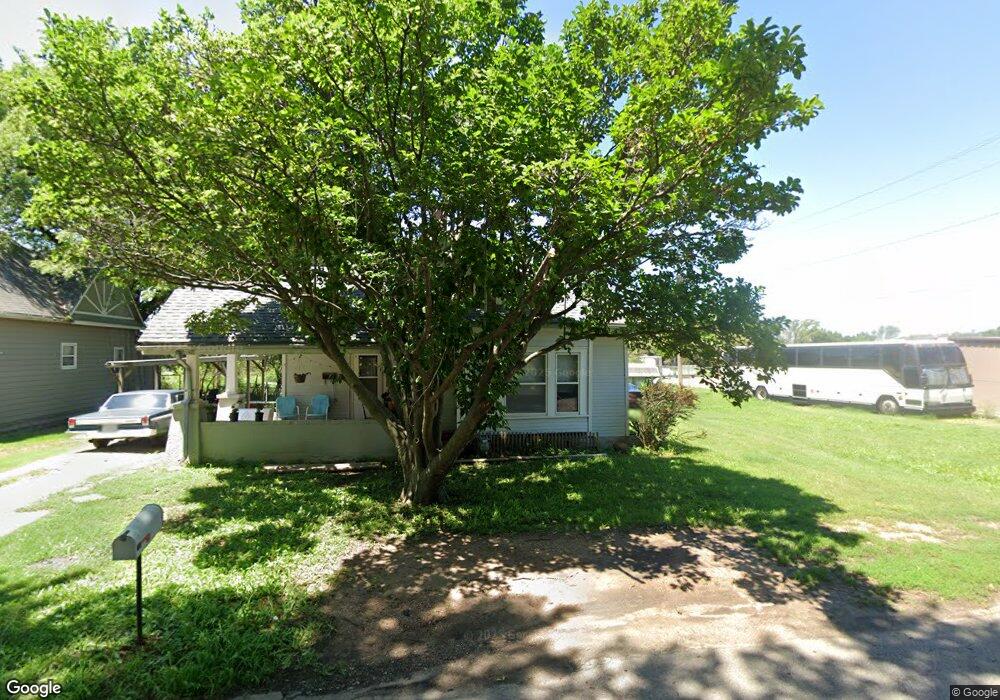
311 N 1st Ave Mulvane, KS 67110
Estimated Value: $161,282 - $162,000
2
Beds
2
Baths
1,585
Sq Ft
$102/Sq Ft
Est. Value
About This Home
This home is located at 311 N 1st Ave, Mulvane, KS 67110 and is currently estimated at $161,641, approximately $101 per square foot. 311 N 1st Ave is a home located in Sedgwick County with nearby schools including Munson Primary School, Mulvane Grade School, and Mulvane Middle School.
Ownership History
Date
Name
Owned For
Owner Type
Purchase Details
Closed on
Aug 5, 2024
Sold by
Tedman Janis K and Tedman Terry F
Bought by
Yates Brian
Current Estimated Value
Home Financials for this Owner
Home Financials are based on the most recent Mortgage that was taken out on this home.
Original Mortgage
$127,645
Outstanding Balance
$125,133
Interest Rate
6.87%
Mortgage Type
FHA
Estimated Equity
$36,508
Purchase Details
Closed on
Jun 17, 2005
Sold by
Evans Barbara L
Bought by
Spencer Dale Allen and Spencer Tawni Lee
Home Financials for this Owner
Home Financials are based on the most recent Mortgage that was taken out on this home.
Original Mortgage
$57,748
Interest Rate
5.76%
Mortgage Type
Credit Line Revolving
Create a Home Valuation Report for This Property
The Home Valuation Report is an in-depth analysis detailing your home's value as well as a comparison with similar homes in the area
Home Values in the Area
Average Home Value in this Area
Purchase History
| Date | Buyer | Sale Price | Title Company |
|---|---|---|---|
| Yates Brian | -- | Alpha National Title Guaranty | |
| Spencer Dale Allen | -- | None Available |
Source: Public Records
Mortgage History
| Date | Status | Borrower | Loan Amount |
|---|---|---|---|
| Open | Yates Brian | $127,645 | |
| Previous Owner | Spencer Dale Allen | $57,748 |
Source: Public Records
Tax History Compared to Growth
Tax History
| Year | Tax Paid | Tax Assessment Tax Assessment Total Assessment is a certain percentage of the fair market value that is determined by local assessors to be the total taxable value of land and additions on the property. | Land | Improvement |
|---|---|---|---|---|
| 2025 | $1,146 | $13,881 | $3,301 | $10,580 |
| 2024 | $1,146 | $8,464 | $2,024 | $6,440 |
| 2023 | $1,146 | $8,464 | $2,024 | $6,440 |
| 2022 | $1,199 | $8,464 | $1,909 | $6,555 |
| 2021 | $1,068 | $7,912 | $1,909 | $6,003 |
| 2020 | $976 | $7,324 | $1,909 | $5,415 |
| 2019 | $1,083 | $7,821 | $1,852 | $5,969 |
| 2018 | $1,048 | $7,821 | $1,852 | $5,969 |
| 2017 | $987 | $0 | $0 | $0 |
| 2016 | $949 | $0 | $0 | $0 |
| 2015 | -- | $0 | $0 | $0 |
| 2014 | -- | $0 | $0 | $0 |
Source: Public Records
Map
Nearby Homes
- 608 N 1st Ave
- 516 N Luella
- 203 W Bridge St
- 1602 N Topaz Ln
- 545 E Mulvane St
- 711 S Central Ave
- 414 Rucker St
- 10100 S Rock Rd
- 828 N Saddle Run St
- 158 Chestnut Dr
- 170 Chestnut Dr
- 105 E Burlington Dr
- 978 N Cedar Brook Cir
- 1532 N Rockwood Blvd
- 1611 N Rock Rd
- 911 E Jade Ct
- 919 E Jade Ct
- 918 E Jade Ct
- 930 E Jade Ct
- 922 E Jade Ct