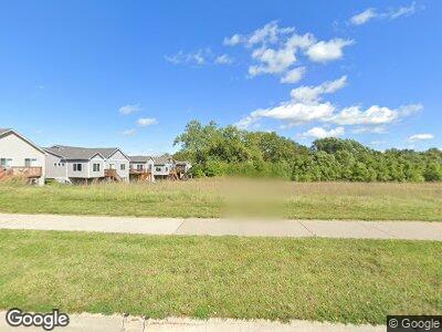
311 SW Brookside Dr Grimes, IA 50111
Estimated Value: $280,560 - $315,000
3
Beds
3
Baths
1,695
Sq Ft
$176/Sq Ft
Est. Value
About This Home
This home is located at 311 SW Brookside Dr, Grimes, IA 50111 and is currently estimated at $298,890, approximately $176 per square foot. 311 SW Brookside Dr is a home located in Polk County with nearby schools including South Prairie Elementary School, Dallas Center-Grimes Middle School, and Dallas Center - Grimes High School.
Ownership History
Date
Name
Owned For
Owner Type
Purchase Details
Closed on
Oct 30, 2018
Sold by
Green Stream Homes Of Iowa Llc
Bought by
Stanbrough Residential Llc
Current Estimated Value
Home Financials for this Owner
Home Financials are based on the most recent Mortgage that was taken out on this home.
Original Mortgage
$1,200,000
Interest Rate
4.6%
Mortgage Type
Construction
Create a Home Valuation Report for This Property
The Home Valuation Report is an in-depth analysis detailing your home's value as well as a comparison with similar homes in the area
Home Values in the Area
Average Home Value in this Area
Purchase History
| Date | Buyer | Sale Price | Title Company |
|---|---|---|---|
| Stanbrough Residential Llc | $180,000 | None Available |
Source: Public Records
Mortgage History
| Date | Status | Borrower | Loan Amount |
|---|---|---|---|
| Closed | Stanbrough Residential Llc | $1,200,000 |
Source: Public Records
Tax History Compared to Growth
Tax History
| Year | Tax Paid | Tax Assessment Tax Assessment Total Assessment is a certain percentage of the fair market value that is determined by local assessors to be the total taxable value of land and additions on the property. | Land | Improvement |
|---|---|---|---|---|
| 2024 | $4,800 | $256,800 | $50,300 | $206,500 |
| 2023 | $4,724 | $256,800 | $50,300 | $206,500 |
| 2022 | $4,756 | $215,200 | $43,500 | $171,700 |
| 2021 | $660 | $215,200 | $43,500 | $171,700 |
| 2020 | $650 | $28,900 | $28,900 | $0 |
| 2019 | $652 | $28,900 | $28,900 | $0 |
| 2018 | $674 | $27,200 | $27,200 | $0 |
| 2017 | $576 | $27,200 | $27,200 | $0 |
| 2016 | $552 | $22,700 | $22,700 | $0 |
| 2015 | $552 | $22,700 | $22,700 | $0 |
| 2014 | -- | $25,200 | $25,200 | $0 |
Source: Public Records
Map
Nearby Homes
- 1312 SW 7th St
- 1408 SW 7th St
- 105 NW Prescott Ln
- 1209 NW 1st Ln
- 3370 NW Prescott Ln
- 1203 NW 2nd St
- 101 NW Sunset Ln
- 1214 NW 3rd St
- 309 NW Beechwood Dr
- 1218 NW 2nd St
- 3112 NW Brookside Dr
- 440 NW Prairie Creek Dr
- 1205 NW 5th St
- 781 SW Cattail Rd
- 100 SE 6th St
- 873 SW Cattail Rd
- 847 SW Cattail Rd
- 500 SE Ewing St
- 304 SE Ewing St
- 813 SW Cattail Rd
- Plat 14 Kennybrook Estates Lots 93 94 95 96 97 98 Dr
- 311 SW Brookside Dr
- 315 SW Brookside Dr
- 1012 SW 5th St
- 1020 SW 5th St
- 317 SW Brookside Dr
- 1010 SW 5th St
- 1008 SW 5th St
- 319 SW Brookside Dr
- 1002 SW 5th St
- 1007 SW 5th St
- 1011 SW 5th St
- 1015 SW 5th St
- 1011 SW 5th St
- 1009 SW 5th St
- 1017 SW 5th St
- 1013 SW 5th St
- 1002 SW 5th St
- 1004 SW 5th St
- 1007 SW 5th St
