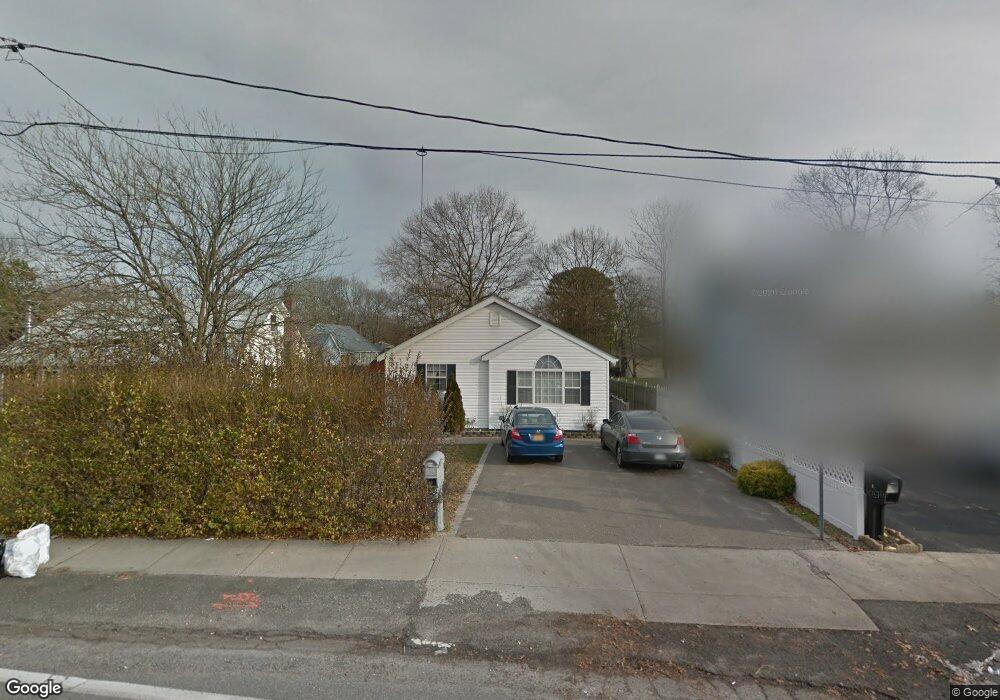
311 William Floyd Pkwy Shirley, NY 11967
Estimated Value: $398,000 - $459,000
3
Beds
1
Bath
930
Sq Ft
$450/Sq Ft
Est. Value
About This Home
This home is located at 311 William Floyd Pkwy, Shirley, NY 11967 and is currently estimated at $418,343, approximately $449 per square foot. 311 William Floyd Pkwy is a home located in Suffolk County with nearby schools including John S. Hobart Elementary School, William Paca Middle School, and William Floyd High School.
Ownership History
Date
Name
Owned For
Owner Type
Purchase Details
Closed on
Mar 7, 2001
Sold by
Oakdale Homes Of Long Island Inc
Bought by
Paisello Domenico and Paisello Annette M
Current Estimated Value
Home Financials for this Owner
Home Financials are based on the most recent Mortgage that was taken out on this home.
Original Mortgage
$118,750
Outstanding Balance
$43,208
Interest Rate
7.01%
Estimated Equity
$375,135
Purchase Details
Closed on
Oct 15, 1997
Sold by
Peluso Paul
Bought by
Oakdale Homes Of Long Island Inc
Purchase Details
Closed on
Dec 8, 1995
Sold by
Kemmler Joseph and Erlwein Lily
Bought by
Peluso Paul
Create a Home Valuation Report for This Property
The Home Valuation Report is an in-depth analysis detailing your home's value as well as a comparison with similar homes in the area
Home Values in the Area
Average Home Value in this Area
Purchase History
| Date | Buyer | Sale Price | Title Company |
|---|---|---|---|
| Paisello Domenico | $125,000 | -- | |
| Oakdale Homes Of Long Island Inc | $9,000 | -- | |
| Peluso Paul | $5,000 | Commonwealth Land Title Ins |
Source: Public Records
Mortgage History
| Date | Status | Borrower | Loan Amount |
|---|---|---|---|
| Open | Paisello Domenico | $118,750 |
Source: Public Records
Tax History Compared to Growth
Tax History
| Year | Tax Paid | Tax Assessment Tax Assessment Total Assessment is a certain percentage of the fair market value that is determined by local assessors to be the total taxable value of land and additions on the property. | Land | Improvement |
|---|---|---|---|---|
| 2024 | $3,841 | $1,100 | $200 | $900 |
| 2023 | $3,841 | $1,100 | $200 | $900 |
| 2022 | $3,811 | $1,100 | $200 | $900 |
| 2021 | $3,811 | $1,100 | $200 | $900 |
| 2020 | $3,937 | $1,100 | $200 | $900 |
| 2019 | $3,937 | $0 | $0 | $0 |
| 2018 | $3,701 | $1,100 | $200 | $900 |
| 2017 | $3,701 | $1,100 | $200 | $900 |
| 2016 | $3,702 | $1,100 | $200 | $900 |
| 2015 | -- | $1,100 | $200 | $900 |
| 2014 | -- | $1,350 | $200 | $1,150 |
Source: Public Records
Map
Nearby Homes
- 59 Oakwood Dr
- 0 Maplewood Dr
- 14 Wellwood Dr
- 11 Sagewood Dr
- 33 Ashwood Dr
- 46 Arpage Dr E
- 52 Arpage Dr E
- 19 Birchwood Dr
- 516 Neighborhood Rd
- 43 Chanel Dr E
- 12 Deer Path
- 4 Beechwood Dr
- 514 Neighborhood Rd
- 487 Neighborhood Rd
- 27 Pinewood Dr
- 55 Pinewood Dr
- 40 Pinewood Dr
- 5 Pinewood Dr
- 17 Golden Gate Dr
- 277 Commack Rd
- 313 William Floyd Pkwy
- 309 William Floyd Pkwy
- 30 Maplewood Dr
- 158 Robinwood Dr
- 28 Maplewood Dr
- 305 William Floyd Pkwy
- 24 Maplewood Dr
- 22 Maplewood Dr
- 301 William Floyd Pkwy
- 316 William Floyd Pkwy
- 168 Robinwood Dr
- 23 Maplewood Dr
- 1 Margin Dr E
- 312 William Floyd Pkwy
- 34 Maplewood Dr
- 19 Maplewood Dr
- 308 William Floyd Pkwy
- 154 Robinwood Dr
- 18 Maplewood Dr
- 17 Maplewood Dr