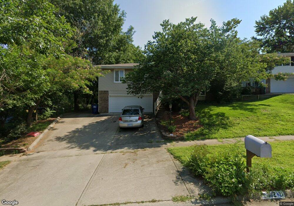
3112 Flint Dr Lawrence, KS 66047
Prairie Meadows NeighborhoodEstimated Value: $358,000 - $390,000
4
Beds
4
Baths
2,777
Sq Ft
$136/Sq Ft
Est. Value
About This Home
This home is located at 3112 Flint Dr, Lawrence, KS 66047 and is currently estimated at $377,027, approximately $135 per square foot. 3112 Flint Dr is a home located in Douglas County with nearby schools including Schwegler Elementary School, Billy Mills Middle School, and Lawrence High School.
Ownership History
Date
Name
Owned For
Owner Type
Purchase Details
Closed on
Jun 29, 2011
Sold by
Wickersheim David A and Wickersheim Nancy L
Bought by
Tozer Travis Newell and Tozer Lisa Liane
Current Estimated Value
Home Financials for this Owner
Home Financials are based on the most recent Mortgage that was taken out on this home.
Original Mortgage
$173,250
Outstanding Balance
$119,303
Interest Rate
4.53%
Mortgage Type
New Conventional
Estimated Equity
$257,724
Create a Home Valuation Report for This Property
The Home Valuation Report is an in-depth analysis detailing your home's value as well as a comparison with similar homes in the area
Home Values in the Area
Average Home Value in this Area
Purchase History
| Date | Buyer | Sale Price | Title Company |
|---|---|---|---|
| Tozer Travis Newell | -- | First American Title |
Source: Public Records
Mortgage History
| Date | Status | Borrower | Loan Amount |
|---|---|---|---|
| Open | Tozer Travis Newell | $173,250 |
Source: Public Records
Tax History Compared to Growth
Tax History
| Year | Tax Paid | Tax Assessment Tax Assessment Total Assessment is a certain percentage of the fair market value that is determined by local assessors to be the total taxable value of land and additions on the property. | Land | Improvement |
|---|---|---|---|---|
| 2025 | $5,082 | $43,079 | $7,475 | $35,604 |
| 2024 | $5,082 | $40,952 | $7,475 | $33,477 |
| 2023 | $4,902 | $38,123 | $5,520 | $32,603 |
| 2022 | $4,538 | $35,075 | $5,060 | $30,015 |
| 2021 | $4,015 | $30,073 | $4,830 | $25,243 |
| 2020 | $3,876 | $29,187 | $4,830 | $24,357 |
| 2019 | $3,772 | $28,440 | $4,830 | $23,610 |
| 2018 | $3,524 | $26,404 | $4,600 | $21,804 |
| 2017 | $3,343 | $24,783 | $4,600 | $20,183 |
| 2016 | $3,111 | $24,104 | $4,602 | $19,502 |
| 2015 | $2,854 | $22,137 | $4,602 | $17,535 |
| 2014 | $2,826 | $22,137 | $4,602 | $17,535 |
Source: Public Records
Map
Nearby Homes
- 2421 Atchison Ave
- 2904 Rimrock Dr
- 2407 Yosemite Dr
- 3307 W 26th St
- 3013 W 23rd Terrace
- 3024 W 23rd Terrace
- 3406 W 25th Terrace
- 2223 Breckenridge Dr
- 2821 Meadow Dr
- 3003 W 29th Terrace
- 2728 Chipperfield Rd
- 2900 Atchison Cir
- 2912 Harrison Ave
- 3009 Atchison Way
- 3033 Havrone Way
- 2523 Morningside Dr
- 2726 Harrison Place
- 3701 W 24th St
- 3713 Sunnybrook Ln
- 3109 W 19th St
- 3108 Flint Dr
- 2432 Atchison Ave
- 3104 Flint Dr
- 3031 Rimrock Dr
- 2428 Atchison Ave
- 3025 Rimrock Dr
- 3109 Flint Dr
- 3101 Rimrock Dr
- 3100 Flint Dr
- 2431 Atchison Ave
- 3105 Flint Dr
- 3021 Rimrock Dr
- 3105 Rimrock Dr
- 2501 Atchison Ave
- 2503 Atchison Ave
- 3101 Flint Dr
- 3024 Flint Dr
- 3017 Rimrock Dr
- 3109 Rimrock Dr
- 2512 Atchison Ave