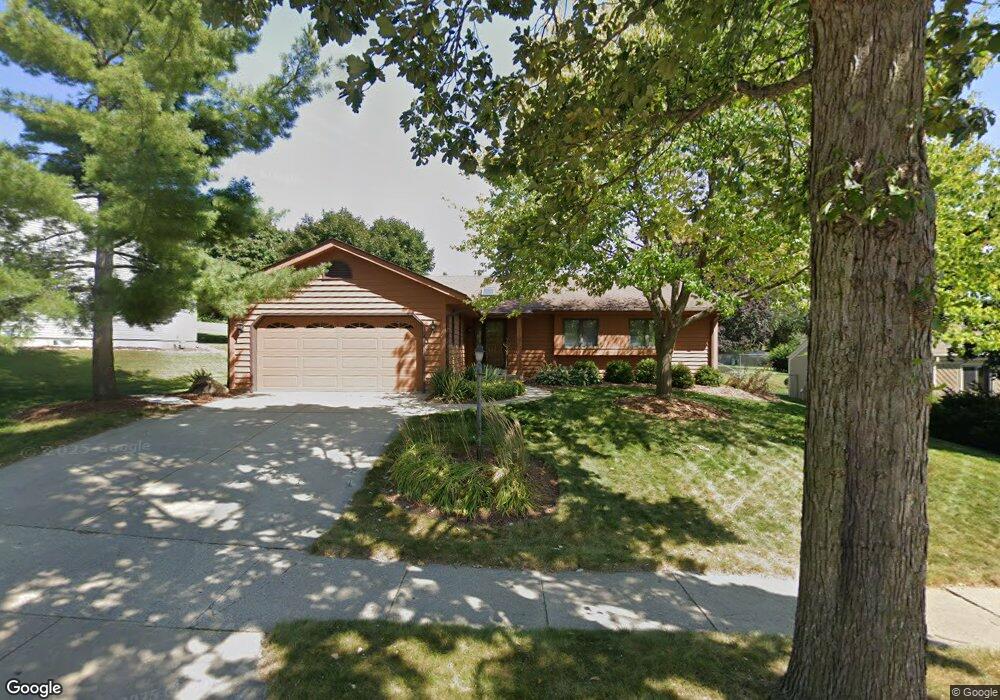
3114 Rolling Ridge Dr Waukesha, WI 53188
Estimated Value: $419,000 - $456,000
3
Beds
2
Baths
1,568
Sq Ft
$276/Sq Ft
Est. Value
About This Home
This home is located at 3114 Rolling Ridge Dr, Waukesha, WI 53188 and is currently estimated at $432,679, approximately $275 per square foot. 3114 Rolling Ridge Dr is a home located in Waukesha County with nearby schools including Meadowbrook Elementary School, Butler Middle School, and North High School.
Ownership History
Date
Name
Owned For
Owner Type
Purchase Details
Closed on
Mar 11, 1997
Sold by
Peterson Steven P and Peterson Susan M
Bought by
Mahoney Patricia A
Current Estimated Value
Home Financials for this Owner
Home Financials are based on the most recent Mortgage that was taken out on this home.
Original Mortgage
$130,800
Outstanding Balance
$15,974
Interest Rate
7.82%
Estimated Equity
$416,705
Create a Home Valuation Report for This Property
The Home Valuation Report is an in-depth analysis detailing your home's value as well as a comparison with similar homes in the area
Home Values in the Area
Average Home Value in this Area
Purchase History
| Date | Buyer | Sale Price | Title Company |
|---|---|---|---|
| Mahoney Patricia A | $163,500 | -- |
Source: Public Records
Mortgage History
| Date | Status | Borrower | Loan Amount |
|---|---|---|---|
| Open | Mahoney Patricia A | $130,800 |
Source: Public Records
Tax History Compared to Growth
Tax History
| Year | Tax Paid | Tax Assessment Tax Assessment Total Assessment is a certain percentage of the fair market value that is determined by local assessors to be the total taxable value of land and additions on the property. | Land | Improvement |
|---|---|---|---|---|
| 2024 | $4,858 | $327,700 | $68,200 | $259,500 |
| 2023 | $4,723 | $327,700 | $68,200 | $259,500 |
| 2022 | $5,645 | $292,100 | $61,200 | $230,900 |
| 2021 | $5,297 | $268,500 | $61,200 | $207,300 |
| 2020 | $5,112 | $268,500 | $61,200 | $207,300 |
| 2019 | $4,956 | $268,500 | $61,200 | $207,300 |
| 2018 | $4,723 | $250,900 | $54,000 | $196,900 |
| 2017 | $4,706 | $250,900 | $54,000 | $196,900 |
| 2016 | $4,557 | $228,100 | $54,000 | $174,100 |
| 2015 | $4,528 | $228,100 | $54,000 | $174,100 |
| 2014 | $4,258 | $211,200 | $54,000 | $157,200 |
| 2013 | $4,361 | $211,200 | $54,000 | $157,200 |
Source: Public Records
Map
Nearby Homes
- 3014 Plymouth Ct
- 2912 Willard Ln
- 2912 N University Dr Unit 305
- 2912 N University Dr Unit 208
- N16W26571 Tall Reeds Ln Unit B
- N15W26518 Tall Reeds Ln Unit C
- N16W26583 Wild Oats Dr Unit C
- N16W26539 Tall Reeds Ln Unit D
- N16W26573 Tall Reeds Ln Unit A
- 2312 Judith Ln
- N16W26567 Tall Reeds Ln Unit D
- N16W26549 Tall Reeds Ln Unit A
- 2605 Emslie Dr
- W276N544 Arrowhead Trail
- W268N1947 Shooting Star Rd Unit B
- N19W26672 Milkweed Ln Unit A
- The Adalyn Plan at Tallgrass - Villas
- 2127 Bluestem Dr Unit 101
- 2106 Bluestem Dr Unit 1301
- 2119 Bluestem Dr Unit 201
- 3118 Rolling Ridge Dr
- 3110 Rolling Ridge Dr
- 3122 Rolling Ridge Dr
- 3106 Rolling Ridge Dr
- 3111 Rolling Ridge Dr
- 3115 Rolling Ridge Dr
- 3119 Rolling Ridge Dr
- 3126 Rolling Ridge Dr
- 2961 Coventry Ln
- 3123 Rolling Ridge Dr
- 3012 Woodridge Ln
- 3127 Rolling Ridge Dr
- 3100 Woodridge Ln
- 2965 Coventry Ln
- 2810 Coventry Ln
- 2957 Coventry Ln
- 2806 Coventry Ln
- 3101 Woodridge Ln
- 3110 Woodridge Ln
- 2802 Coventry Ln
