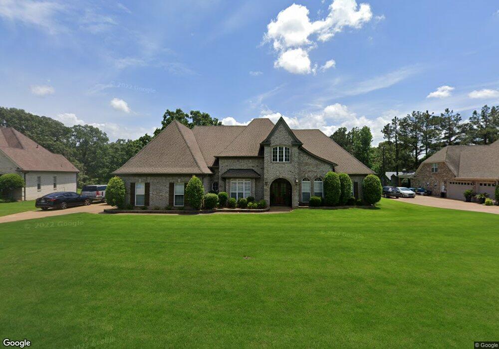
3119 Bridge Moore Dr Nesbit, MS 38651
Pleasant Hill NeighborhoodEstimated Value: $507,521 - $790,000
4
Beds
5
Baths
5,401
Sq Ft
$116/Sq Ft
Est. Value
About This Home
This home is located at 3119 Bridge Moore Dr, Nesbit, MS 38651 and is currently estimated at $626,630, approximately $116 per square foot. 3119 Bridge Moore Dr is a home located in DeSoto County with nearby schools including DeSoto Central Primary School, DeSoto Central Elementary School, and DeSoto Central Middle School.
Ownership History
Date
Name
Owned For
Owner Type
Purchase Details
Closed on
Aug 20, 2021
Sold by
Lee Jairus G and Lee Mashara L
Bought by
Lee Jairus G and Lee Mashara L
Current Estimated Value
Home Financials for this Owner
Home Financials are based on the most recent Mortgage that was taken out on this home.
Original Mortgage
$356,121
Interest Rate
2.8%
Mortgage Type
FHA
Create a Home Valuation Report for This Property
The Home Valuation Report is an in-depth analysis detailing your home's value as well as a comparison with similar homes in the area
Home Values in the Area
Average Home Value in this Area
Purchase History
| Date | Buyer | Sale Price | Title Company |
|---|---|---|---|
| Lee Jairus G | -- | Accommodation |
Source: Public Records
Mortgage History
| Date | Status | Borrower | Loan Amount |
|---|---|---|---|
| Closed | Lee Jairus G | $356,121 |
Source: Public Records
Tax History
| Year | Tax Paid | Tax Assessment Tax Assessment Total Assessment is a certain percentage of the fair market value that is determined by local assessors to be the total taxable value of land and additions on the property. | Land | Improvement |
|---|---|---|---|---|
| 2025 | $3,021 | $36,622 | $5,000 | $31,622 |
| 2024 | $2,679 | $26,792 | $5,000 | $21,792 |
| 2023 | $2,679 | $26,792 | $0 | $0 |
| 2022 | $2,679 | $26,792 | $5,000 | $21,792 |
| 2021 | $2,679 | $26,792 | $5,000 | $21,792 |
| 2020 | $2,504 | $25,049 | $5,000 | $20,049 |
| 2019 | $2,504 | $25,049 | $5,000 | $20,049 |
| 2017 | $2,586 | $46,358 | $25,679 | $20,679 |
| 2016 | $2,586 | $25,679 | $5,000 | $20,679 |
| 2015 | $2,586 | $46,358 | $25,679 | $20,679 |
| 2014 | $2,586 | $25,679 | $0 | $0 |
| 2013 | $2,652 | $25,679 | $0 | $0 |
Source: Public Records
Map
Nearby Homes
- 3456 Susie Cir
- 401 Getwell Rd
- 403 Getwell Rd
- 3491 Hatton Dr
- 3505 Kreunen St
- 3621 Hatton Dr
- 3622 Hatton Dr
- 3617 Kreunen St
- 3631 Kreunen St
- 2951 Eden Ln
- 3820 Windermere Rd N
- 2952 Eden Ln
- 2945 Molly Cove
- 2955 Molly Cove
- 2984 Eden Ln
- 2956 Molly Cove
- 4020 Maryan Ct
- 4055 Bakersfield Dr
- 3250 W Hartland Dr
- 1835 Baisley Dr
- 3103 Bridge Moore Dr
- 3125 Bridge Moore Dr
- 3131 Bridgemoore Dr
- 3077 Bridge Moore Dr
- 4 Bridgemoore Dr
- 3062 Bridgemoore Dr
- 3062 Bridge Moore Dr
- 3062 Bridge Moore Dr
- 3122 Bridge Moore Dr
- Lot 15/16 Bridgemoore
- 2084 Getwell Rd
- 3053 Bridgemoore Dr
- 3053 Bridge Moore Dr
- 3150 Bridge Moore Dr
- 3169 Bridgemoore Dr
- 3169 Bridge Moore Dr
- 3 Bridgemoore Dr
- 3023 Bridge Moore Dr
- 3170 Bridge Moore Dr
- 3203 Bridge Moore Dr
Your Personal Tour Guide
Ask me questions while you tour the home.