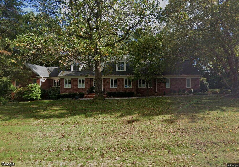
3119 Windsong Dr Oakton, VA 22124
Estimated Value: $1,322,000 - $2,152,000
4
Beds
5
Baths
3,806
Sq Ft
$433/Sq Ft
Est. Value
About This Home
This home is located at 3119 Windsong Dr, Oakton, VA 22124 and is currently estimated at $1,646,762, approximately $432 per square foot. 3119 Windsong Dr is a home located in Fairfax County with nearby schools including Waples Mill Elementary School, Franklin Middle, and Oakton High.
Ownership History
Date
Name
Owned For
Owner Type
Purchase Details
Closed on
Aug 25, 2021
Sold by
William A Flanagan Revocable Living Trus and Dolores Libera Revocable Living Trust
Bought by
Flanagan William A and Libera Dolores
Current Estimated Value
Purchase Details
Closed on
Apr 28, 2015
Sold by
Flanagan William A
Bought by
Flanagan William A
Purchase Details
Closed on
Sep 27, 1994
Sold by
West Monte L
Bought by
Flanagan William A
Create a Home Valuation Report for This Property
The Home Valuation Report is an in-depth analysis detailing your home's value as well as a comparison with similar homes in the area
Home Values in the Area
Average Home Value in this Area
Purchase History
| Date | Buyer | Sale Price | Title Company |
|---|---|---|---|
| Flanagan William A | -- | None Listed On Document | |
| Flanagan William A | -- | None Available | |
| Flanagan William A | -- | None Available | |
| Flanagan William A | -- | -- | |
| Flanagan William A | -- | -- | |
| Flanagan William A | $220,000 | -- |
Source: Public Records
Tax History Compared to Growth
Tax History
| Year | Tax Paid | Tax Assessment Tax Assessment Total Assessment is a certain percentage of the fair market value that is determined by local assessors to be the total taxable value of land and additions on the property. | Land | Improvement |
|---|---|---|---|---|
| 2025 | $18,575 | $1,739,970 | $683,000 | $1,056,970 |
| 2024 | $18,575 | $1,603,370 | $668,000 | $935,370 |
| 2023 | $16,940 | $1,501,140 | $643,000 | $858,140 |
| 2022 | $16,000 | $1,399,200 | $633,000 | $766,200 |
| 2021 | $15,383 | $1,310,830 | $588,000 | $722,830 |
| 2020 | $15,068 | $1,273,180 | $563,000 | $710,180 |
| 2019 | $14,304 | $1,208,620 | $563,000 | $645,620 |
| 2018 | $14,545 | $1,264,760 | $563,000 | $701,760 |
| 2017 | $14,223 | $1,225,040 | $563,000 | $662,040 |
| 2016 | $14,192 | $1,225,040 | $563,000 | $662,040 |
| 2015 | $14,585 | $1,306,870 | $563,000 | $743,870 |
| 2014 | $13,601 | $1,221,450 | $513,000 | $708,450 |
Source: Public Records
Map
Nearby Homes
- 3193 Ariana Dr
- 3010 Westhurst Ct
- 10906 Miller Rd
- 3006 Weber Place
- 11008 Devenish Dr
- 10714 Dudley Ct
- 3424 Jermantown Rd
- 10401 White Granite Dr Unit 2
- 10401 White Granite Dr Unit 1
- Camden Plan at Magnolia Oaks
- Avery Plan at Magnolia Oaks
- 11100 Kings Cavalier Ct
- 11410 Waples Mill Rd
- 3410 Burrows Ave
- 10602 Oak Place
- 10307 Emerald Rock Dr
- 2704 Chariton St
- 10300 Bushman Dr Unit 201
- 10820 Estate Ct
- 10900 Orchard St
- 3124 Windsong Dr
- 3127 Windsong Dr
- 3150 Ariana Dr
- 3118 Windsong Dr
- 10801 Windcloud Ct
- 3128 Windsong Dr
- 3107 Wheatland Farms Ct
- 3154 Ariana Dr
- 3105 Wheatland Farms Ct
- 3132 Windsong Dr
- 3103 Wheatland Farms Ct
- 3115 Windsong Dr
- 10800 Windcloud Ct
- 3109 Wheatland Farms Ct
- 3153 Ariana Dr
- 3199 Wheatland Farms Dr
- 3201 Wheatland Farms Dr
- 10803 Windcloud Ct
- 3158 Ariana Dr
- 3136 Windsong Dr