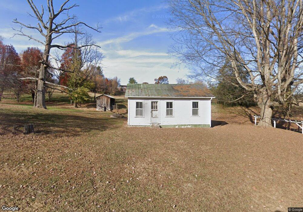
312 Darnell Rd Greeneville, TN 37743
Estimated Value: $90,000 - $224,000
--
Bed
1
Bath
572
Sq Ft
$248/Sq Ft
Est. Value
About This Home
This home is located at 312 Darnell Rd, Greeneville, TN 37743 and is currently estimated at $142,000, approximately $248 per square foot. 312 Darnell Rd is a home located in Greene County with nearby schools including Camp Creek Elementary School, South Greene Middle School, and South Greene High School.
Ownership History
Date
Name
Owned For
Owner Type
Purchase Details
Closed on
Aug 9, 2024
Sold by
Peters Charles C and Peters Dana F
Bought by
Hamilton Michael
Current Estimated Value
Home Financials for this Owner
Home Financials are based on the most recent Mortgage that was taken out on this home.
Original Mortgage
$361,550
Outstanding Balance
$357,451
Interest Rate
6.86%
Mortgage Type
New Conventional
Estimated Equity
-$215,451
Purchase Details
Closed on
Sep 19, 2007
Sold by
Ricker Carmen
Bought by
Peters Charles C
Home Financials for this Owner
Home Financials are based on the most recent Mortgage that was taken out on this home.
Original Mortgage
$22,100
Interest Rate
6.49%
Create a Home Valuation Report for This Property
The Home Valuation Report is an in-depth analysis detailing your home's value as well as a comparison with similar homes in the area
Home Values in the Area
Average Home Value in this Area
Purchase History
| Date | Buyer | Sale Price | Title Company |
|---|---|---|---|
| Hamilton Michael | $350,000 | Reliable Title & Escrow | |
| Peters Charles C | $26,000 | -- |
Source: Public Records
Mortgage History
| Date | Status | Borrower | Loan Amount |
|---|---|---|---|
| Open | Hamilton Michael | $361,550 | |
| Previous Owner | Peters Charles C | $22,100 |
Source: Public Records
Tax History Compared to Growth
Tax History
| Year | Tax Paid | Tax Assessment Tax Assessment Total Assessment is a certain percentage of the fair market value that is determined by local assessors to be the total taxable value of land and additions on the property. | Land | Improvement |
|---|---|---|---|---|
| 2024 | $162 | $9,825 | $4,275 | $5,550 |
| 2023 | $179 | $9,825 | $0 | $0 |
| 2022 | $119 | $5,900 | $3,150 | $2,750 |
| 2021 | $139 | $6,875 | $3,150 | $3,725 |
| 2020 | $139 | $6,875 | $3,150 | $3,725 |
| 2019 | $139 | $6,875 | $3,150 | $3,725 |
| 2018 | $139 | $6,875 | $3,150 | $3,725 |
| 2017 | $105 | $5,300 | $3,150 | $2,150 |
| 2016 | $99 | $5,300 | $3,150 | $2,150 |
| 2015 | $99 | $5,300 | $3,150 | $2,150 |
| 2014 | $99 | $5,300 | $3,150 | $2,150 |
Source: Public Records
Map
Nearby Homes
- 2160 Whirlwind Rd
- 320 Wayland Dr
- 2166 Asheville Hwy
- 1650 Asheville Hwy
- 126 Woodland Cir
- 1124 Hixon Ave
- 2568 Asheville Hwy
- 225 Red Tail Ridge
- 245 Red Tail Ridge Unit Lot 6
- 270 Red Tail Ridge Unit Lot 10
- 208 Majestic Cir
- 74 Cutshall Ave
- 40 Decatur St
- 126 Harrison Dr
- 203 Sunrise Dr
- 150 Decatur St
- 104 Royce St
- 110 Royce St
- 817 Asheville Hwy
- 255 Birdwell Cir
- 344 Darnell Rd
- 388 Darnell Rd
- 2185 Whirlwind Rd
- 2155 Whirlwind Rd
- 2195 Whirlwind Rd
- 2215 Whirlwind Rd
- 2115 Whirlwind Rd
- 2275 Whirlwind Rd
- 2095 Whirlwind Rd
- 2180 Whirlwind Rd
- 2315 Whirlwind Rd
- 2100 Whirlwind Rd
- 2290 Whirlwind Rd
- 2065 Whirlwind Rd
- 2080 Whirlwind Rd
- 2210 Whirlwind Rd
- 2250 Whirlwind Rd
- 2070 Whirlwind Rd
- 2110 Whirlwind Rd
- 2040 Whirlwind Rd