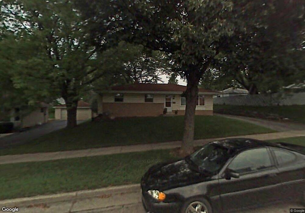
312 Dodie Dr Waukesha, WI 53189
Estimated Value: $319,000 - $350,000
3
Beds
1
Bath
1,138
Sq Ft
$293/Sq Ft
Est. Value
About This Home
This home is located at 312 Dodie Dr, Waukesha, WI 53189 and is currently estimated at $332,869, approximately $292 per square foot. 312 Dodie Dr is a home located in Waukesha County with nearby schools including Waukesha STEM Academy, Horning Middle School, and South High School.
Ownership History
Date
Name
Owned For
Owner Type
Purchase Details
Closed on
Feb 26, 2002
Sold by
Walsh Michael and Walsh Verna N K
Bought by
Otzelberger John M and Otzelberger Julie A
Current Estimated Value
Home Financials for this Owner
Home Financials are based on the most recent Mortgage that was taken out on this home.
Original Mortgage
$131,955
Outstanding Balance
$54,694
Interest Rate
6.95%
Estimated Equity
$278,175
Purchase Details
Closed on
Mar 27, 1996
Sold by
Kartes John R and Kartes Beth E
Bought by
Walsh Michael and Haney Verna N K
Home Financials for this Owner
Home Financials are based on the most recent Mortgage that was taken out on this home.
Original Mortgage
$97,850
Interest Rate
6.98%
Create a Home Valuation Report for This Property
The Home Valuation Report is an in-depth analysis detailing your home's value as well as a comparison with similar homes in the area
Home Values in the Area
Average Home Value in this Area
Purchase History
| Date | Buyer | Sale Price | Title Company |
|---|---|---|---|
| Otzelberger John M | $138,900 | -- | |
| Walsh Michael | $103,000 | -- |
Source: Public Records
Mortgage History
| Date | Status | Borrower | Loan Amount |
|---|---|---|---|
| Open | Otzelberger John M | $131,955 | |
| Previous Owner | Walsh Michael | $97,850 |
Source: Public Records
Tax History Compared to Growth
Tax History
| Year | Tax Paid | Tax Assessment Tax Assessment Total Assessment is a certain percentage of the fair market value that is determined by local assessors to be the total taxable value of land and additions on the property. | Land | Improvement |
|---|---|---|---|---|
| 2024 | $3,840 | $261,800 | $51,800 | $210,000 |
| 2023 | $3,725 | $261,800 | $51,800 | $210,000 |
| 2022 | $3,315 | $176,000 | $55,000 | $121,000 |
| 2021 | $3,384 | $176,000 | $55,000 | $121,000 |
| 2020 | $3,283 | $176,000 | $55,000 | $121,000 |
| 2019 | $3,173 | $176,000 | $55,000 | $121,000 |
| 2018 | $2,917 | $158,600 | $48,900 | $109,700 |
| 2017 | $2,918 | $158,600 | $48,900 | $109,700 |
| 2016 | $3,022 | $154,000 | $48,900 | $105,100 |
| 2015 | $3,007 | $154,000 | $48,900 | $105,100 |
| 2014 | $3,041 | $149,500 | $48,900 | $100,600 |
| 2013 | $3,041 | $149,500 | $48,900 | $100,600 |
Source: Public Records
Map
Nearby Homes
- 1936 Cliff Alex Ct N
- 1522 Big Bend Rd Unit G
- 1432 Big Bend Rd Unit E
- 414 Standing Stone Dr Unit 8-16
- 421 Standing Stone Dr Unit 17-39
- 424 Standing Stone Dr Unit 9-17
- 455 Standing Stone Dr
- 2004 Smart Ct
- 435 Standing Stone Dr Unit 16-37
- 2005 Smart Ct
- 605 Standing Stone Dr
- 609 Standing Stone Dr
- 625 Standing Stone Dr
- 613 Standing Stone Dr
- 621 Standing Stone Dr
- 633 Standing Stone Dr
- The Sawyer Plan at Tenny Woods
- The Everest Plan at Tenny Woods
- The Elaine Plan at Tenny Woods
- The Margot Plan at Tenny Woods
- 318 Dodie Dr
- 1722 S Grand Ave
- 1712 S Grand Ave
- 313 Richard St
- 324 Dodie Dr
- 319 Richard St
- 305 Richard St
- 325 Richard St
- 332 Dodie Dr
- 1828 Enterprise St
- 328 Richard St
- 1723 S Grand Ave
- 1729 S Grand Ave
- 1717 S Grand Ave
- 1803 S Grand Ave
- 314 Richard St
- 1822 Enterprise St
- 304 Richard St
- 1711 S Grand Ave
- 331 Richard St