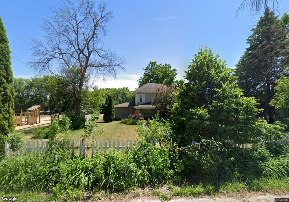
312 E Central St Raymond, IA 50667
Estimated Value: $171,484 - $273,000
5
Beds
1
Bath
1,640
Sq Ft
$128/Sq Ft
Est. Value
About This Home
This home is located at 312 E Central St, Raymond, IA 50667 and is currently estimated at $210,121, approximately $128 per square foot. 312 E Central St is a home located in Black Hawk County with nearby schools including Poyner Elementary School, Bunger Middle School, and East High School.
Ownership History
Date
Name
Owned For
Owner Type
Purchase Details
Closed on
Apr 16, 2014
Sold by
Custer Christina A and Custer Kreg A
Bought by
Custer Kreg A
Current Estimated Value
Home Financials for this Owner
Home Financials are based on the most recent Mortgage that was taken out on this home.
Original Mortgage
$117,472
Interest Rate
4.2%
Mortgage Type
VA
Create a Home Valuation Report for This Property
The Home Valuation Report is an in-depth analysis detailing your home's value as well as a comparison with similar homes in the area
Purchase History
| Date | Buyer | Sale Price | Title Company |
|---|---|---|---|
| Custer Kreg A | -- | None Available |
Source: Public Records
Mortgage History
| Date | Status | Borrower | Loan Amount |
|---|---|---|---|
| Closed | Custer Kreg A | $117,472 |
Source: Public Records
Tax History
| Year | Tax Paid | Tax Assessment Tax Assessment Total Assessment is a certain percentage of the fair market value that is determined by local assessors to be the total taxable value of land and additions on the property. | Land | Improvement |
|---|---|---|---|---|
| 2025 | $1,976 | $172,010 | $19,380 | $152,630 |
| 2024 | $1,976 | $145,150 | $19,380 | $125,770 |
| 2023 | $1,708 | $145,150 | $19,380 | $125,770 |
| 2022 | $1,696 | $123,090 | $19,380 | $103,710 |
| 2021 | $1,718 | $123,090 | $19,380 | $103,710 |
| 2020 | $1,704 | $115,730 | $16,960 | $98,770 |
| 2019 | $1,704 | $115,730 | $16,960 | $98,770 |
| 2018 | $1,678 | $110,800 | $16,960 | $93,840 |
| 2017 | $1,726 | $110,800 | $16,960 | $93,840 |
| 2016 | $1,712 | $110,800 | $16,960 | $93,840 |
| 2015 | $1,712 | $110,800 | $16,960 | $93,840 |
| 2014 | $1,662 | $105,860 | $16,960 | $88,900 |
Source: Public Records
Map
Nearby Homes
- 5955 Osage Rd
- 3121 Gilbertville Rd
- 0 Dubuque Rd Unit NBR20260174
- 000 Lafayette Rd
- 100 Corliss Ave
- 500 Douglas Rd
- TBD Gray St
- 000 Gray St
- 849 Hunter Dr
- Lot # 53 Hunter Dr
- 639 Hunter Dr
- 701 Evansdale Dr
- 240 Marie Ave
- Lot 1 Lafayette Rd
- Lot 5 Lafayette Rd
- 128 Michigan Dr
- 30.66 Acres Mccoy Rd
- 1776 Enid St
- 1760 Michigan Dr
- 4509 Lafayette Rd
- 310 E Central St
- 306 E Central St
- 308 E Central St
- 305 E Central St
- 304 E Central St
- 303 E Central St
- 6908 Lafayette Rd
- 201 1st St
- 207 1st St
- 107 1st St
- 6917 Lafayette Rd
- 218 Washington St
- 305 Commercial St
- 6913 Lafayette Rd
- 101 1st St
- 6909 Lafayette Rd
- 200 1st St
- 203 E Central St
- 6907 Lafayette Rd
- 6905 Lafayette Rd
Your Personal Tour Guide
Ask me questions while you tour the home.