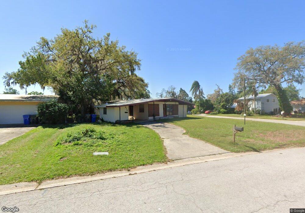
312 Kenmore Rd Brandon, FL 33511
Estimated Value: $291,000 - $321,092
3
Beds
2
Baths
1,278
Sq Ft
$241/Sq Ft
Est. Value
About This Home
This home is located at 312 Kenmore Rd, Brandon, FL 33511 and is currently estimated at $307,523, approximately $240 per square foot. 312 Kenmore Rd is a home located in Hillsborough County with nearby schools including Yates Elementary School, Mann Middle School, and Brandon High School.
Ownership History
Date
Name
Owned For
Owner Type
Purchase Details
Closed on
Aug 21, 2015
Sold by
Mcfarland Barbara Lorraine
Bought by
Millan Nancy
Current Estimated Value
Home Financials for this Owner
Home Financials are based on the most recent Mortgage that was taken out on this home.
Original Mortgage
$132,554
Outstanding Balance
$103,325
Interest Rate
4.09%
Mortgage Type
FHA
Estimated Equity
$204,198
Purchase Details
Closed on
Feb 3, 2009
Sold by
Mcfarland Barbara Lorraine and Mayfield Jack S
Bought by
Mcfarland Barbara Lorraine
Purchase Details
Closed on
Jun 16, 2008
Sold by
Mcfarland Barbara Lorraine and Kirkland Barbara Lorraine
Bought by
Mcfarland Barbara Lorraine and Mayfield Jack Steven
Create a Home Valuation Report for This Property
The Home Valuation Report is an in-depth analysis detailing your home's value as well as a comparison with similar homes in the area
Home Values in the Area
Average Home Value in this Area
Purchase History
| Date | Buyer | Sale Price | Title Company |
|---|---|---|---|
| Millan Nancy | $135,000 | Florida Title Pros | |
| Mcfarland Barbara Lorraine | -- | None Available | |
| Mcfarland Barbara Lorraine | -- | None Available |
Source: Public Records
Mortgage History
| Date | Status | Borrower | Loan Amount |
|---|---|---|---|
| Open | Millan Nancy | $132,554 |
Source: Public Records
Tax History
| Year | Tax Paid | Tax Assessment Tax Assessment Total Assessment is a certain percentage of the fair market value that is determined by local assessors to be the total taxable value of land and additions on the property. | Land | Improvement |
|---|---|---|---|---|
| 2025 | $1,809 | $117,320 | -- | -- |
| 2024 | $1,809 | $114,014 | -- | -- |
| 2023 | $1,714 | $110,693 | $0 | $0 |
| 2022 | $1,577 | $107,469 | $0 | $0 |
| 2021 | $1,548 | $104,339 | $0 | $0 |
| 2020 | $1,469 | $102,898 | $0 | $0 |
| 2019 | $1,364 | $99,414 | $0 | $0 |
| 2018 | $1,313 | $97,560 | $0 | $0 |
| 2017 | $1,284 | $104,096 | $0 | $0 |
| 2016 | $1,258 | $93,588 | $0 | $0 |
| 2015 | $1,950 | $89,155 | $0 | $0 |
| 2014 | $1,825 | $78,005 | $0 | $0 |
| 2013 | -- | $70,914 | $0 | $0 |
Source: Public Records
Map
Nearby Homes
- 310 Kenmore Rd
- 313 Beverly Blvd
- 1105 Briarwood Rd
- 726 Fairmont Dr
- 0 Dew Bloom Rd Unit MFRL4947412
- 730 Clayton St
- 1107 Southside Dr
- 509 S Oakwood Ave
- 721 Holly Terrace
- 1001 Sonesta Ave
- 1121 Tuscanny St
- 603 Westbrook Ave
- 627 Tuscanny St
- 702 Tuscanny St
- 803 Bills Cir
- 126 Ridgewood Ave
- 411 Bryan Rd
- 201 S Mount Carmel Rd
- 312 2nd St
- 712 Lithia Pinecrest Rd
- 320 Kenmore Rd
- 908 Hillside Terrace
- 317 Kenmore Rd
- 319 Kenmore Rd
- 321 Kenmore Rd
- 910 Hillside Terrace
- 308 Kenmore Rd
- 306 Kenmore Rd
- 310 Glendale Dr
- 308 Glendale Dr
- 912 Hillside Terrace
- 907 Hillside Terrace
- 312 Glendale Dr
- 909 Hillside Terrace
- 306 Glendale Dr
- 905 Hillside Terrace
- 909 Woodland Terrace
- 907 Woodland Terrace
- 301 Kenmore Rd
- 304 Kenmore Rd
Your Personal Tour Guide
Ask me questions while you tour the home.