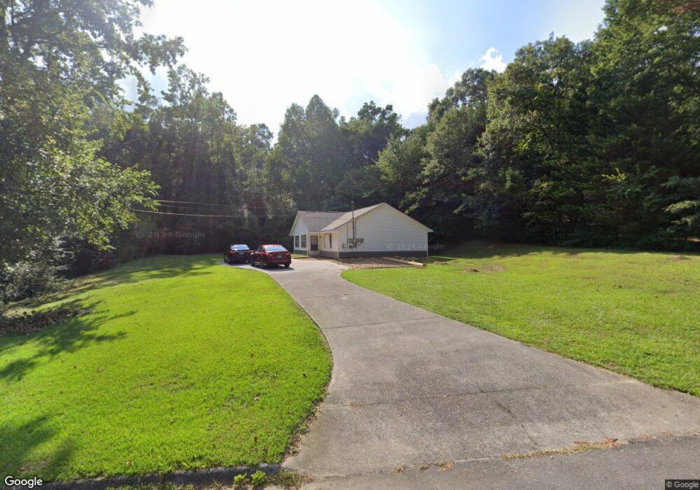
312 Mill Trace Dalton, GA 30721
Estimated Value: $260,116 - $308,000
Studio
2
Baths
1,968
Sq Ft
$144/Sq Ft
Est. Value
About This Home
This home is located at 312 Mill Trace, Dalton, GA 30721 and is currently estimated at $284,372, approximately $144 per square foot. 312 Mill Trace is a home with nearby schools including Pleasant Grove Elementary School, New Hope Middle School, and Northwest Whitfield County High School.
Ownership History
Date
Name
Owned For
Owner Type
Purchase Details
Closed on
Nov 20, 2012
Sold by
Manton Thomas L
Bought by
Manton Fam Partnership Lllp
Current Estimated Value
Purchase Details
Closed on
Dec 21, 2007
Sold by
Not Provided
Bought by
Manton Thomas L
Purchase Details
Closed on
Apr 1, 1996
Bought by
Manton Tom L and Parks Randall C
Create a Home Valuation Report for This Property
The Home Valuation Report is an in-depth analysis detailing your home's value as well as a comparison with similar homes in the area
Purchase History
| Date | Buyer | Sale Price | Title Company |
|---|---|---|---|
| Manton Fam Partnership Lllp | $90,000 | -- | |
| Manton Thomas L | -- | -- | |
| Manton Tom L | $72,500 | -- |
Source: Public Records
Tax History
| Year | Tax Paid | Tax Assessment Tax Assessment Total Assessment is a certain percentage of the fair market value that is determined by local assessors to be the total taxable value of land and additions on the property. | Land | Improvement |
|---|---|---|---|---|
| 2025 | $2,203 | $100,909 | $12,000 | $88,909 |
| 2024 | $2,203 | $100,909 | $12,000 | $88,909 |
| 2023 | $1,575 | $53,156 | $8,000 | $45,156 |
| 2022 | $1,002 | $33,970 | $5,250 | $28,720 |
| 2021 | $1,002 | $33,970 | $5,250 | $28,720 |
| 2020 | $1,036 | $33,970 | $5,250 | $28,720 |
| 2019 | $1,053 | $33,970 | $5,250 | $28,720 |
| 2018 | $1,070 | $33,970 | $5,250 | $28,720 |
| 2017 | $1,071 | $33,970 | $5,250 | $28,720 |
| 2016 | $951 | $31,372 | $5,250 | $26,122 |
| 2014 | $969 | $35,981 | $5,250 | $30,731 |
| 2013 | -- | $35,981 | $5,250 | $30,731 |
Source: Public Records
Map
Nearby Homes
- 522 Westbrook Rd
- 110 Pinewood Way
- 2502 E Hillview Dr
- 112 Albertson Dr
- 503 Moore Dr
- 439 Westbrook Rd
- 0 TRACT 5 2nd St
- 106 Albertson Dr
- The Braselton II Plan at The Andros
- The Manchester II Plan at The Andros
- The Buford II Plan at The Andros
- The Ellison II Plan at The Andros - Townhomes
- The Norwood II Plan at The Andros - Townhomes
- The Reynolds Plan at The Andros
- The Maddux II Plan at The Andros - Townhomes
- The Ryman Plan at The Andros
- The Colby Plan at The Andros
- The Bellwood Plan at The Andros
- The Rutledge Plan at The Andros - Townhomes
- 2311 1st St
- 314 Mill Trace
- 316 Mill Trace
- 313 Mill Trace
- 320 Mill Trace
- 318 Mill Trace
- 319 Mill Trace
- 367 Haig Mill Rd NW
- 395 Haig Mill Rd NW
- 321 Mill Trace
- 321 Mill Trace Unit 321A
- 322 Mill Trace
- 365 Haig Mill Rd NW
- 407 Stackstone Dr
- 323 Mill Trace Unit 323A
- 302 Ricky Dr
- 395 Stackstone Dr
- 409 Stackstone Dr
- 388 Haig Mill Rd NW
- 369 Stackstone Dr
- 324 Mill Trace