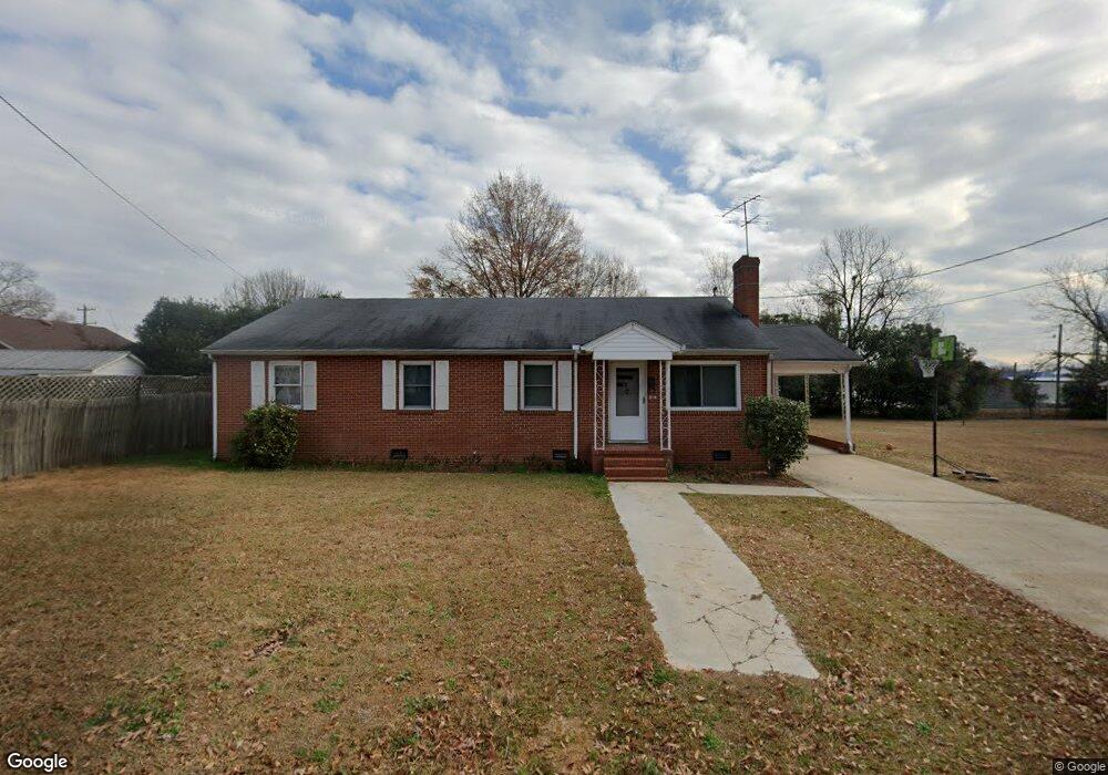
312 N 7th St Smithfield, NC 27577
Estimated Value: $242,000 - $263,000
3
Beds
2
Baths
1,623
Sq Ft
$154/Sq Ft
Est. Value
About This Home
This home is located at 312 N 7th St, Smithfield, NC 27577 and is currently estimated at $249,161, approximately $153 per square foot. 312 N 7th St is a home located in Johnston County with nearby schools including South Smithfield Elementary School, Smithfield Middle School, and Smithfield-Selma High School.
Ownership History
Date
Name
Owned For
Owner Type
Purchase Details
Closed on
Oct 14, 2015
Sold by
Fannie Mae
Bought by
Strickland Steven
Current Estimated Value
Purchase Details
Closed on
Aug 3, 2015
Sold by
Smith Joseph and Smith Joseph
Bought by
Federal National Mortgage Association
Purchase Details
Closed on
Oct 4, 2004
Sold by
Smith Joseph
Bought by
Ingram Charles O
Purchase Details
Closed on
Jan 27, 2003
Sold by
Cecil Sr Cecil B and Cecil Eudelle H
Bought by
Brown Reba Eudelle Hill
Create a Home Valuation Report for This Property
The Home Valuation Report is an in-depth analysis detailing your home's value as well as a comparison with similar homes in the area
Home Values in the Area
Average Home Value in this Area
Purchase History
| Date | Buyer | Sale Price | Title Company |
|---|---|---|---|
| Strickland Steven | -- | None Available | |
| Federal National Mortgage Association | $84,808 | None Available | |
| Ingram Charles O | $100,000 | -- | |
| Cecil Cecil B | $90,000 | -- | |
| Brown Reba Eudelle Hill | -- | -- |
Source: Public Records
Tax History Compared to Growth
Tax History
| Year | Tax Paid | Tax Assessment Tax Assessment Total Assessment is a certain percentage of the fair market value that is determined by local assessors to be the total taxable value of land and additions on the property. | Land | Improvement |
|---|---|---|---|---|
| 2025 | $2,297 | $236,800 | $66,240 | $170,560 |
| 2024 | $1,560 | $125,830 | $31,050 | $94,780 |
| 2023 | $1,585 | $125,830 | $31,050 | $94,780 |
| 2022 | $1,636 | $125,830 | $31,050 | $94,780 |
| 2021 | $1,636 | $125,830 | $31,050 | $94,780 |
| 2020 | $1,674 | $125,830 | $31,050 | $94,780 |
| 2019 | $1,674 | $125,830 | $31,050 | $94,780 |
| 2018 | $1,641 | $121,530 | $31,050 | $90,480 |
| 2017 | $1,641 | $121,530 | $31,050 | $90,480 |
| 2016 | $1,459 | $108,060 | $31,050 | $77,010 |
| 2015 | $729 | $108,060 | $31,050 | $77,010 |
| 2014 | $729 | $108,060 | $31,050 | $77,010 |
Source: Public Records
Map
Nearby Homes
- 91 Lotus Ave
- 706 Caswell St
- 118 N 7th St
- 707 Massey St
- 111 S 5th St
- 612 N 4th St
- 604 E Johnston St
- 602 E Johnston St
- 209 S 6th St
- 211 S 6th St
- 359 Thompson Overlook Way
- 212 S 6th St
- 507 E Woodall St
- 407 E Woodall St
- 429 S 5th St
- 214 Oak Barrel Rd
- 000 Berkshire Rd
- 0 Aspen Dr Unit 10126028
- 38 W Waddell Dr
- 31 W Waddell Dr
- 706 Hancock St
- 702 Hancock St
- 300 N 7th St
- 708 Hancock St
- 616 Hancock St
- 143 Lotus Ave
- 115 Lotus Ave
- 39 Lotus Ave
- 704 Caswell St
- 608 Hancock St
- 312 N Brightleaf Blvd
- 609 Hancock St
- 312 N Sixth St
- 310 N 6th St
- 312 N 6th St
- 308 N 6th St
- 604 Hancock St
- 306 N 6th St
- 400 N Brightleaf Blvd
- 302 N 6th St Unit 2