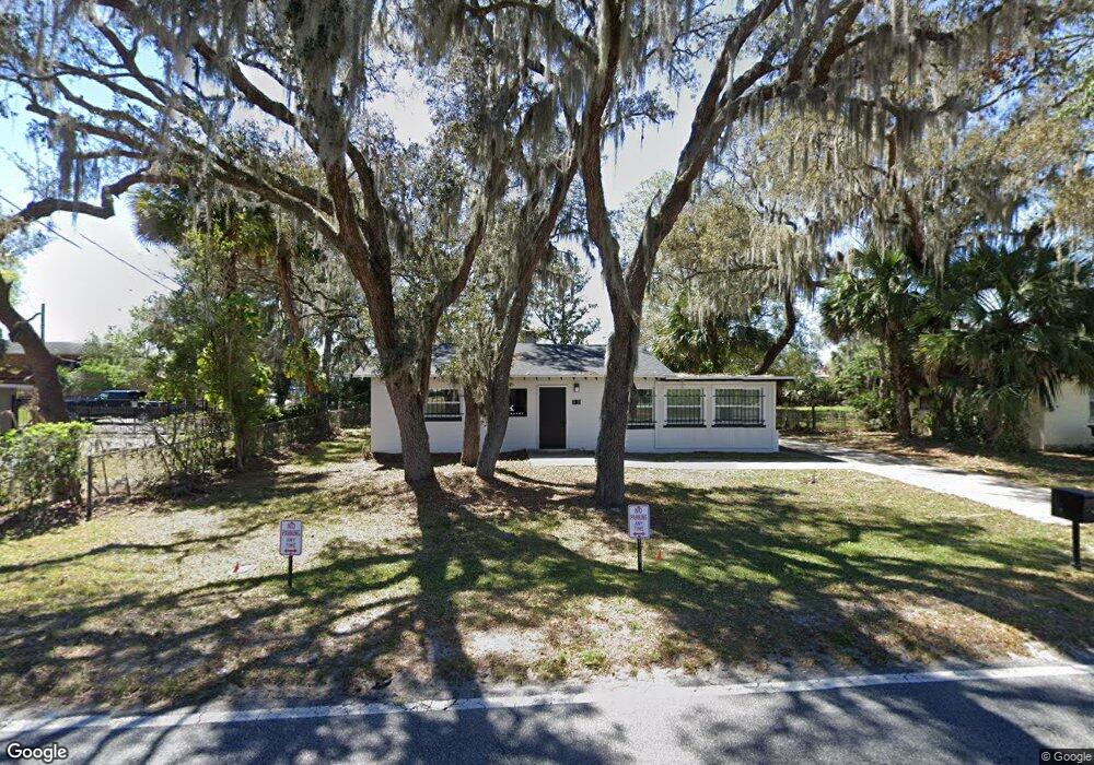
312 Old Dixie Hwy Apopka, FL 32712
Estimated Value: $194,000 - $266,000
2
Beds
1
Bath
1,711
Sq Ft
$129/Sq Ft
Est. Value
About This Home
This home is located at 312 Old Dixie Hwy, Apopka, FL 32712 and is currently estimated at $220,638, approximately $128 per square foot. 312 Old Dixie Hwy is a home located in Orange County with nearby schools including Apopka Elementary School, Apopka Middle School, and Apopka High School.
Ownership History
Date
Name
Owned For
Owner Type
Purchase Details
Closed on
Oct 23, 2015
Sold by
The Bank Of New York Mellon
Bought by
Sbkp Limited Liability Company
Current Estimated Value
Purchase Details
Closed on
Sep 22, 2015
Sold by
Kalantary Abraham
Bought by
The Bank Of New York Mellon and The Bank Of New York
Purchase Details
Closed on
Jul 12, 2006
Sold by
Woodham Robert B
Bought by
Kalantary Abraham
Home Financials for this Owner
Home Financials are based on the most recent Mortgage that was taken out on this home.
Original Mortgage
$25,215
Interest Rate
6.54%
Mortgage Type
Credit Line Revolving
Create a Home Valuation Report for This Property
The Home Valuation Report is an in-depth analysis detailing your home's value as well as a comparison with similar homes in the area
Home Values in the Area
Average Home Value in this Area
Purchase History
| Date | Buyer | Sale Price | Title Company |
|---|---|---|---|
| Sbkp Limited Liability Company | $50,100 | Attorney | |
| The Bank Of New York Mellon | -- | None Available | |
| Kalantary Abraham | $168,100 | Leading Edge Title Partners |
Source: Public Records
Mortgage History
| Date | Status | Borrower | Loan Amount |
|---|---|---|---|
| Previous Owner | Kalantary Abraham | $25,215 | |
| Previous Owner | Kalantary Abraham | $134,480 |
Source: Public Records
Tax History Compared to Growth
Tax History
| Year | Tax Paid | Tax Assessment Tax Assessment Total Assessment is a certain percentage of the fair market value that is determined by local assessors to be the total taxable value of land and additions on the property. | Land | Improvement |
|---|---|---|---|---|
| 2025 | $1,863 | $116,483 | -- | -- |
| 2024 | $1,639 | $116,483 | -- | -- |
| 2023 | $1,639 | $109,444 | $45,000 | $64,444 |
| 2022 | $1,498 | $99,706 | $45,000 | $54,706 |
| 2021 | $1,412 | $93,450 | $45,000 | $48,450 |
| 2020 | $1,171 | $72,326 | $23,000 | $49,326 |
| 2019 | $1,168 | $73,201 | $23,000 | $50,201 |
| 2018 | $1,118 | $72,347 | $23,000 | $49,347 |
| 2017 | $934 | $54,406 | $23,000 | $31,406 |
| 2016 | $891 | $50,693 | $18,000 | $32,693 |
| 2015 | $1,247 | $50,684 | $18,000 | $32,684 |
| 2014 | $1,143 | $51,474 | $21,318 | $30,156 |
Source: Public Records
Map
Nearby Homes
- 140 S Hawthorne Ave
- 48 W Orange St
- 101 W Main St
- 657 W Orange Blossom Trail
- 107 N Central Ave
- 319 Smugglers Way
- 397 Smugglers Way
- 660 W Orange Blossom Trail
- 335 Bluff Ln
- 352 Smugglers Way
- 245 N Central Ave
- 573 S Washington Ave
- 40 W Laurel St
- 292 Bonnie Glen Ln
- 464 Breezeway Dr
- 140 E Oak St
- 462 Shirley Dr
- 160 E Oak St
- 33 W 7th St
- 462 N Lake Ave
- 318 Old Dixie Hwy
- 308 Old Dixie Hwy
- 324 Old Dixie Hwy
- 339 W Main St
- 345 W Orange Blossom Trail
- 345 W Main St
- 340 W Orange Blossom Trail
- 301 W Main St
- 15 N Hawthorne Ave
- 355 W Orange Blossom Trail Unit 355
- 262 W Magnolia St
- 102 N Hawthorne Ave
- 404 W Orange Blossom Trail
- 397 Old Dixie Hwy
- 235 W Orange St
- 407 W Station St
- 405 W Station St
- 110 N Hawthorne Ave
- 254 W Magnolia St
- 101 N Hawthorne Ave