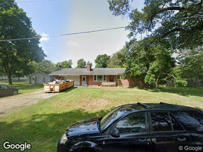
312 S Clark St Athens, MI 49011
Estimated Value: $157,000 - $207,657
3
Beds
1
Bath
1,161
Sq Ft
$156/Sq Ft
Est. Value
About This Home
This home is located at 312 S Clark St, Athens, MI 49011 and is currently estimated at $181,664, approximately $156 per square foot. 312 S Clark St is a home located in Calhoun County with nearby schools including East Leroy Elementary School and Athens Junior/Senor High School.
Ownership History
Date
Name
Owned For
Owner Type
Purchase Details
Closed on
Mar 30, 2012
Sold by
Gable Randal Lee and Gable Larah K
Bought by
Lykins Matthew J
Current Estimated Value
Home Financials for this Owner
Home Financials are based on the most recent Mortgage that was taken out on this home.
Original Mortgage
$98,600
Outstanding Balance
$69,819
Interest Rate
3.92%
Mortgage Type
New Conventional
Estimated Equity
$119,229
Purchase Details
Closed on
Sep 9, 1992
Sold by
Edwards Adrian
Bought by
Gable Randal L
Create a Home Valuation Report for This Property
The Home Valuation Report is an in-depth analysis detailing your home's value as well as a comparison with similar homes in the area
Home Values in the Area
Average Home Value in this Area
Purchase History
| Date | Buyer | Sale Price | Title Company |
|---|---|---|---|
| Lykins Matthew J | $94,900 | Devon Title Agency | |
| Gable Randal L | $65,000 | -- |
Source: Public Records
Mortgage History
| Date | Status | Borrower | Loan Amount |
|---|---|---|---|
| Open | Lykins Matthew J | $98,600 | |
| Previous Owner | Gable Randal Lee | $30,000 | |
| Previous Owner | Gable Randal L | $84,900 |
Source: Public Records
Tax History Compared to Growth
Tax History
| Year | Tax Paid | Tax Assessment Tax Assessment Total Assessment is a certain percentage of the fair market value that is determined by local assessors to be the total taxable value of land and additions on the property. | Land | Improvement |
|---|---|---|---|---|
| 2024 | $1,593 | $92,800 | $0 | $0 |
| 2023 | $1,593 | $77,500 | $0 | $0 |
| 2022 | $607 | $64,700 | $0 | $0 |
| 2021 | $955 | $60,800 | $0 | $0 |
| 2020 | $580 | $56,700 | $0 | $0 |
| 2019 | $0 | $49,500 | $0 | $0 |
| 2018 | $0 | $50,000 | $6,300 | $43,700 |
| 2017 | $0 | $49,500 | $0 | $0 |
| 2016 | $0 | $48,600 | $0 | $0 |
| 2015 | -- | $48,900 | $6,714 | $42,186 |
| 2014 | -- | $51,900 | $6,714 | $45,186 |
Source: Public Records
Map
Nearby Homes
- 420 S Capital Ave
- 429 S Capital Ave
- 150 S Clark St
- 315 S Avenue A
- 145 Kingsbury
- 133 E Mill
- 203 E Mill
- V/L Chippawa Circle Dr
- 3525 3 1 2 Mile Rd
- 0 3 1 2 Mile Rd
- 0 Dotson Dr Unit 24037129
- 3987 3 1 2 Mile Rd
- 793 Blossom Rd
- 170 Tuttle Park Dr
- 771 Q-Drive S
- 914 Sioux Dr
- 1171 Oak Grove Park
- 1161 Oak Grove Park
- 697 Tuttle Rd
- 6160 S Dr S