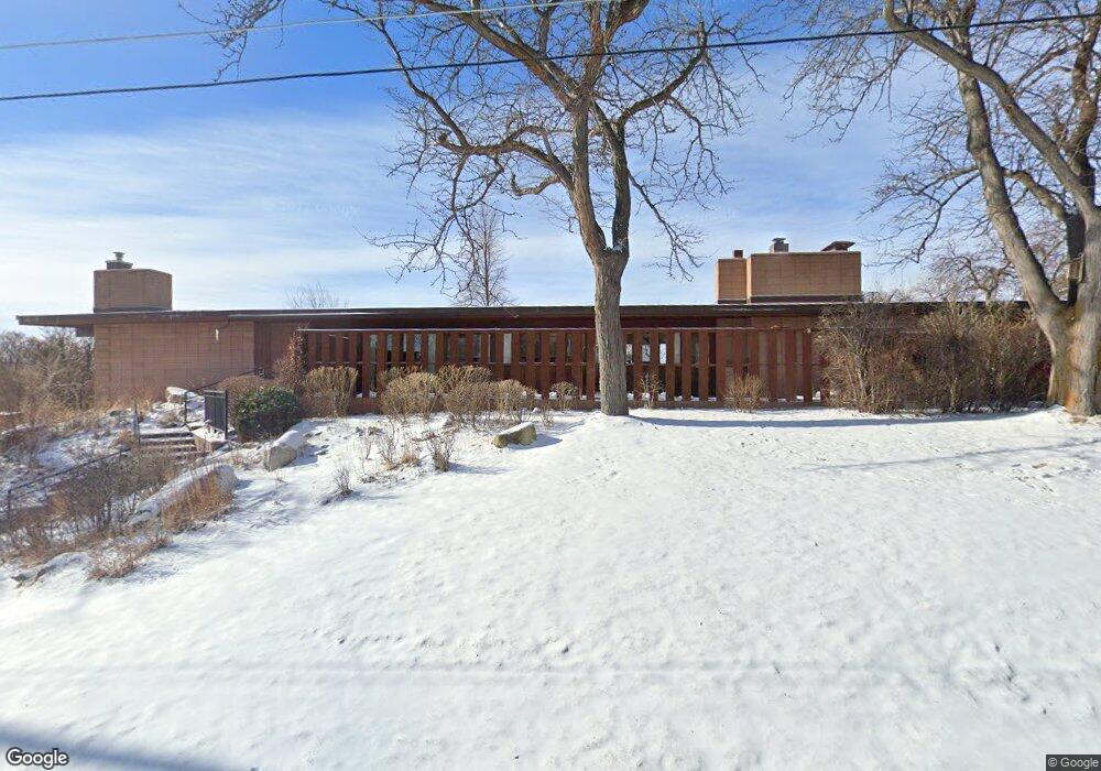
3120 W Macdonald Dr Billings, MT 59102
North Central Billings NeighborhoodEstimated Value: $486,000 - $627,000
3
Beds
3
Baths
3,000
Sq Ft
$184/Sq Ft
Est. Value
About This Home
This home is located at 3120 W Macdonald Dr, Billings, MT 59102 and is currently estimated at $552,782, approximately $184 per square foot. 3120 W Macdonald Dr is a home located in Yellowstone County with nearby schools including Poly Drive School, Will James Junior High School, and Billings Senior High School.
Ownership History
Date
Name
Owned For
Owner Type
Purchase Details
Closed on
Jan 28, 2010
Sold by
Graham David M and Mcdowell Heather
Bought by
Darby Wilbur David and Darby Mary H
Current Estimated Value
Purchase Details
Closed on
Mar 18, 2009
Sold by
Graham David M
Bought by
Graham David M and Mcdowell Heather
Home Financials for this Owner
Home Financials are based on the most recent Mortgage that was taken out on this home.
Original Mortgage
$179,000
Interest Rate
5.04%
Mortgage Type
Purchase Money Mortgage
Purchase Details
Closed on
Mar 31, 2006
Sold by
Fulton Alfred M
Bought by
Graham David M
Home Financials for this Owner
Home Financials are based on the most recent Mortgage that was taken out on this home.
Original Mortgage
$219,400
Interest Rate
6.25%
Mortgage Type
New Conventional
Create a Home Valuation Report for This Property
The Home Valuation Report is an in-depth analysis detailing your home's value as well as a comparison with similar homes in the area
Home Values in the Area
Average Home Value in this Area
Purchase History
| Date | Buyer | Sale Price | Title Company |
|---|---|---|---|
| Darby Wilbur David | -- | None Available | |
| Graham David M | -- | None Available | |
| Graham David M | -- | None Available |
Source: Public Records
Mortgage History
| Date | Status | Borrower | Loan Amount |
|---|---|---|---|
| Previous Owner | Graham David M | $179,000 | |
| Previous Owner | Graham David M | $219,400 |
Source: Public Records
Tax History Compared to Growth
Tax History
| Year | Tax Paid | Tax Assessment Tax Assessment Total Assessment is a certain percentage of the fair market value that is determined by local assessors to be the total taxable value of land and additions on the property. | Land | Improvement |
|---|---|---|---|---|
| 2025 | $4,703 | $516,000 | $80,280 | $435,720 |
| 2024 | $4,703 | $467,700 | $75,624 | $392,076 |
| 2023 | $4,744 | $467,700 | $75,624 | $392,076 |
| 2022 | $4,331 | $374,400 | $0 | $0 |
| 2021 | $4,064 | $374,400 | $0 | $0 |
| 2020 | $4,306 | $383,800 | $0 | $0 |
| 2019 | $4,111 | $383,800 | $0 | $0 |
| 2018 | $3,991 | $365,400 | $0 | $0 |
| 2017 | $3,383 | $365,400 | $0 | $0 |
| 2016 | $3,497 | $332,000 | $0 | $0 |
| 2015 | $3,419 | $332,000 | $0 | $0 |
| 2014 | $2,837 | $143,895 | $0 | $0 |
Source: Public Records
Map
Nearby Homes
- 2737 Gregory Dr N
- 2736 Palm Dr
- 2911 E Macdonald Dr
- 2730 Gregory Dr S
- 2644 Rimrock Rd
- 2646 Rimrock Rd
- 3540 Masterson Cir
- 3580 Masterson Cir
- 2748 Palm Dr
- 3135 Sycamore Ln
- 2815 Palm Dr
- 2411 Granite Ave
- 2717 Patricia Ln
- 3065 Gregory Dr W
- 3450 Masterson Cir
- 3311 Harlou Dr
- 2912 Stinson Ave
- 2516 Lyndale Ln
- 2940 Us Highway 3
- 3106 Forsythia Blvd
- 3190 W Macdonald Dr
- 3119 Gregory Dr
- 3131 Gregory Dr
- 3204 W Macdonald Dr
- 3105 Gregory Dr
- 3100 W Macdonald Dr
- 3120 Gregory Dr
- 3130 Gregory Dr
- 3212 E Macdonald Dr
- 3022 W Macdonald Dr
- 3104 Gregory Dr
- 3139 Gregory Dr
- 3015 Gregory Dr
- 3016 W Macdonald Dr
- 3210 W Macdonald Dr
- 3206 E Macdonald Dr
- 2711 Gregory Dr N
- 2706 Gregory Dr N
- 3121 Sequoia Ln
- 3116 E Macdonald Dr