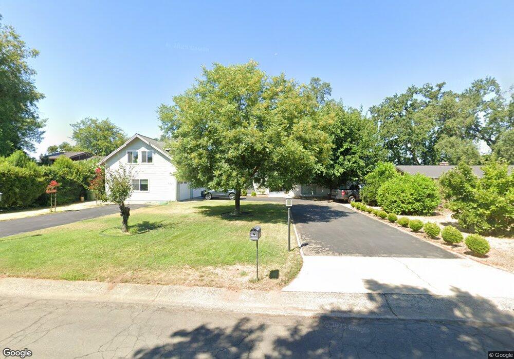
3132 Brent Rd Unit 1 Redding, CA 96002
Bechelli NeighborhoodEstimated Value: $519,000 - $728,000
3
Beds
3
Baths
2,420
Sq Ft
$253/Sq Ft
Est. Value
About This Home
This home is located at 3132 Brent Rd Unit 1, Redding, CA 96002 and is currently estimated at $613,388, approximately $253 per square foot. 3132 Brent Rd Unit 1 is a home located in Shasta County with nearby schools including Rother Elementary School, Parsons Junior High School, and Enterprise High School.
Ownership History
Date
Name
Owned For
Owner Type
Purchase Details
Closed on
Dec 4, 2025
Sold by
Vanbrocklin John
Bought by
Van Brocklin Family Trust and Van Brocklin
Current Estimated Value
Purchase Details
Closed on
Aug 6, 2020
Sold by
Moberley Carr Sandra A
Bought by
Vanbrocklin John Van and Brocklin Pamela K
Purchase Details
Closed on
Sep 15, 2003
Sold by
Moberley W T and Moberley Radeen
Bought by
Moberely Wesley T and Moberley Radeen
Purchase Details
Closed on
Jul 22, 1999
Sold by
Robert Ericson and Robert Arne S
Bought by
Moberley W T and Moberley Radeen
Purchase Details
Closed on
Jun 16, 1998
Sold by
Ericson Robert M and Ericson Arne S
Bought by
Ericson Robert M and Ericson Arne S
Create a Home Valuation Report for This Property
The Home Valuation Report is an in-depth analysis detailing your home's value as well as a comparison with similar homes in the area
Home Values in the Area
Average Home Value in this Area
Purchase History
| Date | Buyer | Sale Price | Title Company |
|---|---|---|---|
| Van Brocklin Family Trust | -- | None Listed On Document | |
| Van Brocklin Family Trust | -- | None Listed On Document | |
| Vanbrocklin John Van | -- | None Available | |
| Vanbrocklin John Van | -- | None Available | |
| Moberely Wesley T | -- | -- | |
| Moberely Wesley T | -- | -- | |
| Moberley W T | $325,000 | Placer Title Company | |
| Moberley W T | $325,000 | Placer Title Company | |
| Ericson Robert M | -- | -- | |
| Ericson Robert M | -- | -- |
Source: Public Records
Tax History
| Year | Tax Paid | Tax Assessment Tax Assessment Total Assessment is a certain percentage of the fair market value that is determined by local assessors to be the total taxable value of land and additions on the property. | Land | Improvement |
|---|---|---|---|---|
| 2025 | $7,285 | $682,519 | $188,594 | $493,925 |
| 2024 | $7,184 | $669,138 | $184,897 | $484,241 |
| 2023 | $7,184 | $656,019 | $181,272 | $474,747 |
| 2022 | $6,980 | $643,157 | $177,718 | $465,439 |
| 2021 | $6,741 | $630,547 | $174,234 | $456,313 |
| 2020 | $6,712 | $624,083 | $172,448 | $451,635 |
| 2019 | $6,657 | $611,847 | $169,067 | $442,780 |
| 2018 | $6,580 | $599,851 | $165,752 | $434,099 |
| 2017 | $6,698 | $588,090 | $162,502 | $425,588 |
| 2016 | $6,261 | $576,560 | $159,316 | $417,244 |
| 2015 | $6,209 | $567,900 | $156,923 | $410,977 |
| 2014 | $6,164 | $556,777 | $153,850 | $402,927 |
Source: Public Records
Map
Nearby Homes
- 3425 Riverview Dr
- 351 Weldon St
- 2590 Henderson Rd
- 2630 Wyndham Ln
- 3829 Thea Dr
- 3817 Thea Dr
- 0000 Wyndham Pointe Subdivision
- 3660-3671 Technology Way
- 550 Parsons Dr
- 0 Lot4 Unit 2 Ph 2 Stillwater Unit 25-4962
- 0 Lot3 Unit 2 Ph 2 Stillwater Unit 25-4961
- 0 Lot6 Unit 2 Ph 2 Stillwater Unit 25-4964
- 0 Lot5 Unit 2 Ph 2 Stillwater Unit 25-4963
- 0 Lot16 Unit 2 Ph 2 Stillwater Unit 25-4958
- 0 Lot9 Unit 2 Ph 2 Stillwater Unit 25-4967
- 0 Lot2 Unit 2 Ph 2 Stillwater Unit 25-4960
- 0 Lot11 Unit 2 Ph 2 Stillwater Unit 25-4953
- 0 Lot10 Unit 2 Ph 2 Stillwater Unit 25-4952
- 0 Lot7 Unit 2 Ph 2 Stillwater Unit 25-4965
- 1108 4th St
Your Personal Tour Guide
Ask me questions while you tour the home.