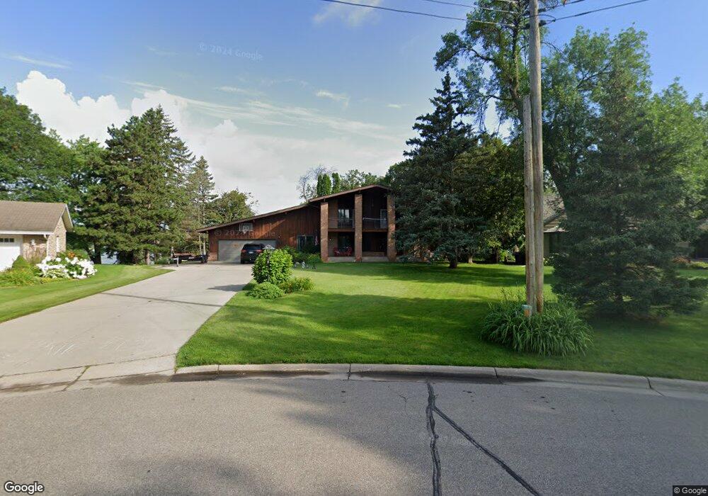
3135 Sandy Hook Dr Saint Paul, MN 55113
South Owasso NeighborhoodEstimated Value: $1,193,173 - $1,360,000
4
Beds
3
Baths
3,084
Sq Ft
$417/Sq Ft
Est. Value
About This Home
This home is located at 3135 Sandy Hook Dr, Saint Paul, MN 55113 and is currently estimated at $1,285,543, approximately $416 per square foot. 3135 Sandy Hook Dr is a home located in Ramsey County with nearby schools including Emmet D. Williams Elementary School, Roseville Area Middle School, and Roseville Area High School.
Ownership History
Date
Name
Owned For
Owner Type
Purchase Details
Closed on
Mar 20, 2018
Sold by
Lehr Camilla and Lehr John
Bought by
Lehr John and Lehr Camila
Current Estimated Value
Purchase Details
Closed on
May 13, 2013
Sold by
Lwl Properties Llc
Bought by
Lehr John
Home Financials for this Owner
Home Financials are based on the most recent Mortgage that was taken out on this home.
Original Mortgage
$660,000
Interest Rate
3.52%
Mortgage Type
New Conventional
Purchase Details
Closed on
May 2, 2013
Sold by
Lehr Cammy and Lehr John
Bought by
Lehr John and Lehr Cammy
Home Financials for this Owner
Home Financials are based on the most recent Mortgage that was taken out on this home.
Original Mortgage
$660,000
Interest Rate
3.52%
Mortgage Type
New Conventional
Create a Home Valuation Report for This Property
The Home Valuation Report is an in-depth analysis detailing your home's value as well as a comparison with similar homes in the area
Home Values in the Area
Average Home Value in this Area
Purchase History
| Date | Buyer | Sale Price | Title Company |
|---|---|---|---|
| Lehr John | -- | None Available | |
| Lehr John | $660,000 | None Available | |
| Lehr John | -- | None Available |
Source: Public Records
Mortgage History
| Date | Status | Borrower | Loan Amount |
|---|---|---|---|
| Previous Owner | Lehr John | $660,000 |
Source: Public Records
Tax History
| Year | Tax Paid | Tax Assessment Tax Assessment Total Assessment is a certain percentage of the fair market value that is determined by local assessors to be the total taxable value of land and additions on the property. | Land | Improvement |
|---|---|---|---|---|
| 2025 | $14,830 | $1,267,900 | $403,300 | $864,600 |
| 2023 | $14,830 | $1,024,000 | $403,300 | $620,700 |
| 2022 | $16,498 | $1,053,800 | $403,300 | $650,500 |
| 2021 | $14,856 | $1,041,600 | $403,300 | $638,300 |
| 2020 | $14,030 | $939,400 | $403,300 | $536,100 |
| 2019 | $12,436 | $854,000 | $403,300 | $450,700 |
| 2018 | $12,994 | $760,500 | $403,300 | $357,200 |
| 2017 | $12,646 | $764,900 | $403,300 | $361,600 |
| 2016 | $12,634 | $0 | $0 | $0 |
| 2015 | $11,152 | $772,200 | $403,300 | $368,900 |
| 2014 | $11,462 | $0 | $0 | $0 |
Source: Public Records
Map
Nearby Homes
- 340 S Owasso Blvd W
- 613 S Owasso Blvd W
- 479 Centennial Dr
- 3318 W Owasso Blvd
- 405 Judith Ave
- 3098 Victoria St N
- 3399 Kent St Unit 211
- 255 County Road C2 W
- 3421 Kent St Unit 614
- 3421 Kent St Unit 603
- 2972 Woodbridge St
- 3431 Kent St Unit 801
- 3461 Kent St Unit 1116
- 3461 Kent St Unit 1005
- 972 Lydia Dr W
- 3475 Chandler Rd
- 953 Lydia Ave W
- 632 Harriet Ave
- 2730 Dale St N Unit D309
- 2870 Victoria St N
- 3141 Sandy Hook Dr
- 3125 Sandy Hook Dr
- 3153 Sandy Hook Dr
- 3115 Sandy Hook Dr
- 3120 Sandy Hook Dr
- 3161 Sandy Hook Dr
- 3105 Sandy Hook Dr
- 3063 Little Bay Rd
- 3050 Little Bay Rd
- 3097 Sandy Hook Dr
- 3053 Little Bay Rd
- 3040 Little Bay Rd
- 3087 Sandy Hook Dr
- 3043 Little Bay Rd
- 3088 Sandy Hook Dr
- 3050 Sandy Hook Dr
- 3030 Little Bay Rd
- 3031 Little Bay Rd
- 3079 Sandy Hook Dr
- 3042 Sandy Hook Dr
Your Personal Tour Guide
Ask me questions while you tour the home.