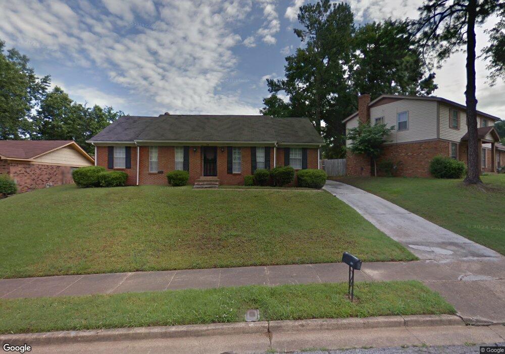
3140 Dumbeath Rd Memphis, TN 38128
Frayser NeighborhoodEstimated Value: $139,143 - $187,000
3
Beds
2
Baths
1,726
Sq Ft
$99/Sq Ft
Est. Value
About This Home
This home is located at 3140 Dumbeath Rd, Memphis, TN 38128 and is currently estimated at $170,036, approximately $98 per square foot. 3140 Dumbeath Rd is a home located in Shelby County with nearby schools including Scenic Hills Elementary School, Raleigh Egypt High School, and Promise Academy - Spring Hill.
Ownership History
Date
Name
Owned For
Owner Type
Purchase Details
Closed on
Sep 28, 2013
Sold by
Earl Gloria and Hill Marcus D
Bought by
Earl Gloria A
Current Estimated Value
Purchase Details
Closed on
Dec 19, 2011
Sold by
Earl Gloria A
Bought by
Earl Gloria and Hill Marcus D
Purchase Details
Closed on
Jan 5, 2007
Sold by
Hill Marcus D
Bought by
Earl Gloria A
Purchase Details
Closed on
Jan 6, 2005
Sold by
Earl Gloria A
Bought by
Von Toby Land Trust
Purchase Details
Closed on
Dec 2, 2004
Sold by
Hill Marcus D
Bought by
Earl Gloria A
Purchase Details
Closed on
Apr 29, 2004
Sold by
Earl Gloria A
Bought by
Von Toby Land Trust
Purchase Details
Closed on
Jun 5, 2003
Sold by
Hill Marcus D
Bought by
Earl Gloria A
Purchase Details
Closed on
Jul 13, 2002
Sold by
Earl Gloria A
Bought by
Hill Marcus D
Create a Home Valuation Report for This Property
The Home Valuation Report is an in-depth analysis detailing your home's value as well as a comparison with similar homes in the area
Home Values in the Area
Average Home Value in this Area
Purchase History
| Date | Buyer | Sale Price | Title Company |
|---|---|---|---|
| Earl Gloria A | -- | None Available | |
| Earl Gloria | -- | None Available | |
| Earl Gloria A | -- | None Available | |
| Von Toby Land Trust | -- | -- | |
| Earl Gloria A | -- | -- | |
| Von Toby Land Trust | -- | -- | |
| Earl Gloria A | -- | -- | |
| Hill Marcus D | -- | -- |
Source: Public Records
Tax History
| Year | Tax Paid | Tax Assessment Tax Assessment Total Assessment is a certain percentage of the fair market value that is determined by local assessors to be the total taxable value of land and additions on the property. | Land | Improvement |
|---|---|---|---|---|
| 2025 | $874 | $41,350 | $3,750 | $37,600 |
| 2024 | $874 | $25,775 | $2,900 | $22,875 |
| 2023 | $1,570 | $25,775 | $2,900 | $22,875 |
| 2022 | $1,570 | $25,775 | $2,900 | $22,875 |
| 2021 | $1,866 | $25,775 | $2,900 | $22,875 |
| 2020 | $1,360 | $18,775 | $2,900 | $15,875 |
| 2019 | $600 | $18,775 | $2,900 | $15,875 |
| 2018 | $600 | $18,775 | $2,900 | $15,875 |
| 2017 | $614 | $18,775 | $2,900 | $15,875 |
| 2016 | $768 | $17,575 | $0 | $0 |
| 2014 | $768 | $17,575 | $0 | $0 |
Source: Public Records
Map
Nearby Homes
- 3153 Kirkcaldy Rd
- 3212 Whitney Ave
- 0 Helmsdale Rd
- 0 Taransay Rd
- 3228 Whitney Ave
- 3034 Bannockburn Rd
- 3131 Peggy Rd
- 3010 Falkirk Rd
- 2976 Scotland Rd
- 2958 E Glengarry Rd
- 3034 Laurencekirk Rd
- 29 Felton Rd
- 3480 Tallyho Rd
- 3095 Spring Hill Dr
- 2995 Frayser-Raleigh Rd
- 2869 Dumbarton Oaks Dr
- 3457 E Rolling Woods Dr
- 0 Allen Rd Unit 10207133
- 3323 Scenic Hwy
- 3485 Felton Rd
- 3134 Dumbeath Rd
- 3213 Braemar Dr
- 3126 Dumbeath Rd
- 3221 Braemar Dr
- 3143 Dumbeath Rd
- 3137 Dumbeath Rd
- 3227 Braemar Dr
- 3151 Dumbeath Rd
- 3120 Dumbeath Rd
- 3127 Dumbeath Rd
- 3208 Braemar Dr
- 3134 Taransay Rd Unit 15
- 3216 Braemar Dr
- 3121 Dumbeath Rd
- 3204 Braemar Dr
- 3138 Taransay Rd Unit 16
- 3233 Braemar Dr
- 3112 Dumbeath Rd
- 3222 Braemar Dr
- 3132 Taransay Rd Unit 14
Your Personal Tour Guide
Ask me questions while you tour the home.