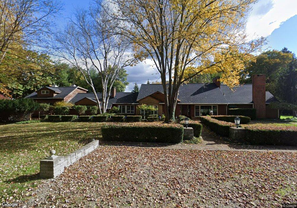
31400 Kennoway Ct Unit Bldg-Unit Beverly Hills, MI 48025
Estimated Value: $1,058,000 - $1,312,000
3
Beds
4
Baths
5,460
Sq Ft
$210/Sq Ft
Est. Value
About This Home
This home is located at 31400 Kennoway Ct Unit Bldg-Unit, Beverly Hills, MI 48025 and is currently estimated at $1,148,604, approximately $210 per square foot. 31400 Kennoway Ct Unit Bldg-Unit is a home located in Oakland County with nearby schools including Wylie E. Groves High School, Beverly Elementary School, and Berkshire Middle School.
Ownership History
Date
Name
Owned For
Owner Type
Purchase Details
Closed on
Jul 27, 2020
Sold by
Hanson Catherine
Bought by
Silber Anthony and Johnson Mary
Current Estimated Value
Home Financials for this Owner
Home Financials are based on the most recent Mortgage that was taken out on this home.
Original Mortgage
$510,400
Outstanding Balance
$453,597
Interest Rate
3.1%
Mortgage Type
New Conventional
Estimated Equity
$695,007
Purchase Details
Closed on
Sep 5, 1997
Sold by
Molnar Peter M
Bought by
Hanson Howard
Home Financials for this Owner
Home Financials are based on the most recent Mortgage that was taken out on this home.
Original Mortgage
$211,500
Interest Rate
7.54%
Create a Home Valuation Report for This Property
The Home Valuation Report is an in-depth analysis detailing your home's value as well as a comparison with similar homes in the area
Home Values in the Area
Average Home Value in this Area
Purchase History
| Date | Buyer | Sale Price | Title Company |
|---|---|---|---|
| Silber Anthony | $732,500 | Title One Inc | |
| Hanson Howard | $282,000 | -- |
Source: Public Records
Mortgage History
| Date | Status | Borrower | Loan Amount |
|---|---|---|---|
| Open | Silber Anthony | $510,400 | |
| Previous Owner | Hanson Howard | $211,500 |
Source: Public Records
Tax History Compared to Growth
Tax History
| Year | Tax Paid | Tax Assessment Tax Assessment Total Assessment is a certain percentage of the fair market value that is determined by local assessors to be the total taxable value of land and additions on the property. | Land | Improvement |
|---|---|---|---|---|
| 2024 | $13,488 | $391,100 | $0 | $0 |
| 2023 | $13,378 | $385,040 | $0 | $0 |
| 2022 | $14,642 | $373,340 | $0 | $0 |
| 2021 | $14,785 | $358,850 | $0 | $0 |
| 2020 | $6,614 | $357,530 | $0 | $0 |
| 2019 | $5,207 | $348,810 | $0 | $0 |
| 2018 | $7,494 | $300,290 | $0 | $0 |
| 2017 | $7,475 | $300,290 | $0 | $0 |
| 2016 | $7,490 | $286,650 | $0 | $0 |
| 2015 | -- | $264,740 | $0 | $0 |
| 2014 | -- | $222,420 | $0 | $0 |
| 2011 | -- | $178,640 | $0 | $0 |
Source: Public Records
Map
Nearby Homes
- 31462 Waltham Rd
- 19938 Waltham Rd
- 19905 Beverly Rd
- 19710 W 13 Mile Rd Unit 107
- 19710 W 13 Mile Rd Unit 111
- 19710 W 13 Mile Rd Unit 101
- 19710 W 13 Mile Rd Unit 105
- 19710 W 13 Mile Rd Unit 201
- 19710 W 13 Mile Rd Unit 108
- 31035 Tremont Ln
- 21700 W 13 Mile Rd
- 31018 Pickwick Ln
- 31430 Lahser Rd
- 19332 Beverly Rd
- 19245 Eldridge Ln
- 31112 Pickwick Ln
- 20079 Forestwood St
- 20666 Southome St
- 22025 Orchard Way
- 21993 Riverview Dr
- 31400 Kennoway Ct
- 31360 Kennoway Ct
- 20440 Ronsdale Dr
- 31381 Kennoway Ct
- 20435 Ronsdale Dr
- 31355 Kennoway Ct
- 20730 Kennoway Cir
- 31505 Kennoway Ct
- 20410 Ronsdale Dr
- 20415 Ronsdale Dr
- 20755 Kennoway Cir
- 20754 Kennoway Cir
- 20392 Ronsdale Dr
- 20724 Kennoway Cir
- 31533 Kennoway Ct
- 20351 Ronsdale Dr
- 31560 Eastlady Dr
- 31555 Kennoway Ct
- 20285 Douglas Ct
- 20775 Kennoway Cir