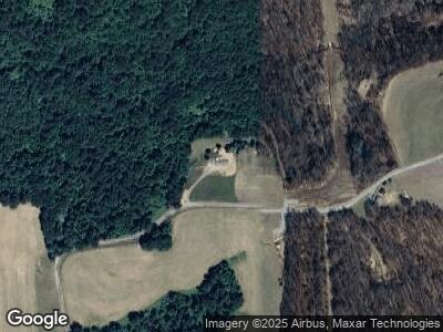
315 Adams Rd Templeton, PA 16259
Boggs Township NeighborhoodEstimated Value: $180,718 - $230,000
3
Beds
1
Bath
1,316
Sq Ft
$155/Sq Ft
Est. Value
About This Home
This home is located at 315 Adams Rd, Templeton, PA 16259 and is currently estimated at $204,573, approximately $155 per square foot. 315 Adams Rd is a home with nearby schools including Dayton Elementary School, Shannock Valley Elementary Schoo, and Elderton Elementary School.
Ownership History
Date
Name
Owned For
Owner Type
Purchase Details
Closed on
Feb 14, 2014
Sold by
Atherton Michelle L and Atherton Robert Dale
Bought by
Atherton Robert D
Current Estimated Value
Purchase Details
Closed on
Feb 27, 2009
Sold by
Johns Hope L
Bought by
Atherton Robert Dale and Atherton Michelle L
Create a Home Valuation Report for This Property
The Home Valuation Report is an in-depth analysis detailing your home's value as well as a comparison with similar homes in the area
Home Values in the Area
Average Home Value in this Area
Purchase History
| Date | Buyer | Sale Price | Title Company |
|---|---|---|---|
| Atherton Robert D | -- | None Available | |
| Atherton Robert Dale | -- | None Available |
Source: Public Records
Mortgage History
| Date | Status | Borrower | Loan Amount |
|---|---|---|---|
| Open | Atherton Robert D | $140,000 | |
| Closed | Atherton Robert D | $110,000 | |
| Closed | Atherton Robert D | $75,436 |
Source: Public Records
Tax History Compared to Growth
Tax History
| Year | Tax Paid | Tax Assessment Tax Assessment Total Assessment is a certain percentage of the fair market value that is determined by local assessors to be the total taxable value of land and additions on the property. | Land | Improvement |
|---|---|---|---|---|
| 2025 | $3,137 | $37,370 | $22,590 | $14,780 |
| 2024 | $2,950 | $37,370 | $22,590 | $14,780 |
| 2023 | $2,547 | $37,370 | $22,590 | $14,780 |
| 2022 | $2,547 | $37,370 | $22,590 | $14,780 |
| 2021 | $2,547 | $37,370 | $22,590 | $14,780 |
| 2020 | $2,547 | $37,370 | $22,590 | $14,780 |
| 2019 | $2,547 | $37,370 | $22,590 | $14,780 |
| 2018 | $2,544 | $32,265 | $11,155 | $21,110 |
| 2017 | $2,525 | $37,370 | $22,590 | $14,780 |
| 2016 | $2,525 | $37,370 | $22,590 | $14,780 |
| 2015 | -- | $37,370 | $22,590 | $14,780 |
| 2014 | -- | $22,590 | $15,200 | $7,390 |
Source: Public Records
Map
Nearby Homes
- 0 State Route 1034
- 160 Cornman Rd
- 231 Stone Ave
- 238 3rd St
- 712 Stewartson Rd
- 801 Pennsylvania 28
- 590 Rimer Hill Rd
- 109 3rd St
- 122 Bells Ln
- 109 Center Dr
- 153 State Route 1035
- 1154 Deer Rd
- 229 Millenium Dr
- 0 Rte 422 Unit 1672859
- 180 Green Brae Rd
- 232 Clearfield Pike
- 1520 Orr Ave
- 129 Green Brae Rd
- 119 6th St
- 1502 N Grant Ave