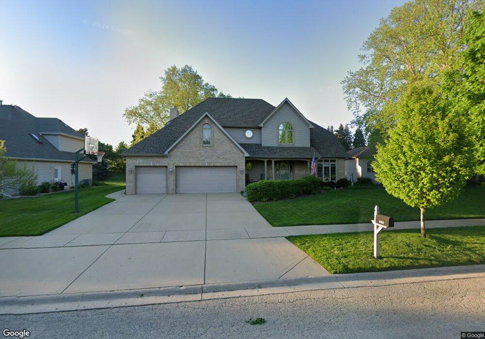
315 Ash Grove Ln Oswego, IL 60543
Northwest Oswego NeighborhoodEstimated Value: $527,000 - $569,000
4
Beds
3
Baths
2,845
Sq Ft
$191/Sq Ft
Est. Value
About This Home
This home is located at 315 Ash Grove Ln, Oswego, IL 60543 and is currently estimated at $542,508, approximately $190 per square foot. 315 Ash Grove Ln is a home located in Kendall County with nearby schools including Fox Chase Elementary School, Traughber Junior High School, and Oswego High School.
Ownership History
Date
Name
Owned For
Owner Type
Purchase Details
Closed on
Jan 26, 2001
Sold by
Gargo Jerry D and Kauffman Roy Albert
Bought by
Hathaway Steven and Hathaway Donna Marie L
Current Estimated Value
Home Financials for this Owner
Home Financials are based on the most recent Mortgage that was taken out on this home.
Original Mortgage
$120,000
Interest Rate
7.22%
Purchase Details
Closed on
Sep 21, 1999
Sold by
Standard Bank & Trust Company
Bought by
Gargo Jerry D and Kauffman Roy Albert
Home Financials for this Owner
Home Financials are based on the most recent Mortgage that was taken out on this home.
Original Mortgage
$43,140
Interest Rate
7.55%
Create a Home Valuation Report for This Property
The Home Valuation Report is an in-depth analysis detailing your home's value as well as a comparison with similar homes in the area
Home Values in the Area
Average Home Value in this Area
Purchase History
| Date | Buyer | Sale Price | Title Company |
|---|---|---|---|
| Hathaway Steven | $263,000 | Law Title Insurance Co Inc | |
| Gargo Jerry D | $54,500 | -- |
Source: Public Records
Mortgage History
| Date | Status | Borrower | Loan Amount |
|---|---|---|---|
| Closed | Hathaway Steven | $120,000 | |
| Previous Owner | Gargo Jerry D | $43,140 |
Source: Public Records
Tax History Compared to Growth
Tax History
| Year | Tax Paid | Tax Assessment Tax Assessment Total Assessment is a certain percentage of the fair market value that is determined by local assessors to be the total taxable value of land and additions on the property. | Land | Improvement |
|---|---|---|---|---|
| 2024 | $11,572 | $150,899 | $16,512 | $134,387 |
| 2023 | $10,442 | $135,008 | $14,773 | $120,235 |
| 2022 | $10,442 | $122,568 | $13,412 | $109,156 |
| 2021 | $10,069 | $114,482 | $13,412 | $101,070 |
| 2020 | $9,912 | $112,500 | $13,412 | $99,088 |
| 2019 | $9,760 | $109,223 | $13,021 | $96,202 |
| 2018 | $9,693 | $103,372 | $13,021 | $90,351 |
| 2017 | $9,640 | $99,897 | $13,021 | $86,876 |
| 2016 | $9,114 | $93,091 | $13,021 | $80,070 |
| 2015 | $8,443 | $82,675 | $11,225 | $71,450 |
| 2014 | -- | $75,807 | $11,225 | $64,582 |
| 2013 | -- | $74,880 | $11,225 | $63,655 |
Source: Public Records
Map
Nearby Homes
- 238 Willowwood Dr
- 435 Fawn Dr
- 805 Cougar Ln
- 338 Millstream Ln Unit 1
- 409 Fawn Dr
- 458 Greenview Ln
- 514 Bentson St
- 602 Clearwater Ct Unit 2
- 173 Dolores St
- LOT 10 SW Station Dr
- 608 Clearwater Ct
- 125 Presidential Blvd Unit 3248
- 505 Parkland Ct
- 107 Kristine St
- 517 Meadowwood Ln Unit 3
- 618 Pineridge Dr N Unit 618
- 614 Pineridge Dr N Unit 43
- 5161 US Highway 34
- 2100 Light Rd Unit 109
- 5055 U S 34
- 317 Ash Grove Ln
- 313 Ash Grove Ln
- LOT 7 Mill Rd
- Lot 8 Mill Rd
- 311 Ash Grove Ln
- 319 Ash Grove Ln
- 314 Ash Grove Ln
- 316 Ash Grove Ln
- 312 Ash Grove Ln
- 321 Ash Grove Ln
- 309 Ash Grove Ln
- 116 Willowwood Dr N
- 318 Ash Grove Ln
- 310 Ash Grove Ln
- 114 Willowwood Dr N
- 118 Willowwood Dr N
- 320 Ash Grove Ln
- 308 Ash Grove Ln
- 227 Willowwood Dr
- 225 Willowwood Dr