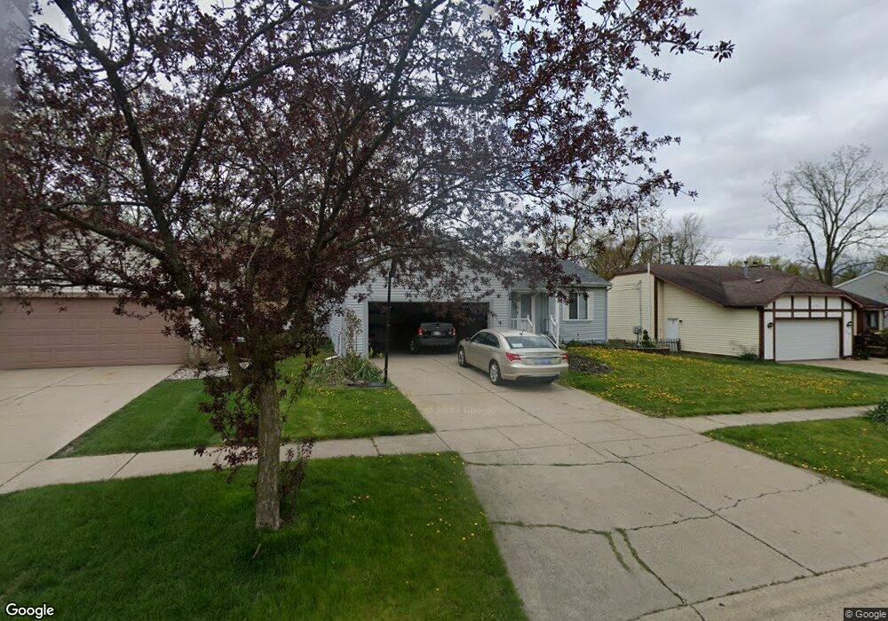
315 Bronco Way Lansing, MI 48917
Estimated Value: $227,000 - $245,000
3
Beds
2
Baths
1,752
Sq Ft
$136/Sq Ft
Est. Value
About This Home
This home is located at 315 Bronco Way, Lansing, MI 48917 and is currently estimated at $238,648, approximately $136 per square foot. 315 Bronco Way is a home located in Eaton County with nearby schools including Waverly Senior High School, Greater Lansing Adventist School, and St. Gerard Elementary School.
Ownership History
Date
Name
Owned For
Owner Type
Purchase Details
Closed on
Nov 14, 2019
Sold by
Johnson Tresa A
Bought by
Grossman Tresa A and Grossman Richard E
Current Estimated Value
Purchase Details
Closed on
Mar 10, 2006
Sold by
Neal Tresa A
Bought by
Neal Tresa A and Johnson Tresa A
Home Financials for this Owner
Home Financials are based on the most recent Mortgage that was taken out on this home.
Original Mortgage
$60,500
Interest Rate
6.22%
Mortgage Type
New Conventional
Create a Home Valuation Report for This Property
The Home Valuation Report is an in-depth analysis detailing your home's value as well as a comparison with similar homes in the area
Home Values in the Area
Average Home Value in this Area
Purchase History
| Date | Buyer | Sale Price | Title Company |
|---|---|---|---|
| Grossman Tresa A | -- | None Available | |
| Neal Tresa A | -- | Cislo Title Co |
Source: Public Records
Mortgage History
| Date | Status | Borrower | Loan Amount |
|---|---|---|---|
| Previous Owner | Neal Tresa A | $60,500 |
Source: Public Records
Tax History Compared to Growth
Tax History
| Year | Tax Paid | Tax Assessment Tax Assessment Total Assessment is a certain percentage of the fair market value that is determined by local assessors to be the total taxable value of land and additions on the property. | Land | Improvement |
|---|---|---|---|---|
| 2025 | $4,637 | $103,000 | $0 | $0 |
| 2024 | $2,566 | $94,700 | $0 | $0 |
| 2023 | $2,444 | $86,200 | $0 | $0 |
| 2022 | $4,072 | $79,900 | $0 | $0 |
| 2021 | $4,377 | $74,500 | $0 | $0 |
| 2020 | $3,899 | $72,000 | $0 | $0 |
| 2019 | $2,933 | $69,004 | $0 | $0 |
| 2018 | $2,879 | $66,700 | $0 | $0 |
| 2017 | $2,810 | $64,500 | $0 | $0 |
| 2016 | -- | $63,600 | $0 | $0 |
| 2015 | -- | $62,600 | $0 | $0 |
| 2014 | -- | $59,232 | $0 | $0 |
| 2013 | -- | $58,300 | $0 | $0 |
Source: Public Records
Map
Nearby Homes
- 205 Renker Rd
- 215 Winifred Ave Unit A & B
- 531 Harriet Ave
- 4120 Arlene Dr
- 0000 N Dibble Ave
- 210 Park Meadows Dr Unit 25
- 4220 Otis St
- 2517 W Michigan Ave
- 3707 W Michigan Ave
- 4819 Moultrie Cir
- 516 Hume Blvd
- 1049 Maycroft Rd
- 612 S Dibble Blvd
- 4616 W St Joe Hwy
- 1031 Mall Dr E
- 3435 Hagan St
- 918 Harvest Ln
- 1222 Ravenswood Dr
- 240 N Deerfield Ave
- 1018 Pickton Dr
- 319 Bronco Way
- 307 Bronco Way
- 325 Bronco Way
- 312 Harriet Ave
- 306 Harriet Ave
- 316 Harriet Ave
- 320 Harriet Ave
- 318 Bronco Way
- 333 Bronco Way
- 312 Bronco Way
- 324 Bronco Way
- 304 Bronco Way
- 230 Harriet Ave
- 326 Harriet Ave
- 330 Bronco Way
- 339 Bronco Way
- 4411 Colt Run
- 4405 Colt Run
- 228 Harriet Ave
- 338 Bronco Way