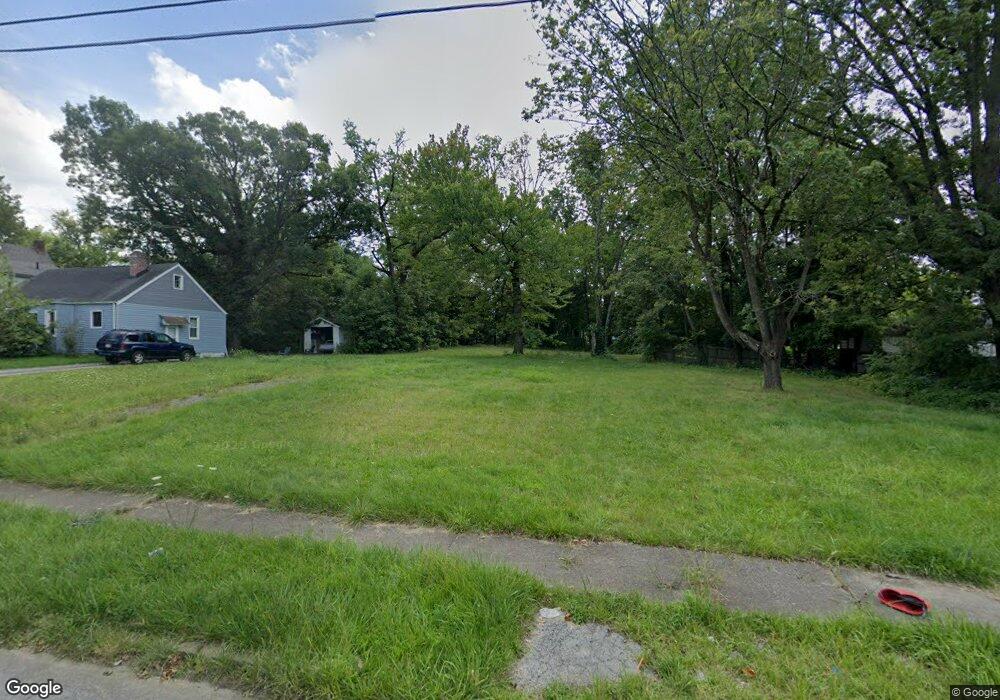
315 E Boston Ave Youngstown, OH 44507
Cottage Grove NeighborhoodEstimated Value: $30,000 - $47,134
3
Beds
2
Baths
1,358
Sq Ft
$28/Sq Ft
Est. Value
About This Home
This home is located at 315 E Boston Ave, Youngstown, OH 44507 and is currently estimated at $38,567, approximately $28 per square foot. 315 E Boston Ave is a home located in Mahoning County with nearby schools including Taft Elementary School, East High School, and Horizon Science Academy - Youngstown.
Ownership History
Date
Name
Owned For
Owner Type
Purchase Details
Closed on
Nov 15, 2010
Sold by
Weathers Gerald L
Bought by
Poon Anson
Current Estimated Value
Purchase Details
Closed on
Mar 5, 2010
Sold by
Secretary Of Housing & Urban Development
Bought by
Weathers Gerald L
Purchase Details
Closed on
Apr 6, 2009
Sold by
Minter William H and Minter Juanita
Bought by
Midfirst Bank
Purchase Details
Closed on
Mar 10, 2009
Sold by
Midfirst Bank
Bought by
The Secretary Of Housing & Urban Develop
Purchase Details
Closed on
Mar 16, 1990
Bought by
Minter William H and Minter J
Create a Home Valuation Report for This Property
The Home Valuation Report is an in-depth analysis detailing your home's value as well as a comparison with similar homes in the area
Home Values in the Area
Average Home Value in this Area
Purchase History
| Date | Buyer | Sale Price | Title Company |
|---|---|---|---|
| Poon Anson | $8,300 | Attorney | |
| Weathers Gerald L | $11,500 | Attorney | |
| Midfirst Bank | $24,000 | None Available | |
| The Secretary Of Housing & Urban Develop | -- | Attorney | |
| Minter William H | $39,900 | -- |
Source: Public Records
Tax History Compared to Growth
Tax History
| Year | Tax Paid | Tax Assessment Tax Assessment Total Assessment is a certain percentage of the fair market value that is determined by local assessors to be the total taxable value of land and additions on the property. | Land | Improvement |
|---|---|---|---|---|
| 2024 | -- | $230 | $230 | -- |
| 2022 | $0 | $260 | $260 | $0 |
| 2021 | $1 | $260 | $260 | $0 |
| 2020 | $1 | $260 | $260 | $0 |
| 2019 | $1 | $230 | $230 | $0 |
| 2018 | $469 | $230 | $230 | $0 |
| 2017 | $466 | $6,510 | $770 | $5,740 |
| 2016 | $721 | $10,870 | $770 | $10,100 |
| 2015 | $706 | $10,870 | $770 | $10,100 |
| 2014 | -- | $10,870 | $770 | $10,100 |
| 2013 | $692 | $10,870 | $770 | $10,100 |
Source: Public Records
Map
Nearby Homes
- 358 E Auburndale Ave
- 207 E Lucius Ave
- 144 Brooklyn Ave
- 524 E Philadelphia Ave
- 123 E Boston Ave
- 182 E Auburndale Ave
- 102 E Boston Ave
- 2740 South Ave
- 161 E Auburndale Ave
- 537 Cambridge Ave
- 131 E Ravenwood Ave Unit 133
- 371 Potomac Ave
- 116 Hilton Ave
- 582 Roxbury Ave
- 3726 Sunset Blvd
- 805 E Boston Ave
- 564 Miller St
- 0000 S Ave
- 365 E Midlothian Blvd
- 808 Marmion Ave
- 317 E Boston Ave
- 321 E Boston Ave
- 3111 Rush Blvd
- 3107 Rush Blvd
- 3115 Rush Blvd
- 325 E Boston Ave
- 326 E Boston Ave
- 345 E Boston Ave
- 330 E Boston Ave
- 320 E Boston Ave
- 334 E Boston Ave
- 3121 Rush Blvd
- 3023 Rush Blvd
- 338 E Boston Ave
- 3021 Rush Blvd
- 347 E Boston Ave
- 318 E Avondale Ave
- 322 E Avondale Ave
- 314 E Avondale Ave
- 3017 Rush Blvd
