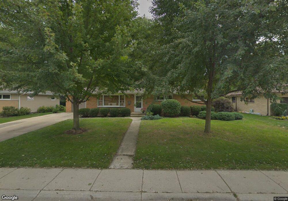
315 Eastgate St Algonquin, IL 60102
Estimated Value: $292,746 - $358,000
3
Beds
1
Bath
1,335
Sq Ft
$250/Sq Ft
Est. Value
About This Home
This home is located at 315 Eastgate St, Algonquin, IL 60102 and is currently estimated at $333,687, approximately $249 per square foot. 315 Eastgate St is a home located in McHenry County with nearby schools including Eastview Elementary School, Algonquin Middle School, and Dundee-Crown High School.
Ownership History
Date
Name
Owned For
Owner Type
Purchase Details
Closed on
May 29, 2024
Sold by
Fox Jeffrey E
Bought by
Fox Revocable Declaration Of Trust and Fox
Current Estimated Value
Purchase Details
Closed on
Oct 29, 1999
Sold by
Guillot Elizabeth C
Bought by
Fox Jeffrey E
Home Financials for this Owner
Home Financials are based on the most recent Mortgage that was taken out on this home.
Original Mortgage
$122,300
Interest Rate
7.78%
Create a Home Valuation Report for This Property
The Home Valuation Report is an in-depth analysis detailing your home's value as well as a comparison with similar homes in the area
Purchase History
| Date | Buyer | Sale Price | Title Company |
|---|---|---|---|
| Fox Revocable Declaration Of Trust | -- | None Listed On Document | |
| Fox Jeffrey E | $152,900 | -- |
Source: Public Records
Mortgage History
| Date | Status | Borrower | Loan Amount |
|---|---|---|---|
| Previous Owner | Fox Jeffrey E | $122,300 |
Source: Public Records
Tax History
| Year | Tax Paid | Tax Assessment Tax Assessment Total Assessment is a certain percentage of the fair market value that is determined by local assessors to be the total taxable value of land and additions on the property. | Land | Improvement |
|---|---|---|---|---|
| 2024 | $5,903 | $83,463 | $13,053 | $70,410 |
| 2023 | $5,579 | $74,647 | $11,674 | $62,973 |
| 2022 | $4,870 | $62,787 | $16,092 | $46,695 |
| 2021 | $4,658 | $58,494 | $14,992 | $43,502 |
| 2020 | $4,528 | $56,423 | $14,461 | $41,962 |
| 2019 | $4,408 | $54,004 | $13,841 | $40,163 |
| 2018 | $4,183 | $49,888 | $12,786 | $37,102 |
| 2017 | $4,083 | $46,997 | $12,045 | $34,952 |
| 2016 | $4,004 | $44,079 | $11,297 | $32,782 |
| 2013 | -- | $56,434 | $10,539 | $45,895 |
Source: Public Records
Map
Nearby Homes
- 719 Webster St
- 600 E Algonquin Rd
- 1188 E Algonquin Rd
- 953 Old Oak Cir
- 0 River Dr N Unit MRD12473279
- 407 La Fox River Dr
- 108 La Fox Dr
- 19N963 Manito Trail
- Lot 4 b Ryan Pkwy
- 1770 E Algonquin Rd
- 21 Division St
- 0 Natoma Trail
- lot 25 Wabican Trail
- 9 Echowood Dr
- 1730 Tanglewood Dr
- 510 Golden Valley Ln
- 324 Lake Gillilan Way Unit 242
- Lot #3-5 Hayes Rd
- 1625 Powder Horn Dr
- 1200 Hillside View
Your Personal Tour Guide
Ask me questions while you tour the home.