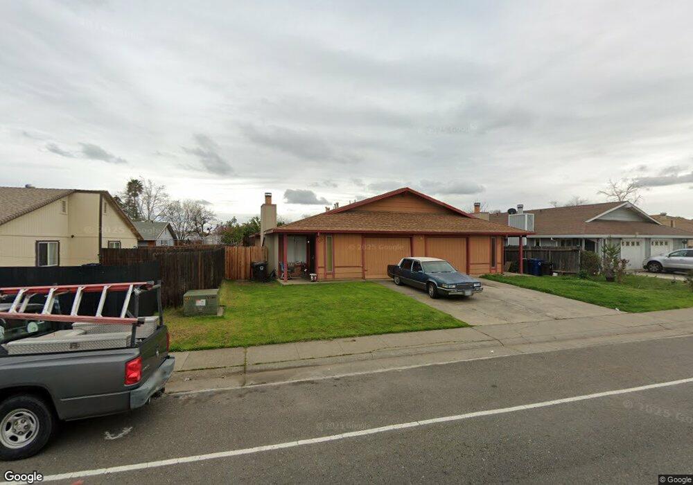
3155 Laurelhurst Dr Rancho Cordova, CA 95670
South White Rock NeighborhoodEstimated Value: $428,000 - $566,000
5
Beds
4
Baths
2,069
Sq Ft
$246/Sq Ft
Est. Value
About This Home
This home is located at 3155 Laurelhurst Dr, Rancho Cordova, CA 95670 and is currently estimated at $508,881, approximately $245 per square foot. 3155 Laurelhurst Dr is a home located in Sacramento County with nearby schools including Cordova Villa Elementary School, Mills Middle School, and Cordova High School.
Ownership History
Date
Name
Owned For
Owner Type
Purchase Details
Closed on
Jul 15, 1999
Sold by
Sell Sell Scott M Scott M and Sell Sandra J Gange
Bought by
Kumar Chandresh A and Kumar Anu R
Current Estimated Value
Home Financials for this Owner
Home Financials are based on the most recent Mortgage that was taken out on this home.
Original Mortgage
$92,150
Outstanding Balance
$25,975
Interest Rate
7.64%
Estimated Equity
$482,906
Create a Home Valuation Report for This Property
The Home Valuation Report is an in-depth analysis detailing your home's value as well as a comparison with similar homes in the area
Home Values in the Area
Average Home Value in this Area
Purchase History
| Date | Buyer | Sale Price | Title Company |
|---|---|---|---|
| Kumar Chandresh A | $95,000 | Chicago Title Co |
Source: Public Records
Mortgage History
| Date | Status | Borrower | Loan Amount |
|---|---|---|---|
| Open | Kumar Chandresh A | $92,150 |
Source: Public Records
Tax History Compared to Growth
Tax History
| Year | Tax Paid | Tax Assessment Tax Assessment Total Assessment is a certain percentage of the fair market value that is determined by local assessors to be the total taxable value of land and additions on the property. | Land | Improvement |
|---|---|---|---|---|
| 2025 | $1,816 | $145,987 | $46,095 | $99,892 |
| 2024 | $1,816 | $143,126 | $45,192 | $97,934 |
| 2023 | $1,780 | $140,320 | $44,306 | $96,014 |
| 2022 | $1,756 | $137,570 | $43,438 | $94,132 |
| 2021 | $1,721 | $134,874 | $42,587 | $92,287 |
| 2020 | $1,709 | $133,492 | $42,151 | $91,341 |
| 2019 | $1,681 | $130,875 | $41,325 | $89,550 |
| 2018 | $1,638 | $128,310 | $40,515 | $87,795 |
| 2017 | $1,597 | $125,795 | $39,721 | $86,074 |
| 2016 | $1,538 | $123,330 | $38,943 | $84,387 |
| 2015 | $1,462 | $121,479 | $38,359 | $83,120 |
| 2014 | $1,554 | $119,100 | $37,608 | $81,492 |
Source: Public Records
Map
Nearby Homes
- 10395 S White Rock Rd Unit B
- 10472 Abbottford Way
- 10276 S White Rock Rd
- 10850 Basie Way
- 10335 White Rock Rd
- 10834 Basie Way
- 10518 Mills Acres Cir
- 10806 Basie Way
- 10233 Countryside Way
- 10035 Mills Station Rd
- 10035 Mills Station Rd Unit 60
- 10035 Mills Station Rd Unit 26
- 10035 Mills Station Rd Unit 136
- 10035 Mills Station Rd Unit 153
- 10320 Malaga Way
- 2669 Dawes St
- 50 Shrine Way
- 102 Countess
- 2722 La Verta Ct
- 10204 Malaga Way
- 3161 Laurelhurst Dr
- 3100 Chettenham Dr
- 3104 Chettenham Dr
- 3175 Laurelhurst Dr
- 3108 Chettenham Dr
- 3230 Nosler Ct
- 3231 Nosler Ct
- 3156 Laurelhurst Dr
- 3152 Laurelhurst Dr
- 3179 Laurelhurst Dr
- 3112 Chettenham Dr
- 3160 Laurelhurst Dr
- 3148 Laurelhurst Dr
- 3234 Nosler Ct
- 3144 Laurelhurst Dr
- 3235 Nosler Ct
- 3116 Chettenham Dr
- 3183 Laurelhurst Dr
- 3178 Laurelhurst Dr
- 3101 Chettenham Dr