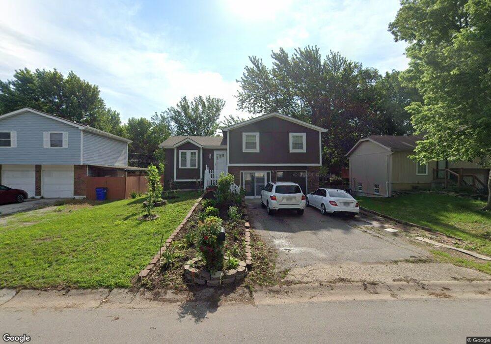
316 N Logan St Olathe, KS 66061
Estimated Value: $264,259 - $297,000
3
Beds
2
Baths
1,015
Sq Ft
$274/Sq Ft
Est. Value
About This Home
This home is located at 316 N Logan St, Olathe, KS 66061 and is currently estimated at $277,815, approximately $273 per square foot. 316 N Logan St is a home located in Johnson County with nearby schools including Fairview Elementary School, Summit Trail Middle School, and Olathe Northwest High School.
Ownership History
Date
Name
Owned For
Owner Type
Purchase Details
Closed on
Apr 16, 2024
Sold by
Nonthaveth Tom and Donphouluang Sengphachan
Bought by
Tom Nonthaveth And Sengphachan Donphouluang T and Nonthaveth
Current Estimated Value
Purchase Details
Closed on
Jan 12, 2005
Sold by
Nonthaveth Khamphoua and Nonthaveth Khamphopua
Bought by
Nonthaveth Tom
Home Financials for this Owner
Home Financials are based on the most recent Mortgage that was taken out on this home.
Original Mortgage
$95,000
Interest Rate
7%
Mortgage Type
Adjustable Rate Mortgage/ARM
Create a Home Valuation Report for This Property
The Home Valuation Report is an in-depth analysis detailing your home's value as well as a comparison with similar homes in the area
Home Values in the Area
Average Home Value in this Area
Purchase History
| Date | Buyer | Sale Price | Title Company |
|---|---|---|---|
| Tom Nonthaveth And Sengphachan Donphouluang T | -- | None Listed On Document | |
| Nonthaveth Tom | -- | Old Republic Title |
Source: Public Records
Mortgage History
| Date | Status | Borrower | Loan Amount |
|---|---|---|---|
| Previous Owner | Nonthaveth Tom | $95,000 |
Source: Public Records
Tax History Compared to Growth
Tax History
| Year | Tax Paid | Tax Assessment Tax Assessment Total Assessment is a certain percentage of the fair market value that is determined by local assessors to be the total taxable value of land and additions on the property. | Land | Improvement |
|---|---|---|---|---|
| 2024 | $2,593 | $23,747 | $4,073 | $19,674 |
| 2023 | $2,513 | $22,298 | $3,705 | $18,593 |
| 2022 | $2,195 | $19,009 | $3,367 | $15,642 |
| 2021 | $2,211 | $18,055 | $3,367 | $14,688 |
| 2020 | $2,158 | $17,469 | $2,928 | $14,541 |
| 2019 | $2,165 | $16,422 | $2,928 | $13,494 |
| 2018 | $1,930 | $15,445 | $2,344 | $13,101 |
| 2017 | $1,749 | $13,881 | $2,344 | $11,537 |
| 2016 | $1,621 | $13,214 | $2,344 | $10,870 |
| 2015 | $1,533 | $12,524 | $2,344 | $10,180 |
| 2013 | -- | $11,258 | $2,134 | $9,124 |
Source: Public Records
Map
Nearby Homes
- 612 N Logan St
- 507 W Park St
- 619 N Walnut St
- 573 W Loula St
- 631 N Willie St
- 600 W Elm St
- 397 W Johnston St
- 532 N Water St
- 109 E Cedar St
- 336 E Park St
- 540 W Northview St
- 1012 N Troost Ave
- 582 W Layton St
- 955 N Parker Terrace
- 335 S Water St
- 1425 W Poplar St
- 1002 N Parker Terrace
- 1010 N Parker Terrace
- 500 E Johnston St
- 401 S Harrison St
- 312 N Logan St
- 320 N Logan St
- 324 N Logan St
- 308 N Logan St
- 327 N Lincoln St
- 325 N Lincoln St
- 323 N Lincoln St
- 304 N Logan St
- 307 N Logan St
- 329 N Lincoln St
- 328 N Logan St
- 305 N Logan St
- 319 N Lincoln St
- 311 N Logan St
- 300 N Logan St
- 315 N Lincoln St
- 700 W Poplar St
- 303 N Logan St
- 330 N Lincoln St
- 315 N Logan St