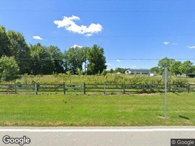
3166 State Route 321 Sardinia, OH 45171
--
Bed
--
Bath
--
Sq Ft
4.91
Acres
About This Home
This home is located at 3166 State Route 321, Sardinia, OH 45171. 3166 State Route 321 is a home located in Highland County with nearby schools including Bright Elementary School, Whiteoak Junior High School, and Whiteoak High School.
Ownership History
Date
Name
Owned For
Owner Type
Purchase Details
Closed on
Aug 1, 2018
Sold by
Harold Dorsey
Bought by
Mootz Charles R and Surv Denise L
Home Financials for this Owner
Home Financials are based on the most recent Mortgage that was taken out on this home.
Interest Rate
4.54%
Purchase Details
Closed on
Sep 15, 2009
Sold by
Carraher Farms Trucking Inc
Bought by
Dorsey Harold and Dorsey Vicky
Purchase Details
Closed on
Mar 25, 1999
Sold by
Wilson James K
Bought by
Carraher Farms Trucking Inc
Home Financials for this Owner
Home Financials are based on the most recent Mortgage that was taken out on this home.
Original Mortgage
$38,800
Interest Rate
6.85%
Mortgage Type
New Conventional
Create a Home Valuation Report for This Property
The Home Valuation Report is an in-depth analysis detailing your home's value as well as a comparison with similar homes in the area
Home Values in the Area
Average Home Value in this Area
Purchase History
| Date | Buyer | Sale Price | Title Company |
|---|---|---|---|
| Mootz Charles R | $250,000 | -- | |
| Dorsey Harold | $208,000 | Attorney | |
| Carraher Farms Trucking Inc | $53,800 | -- |
Source: Public Records
Mortgage History
| Date | Status | Borrower | Loan Amount |
|---|---|---|---|
| Closed | Mootz Charles R | -- | |
| Previous Owner | Carraher Farms Trucking Inc | $38,800 |
Source: Public Records
Tax History Compared to Growth
Tax History
| Year | Tax Paid | Tax Assessment Tax Assessment Total Assessment is a certain percentage of the fair market value that is determined by local assessors to be the total taxable value of land and additions on the property. | Land | Improvement |
|---|---|---|---|---|
| 2024 | $327 | $9,840 | $9,840 | $0 |
| 2023 | $327 | $6,970 | $6,970 | $0 |
| 2022 | $270 | $6,970 | $6,970 | $0 |
| 2021 | $276 | $6,970 | $6,970 | $0 |
| 2020 | $278 | $6,970 | $6,970 | $0 |
| 2019 | $278 | $6,970 | $6,970 | $0 |
| 2018 | $279 | $6,970 | $6,970 | $0 |
| 2017 | $236 | $5,570 | $5,570 | $0 |
| 2016 | $236 | $5,570 | $5,570 | $0 |
| 2015 | $111 | $5,570 | $5,570 | $0 |
| 2014 | $112 | $5,570 | $5,570 | $0 |
| 2013 | $110 | $5,570 | $5,570 | $0 |
Source: Public Records
Map
Nearby Homes
- 0 W Diehl Ave
- 24 N High St
- 7370 Mowrystown-Sardinia Rd
- 0 Duncanson Road Lot Unit Wp003
- 12754 5 Points Mowrystown Rd
- 13427 Stieman Rd
- 13369 Busch Rd
- 7451 Brookfield Place
- 0 N St Rt 32 Unit 1745639
- Ac Bachman Rd
- 0 Sitting Bull Dr Unit 1845345
- 1254 Gath Rd
- 175 Winchester St
- 0 Mochican Cove Unit 1833148
- 0 Creek - Lot# 2795 Dr Unit 1803735
- 124 S Main St
- 0 St Rt 134 Unit 1845159
- 12714 Freeh Rd
- 1084 E Dehaas Ln
- 12824 Heaton Rd
- 3166 State Route 321
- 4444 Ohio 321
- 3082 State Route 321
- 3180 State Route 321
- 3036 State Route 321
- 3230 State Route 321
- 3031 State Route 321
- 86 W Main St
- 82 W Main St
- 108 W Main St
- 92 W Main St
- 3004 State Route 321
- 99 W Main St
- 92 Main St
- 2981 State Route 321
- 92 W Main St
- 90 W Main St
- 88 W Main St
- 88 Main St W
- 83 W Main St
