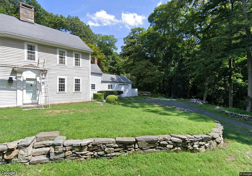
317 Joshuatown Rd Old Lyme, CT 06371
Estimated Value: $797,382 - $1,209,000
2
Beds
3
Baths
2,146
Sq Ft
$461/Sq Ft
Est. Value
About This Home
This home is located at 317 Joshuatown Rd, Old Lyme, CT 06371 and is currently estimated at $990,096, approximately $461 per square foot. 317 Joshuatown Rd is a home located in New London County with nearby schools including Lyme Consolidated School, Lyme-Old Lyme Middle School, and Lyme-Old Lyme High School.
Ownership History
Date
Name
Owned For
Owner Type
Purchase Details
Closed on
May 28, 1991
Sold by
Kilpatrick Donald G and Lavine Karen S
Bought by
Jarrebeck Francis E
Current Estimated Value
Create a Home Valuation Report for This Property
The Home Valuation Report is an in-depth analysis detailing your home's value as well as a comparison with similar homes in the area
Home Values in the Area
Average Home Value in this Area
Purchase History
| Date | Buyer | Sale Price | Title Company |
|---|---|---|---|
| Jarrebeck Francis E | $192,000 | -- | |
| Jarrebeck Francis E | $192,000 | -- |
Source: Public Records
Mortgage History
| Date | Status | Borrower | Loan Amount |
|---|---|---|---|
| Open | Jarrebeck Francis E | $225,000 | |
| Closed | Jarrebeck Francis E | $150,000 |
Source: Public Records
Tax History Compared to Growth
Tax History
| Year | Tax Paid | Tax Assessment Tax Assessment Total Assessment is a certain percentage of the fair market value that is determined by local assessors to be the total taxable value of land and additions on the property. | Land | Improvement |
|---|---|---|---|---|
| 2025 | $6,555 | $452,100 | $188,300 | $263,800 |
| 2024 | $6,555 | $452,100 | $188,300 | $263,800 |
| 2023 | $8,945 | $322,600 | $119,500 | $203,100 |
| 2022 | $6,410 | $321,300 | $119,500 | $201,800 |
| 2021 | $6,410 | $321,300 | $119,500 | $201,800 |
| 2020 | $6,410 | $321,300 | $119,500 | $201,800 |
| 2019 | $6,410 | $321,300 | $119,500 | $201,800 |
| 2018 | $6,651 | $357,600 | $151,300 | $206,300 |
| 2017 | $6,526 | $357,600 | $151,300 | $206,300 |
| 2016 | $6,526 | $357,600 | $151,300 | $206,300 |
| 2015 | $6,347 | $357,600 | $151,300 | $206,300 |
| 2014 | $6,079 | $357,600 | $151,300 | $206,300 |
Source: Public Records
Map
Nearby Homes
- 153 Mitchell Hill Rd
- 155 Joshuatown Rd
- 53 Selden Rd
- 496 Joshuatown Rd
- 45 Clark Rd
- 17 Lookout Hill
- 11 Phelps Rd
- 7 Shelter Rock Rd
- 153 Ferry Rd
- 21 River Ln
- 0 Florida Rd
- 31 Birch Hill Rd
- 41B River Rd
- 89 Book Hill Rd
- 62 River St
- 5 Mitchell Ln
- 85 River Rd Unit B7
- 11 Winter Ave
- 131 Middlesex Ave
- 257 Norwich Salem Rd
- 307 Joshuatown Rd
- 319 Joshuatown Rd
- 313 Joshuatown Rd
- 303 Joshuatown Rd
- 100 Mitchell Hill Rd
- 320 Joshuatown Rd
- 58 Mitchell Hill Rd
- 64 Mitchell Hill Rd
- 16 Josie Perkins Ln Unit 3
- 16 Josie Perkins Ln
- 302 Joshuatown Rd
- 102 Mitchell Hill Rd
- 6 Josie Perkins Ln
- 86 Mitchell Hill Rd
- 296 Joshuatown Rd
- 296A Joshuatown Rd
- 19 Josie Perkins Ln
- 30 Josie Perkins Ln
- 77 Mitchell Hill Rd
- 111 Mitchell Hill Rd