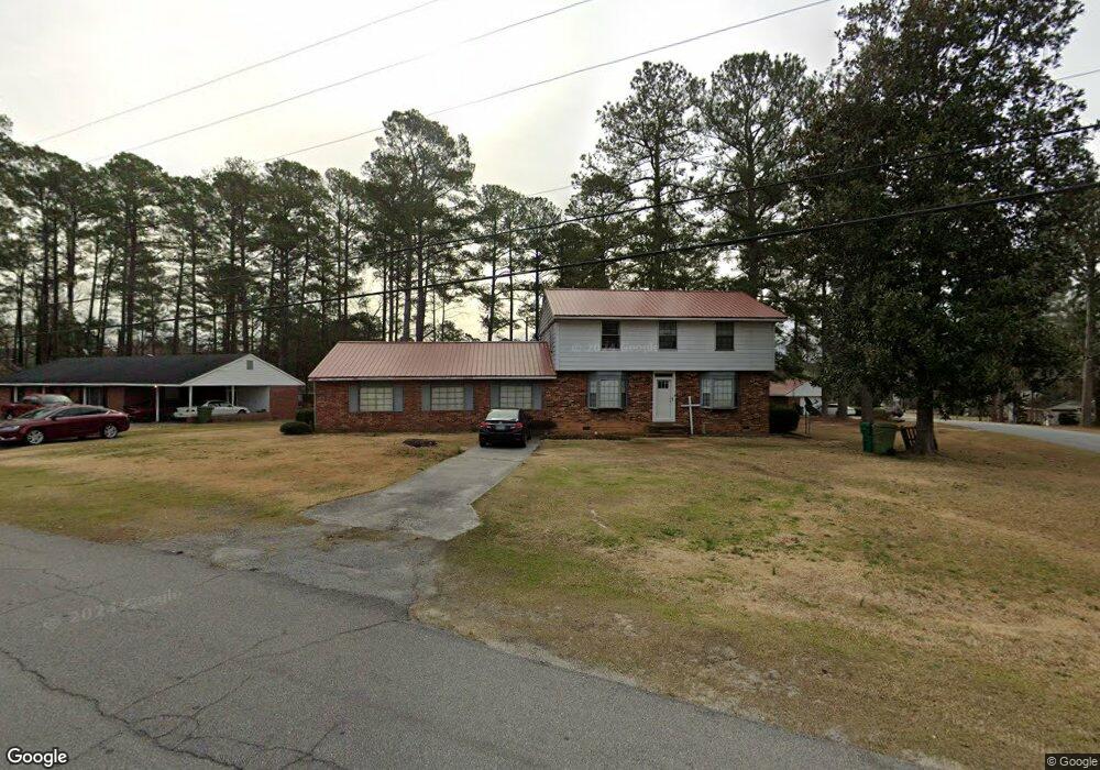
317 Michael St Thomson, GA 30824
Estimated Value: $197,000 - $238,000
4
Beds
3
Baths
2,700
Sq Ft
$82/Sq Ft
Est. Value
About This Home
This home is located at 317 Michael St, Thomson, GA 30824 and is currently estimated at $222,177, approximately $82 per square foot. 317 Michael St is a home located in McDuffie County with nearby schools including Thomson High School.
Ownership History
Date
Name
Owned For
Owner Type
Purchase Details
Closed on
Jul 29, 2005
Sold by
Bank One National Associat
Bought by
Neal Demetrius
Current Estimated Value
Home Financials for this Owner
Home Financials are based on the most recent Mortgage that was taken out on this home.
Original Mortgage
$86,689
Outstanding Balance
$44,150
Interest Rate
5.48%
Mortgage Type
FHA
Estimated Equity
$178,027
Purchase Details
Closed on
Dec 7, 2004
Sold by
Witt Allen Grady and Witt Deana
Bought by
Bank One National Assoc
Purchase Details
Closed on
Jul 1, 2002
Sold by
Usry Gloria E
Bought by
Witt Allen Grady
Purchase Details
Closed on
Apr 6, 1977
Sold by
Usry Henry T and Usry Gloria E
Bought by
Usry Gloria E
Create a Home Valuation Report for This Property
The Home Valuation Report is an in-depth analysis detailing your home's value as well as a comparison with similar homes in the area
Home Values in the Area
Average Home Value in this Area
Purchase History
| Date | Buyer | Sale Price | Title Company |
|---|---|---|---|
| Neal Demetrius | $88,050 | -- | |
| Bank One National Assoc | $113,900 | -- | |
| Witt Allen Grady | $90,500 | -- | |
| Usry Gloria E | -- | -- |
Source: Public Records
Mortgage History
| Date | Status | Borrower | Loan Amount |
|---|---|---|---|
| Open | Neal Demetrius | $86,689 |
Source: Public Records
Tax History Compared to Growth
Tax History
| Year | Tax Paid | Tax Assessment Tax Assessment Total Assessment is a certain percentage of the fair market value that is determined by local assessors to be the total taxable value of land and additions on the property. | Land | Improvement |
|---|---|---|---|---|
| 2025 | $2,532 | $80,183 | $3,294 | $76,889 |
| 2024 | $2,532 | $75,808 | $2,844 | $72,964 |
| 2023 | $2,426 | $72,701 | $2,700 | $70,001 |
| 2022 | $1,348 | $37,338 | $1,800 | $35,538 |
| 2021 | $1,086 | $30,001 | $1,800 | $28,201 |
| 2020 | $1,468 | $41,839 | $7,513 | $34,326 |
| 2019 | $1,480 | $41,839 | $7,513 | $34,326 |
| 2018 | $1,496 | $41,839 | $7,513 | $34,326 |
| 2017 | $1,343 | $41,839 | $7,513 | $34,326 |
| 2016 | $1,295 | $40,207 | $7,513 | $32,694 |
| 2015 | $1,146 | $40,206 | $7,513 | $32,694 |
| 2014 | $1,150 | $40,207 | $7,513 | $32,694 |
| 2013 | -- | $40,206 | $7,513 | $32,693 |
Source: Public Records
Map
Nearby Homes
- 323 Michael St
- 812 Austin St
- 313 Michael St
- 308 Stonewall Dr
- 316 Michael St
- 807 Austin St
- 327 Michael St
- 322 Michael St
- 811 Austin St
- 312 Stonewall Dr
- 310 Michael St
- 307 Michael St
- 326 Michael St
- 331 Michael St
- 302 Austin Cir
- 815 Austin St
- 814 Austin St
- 307 Stonewall Dr
- 330 Michael St
- 300 Austin Cir