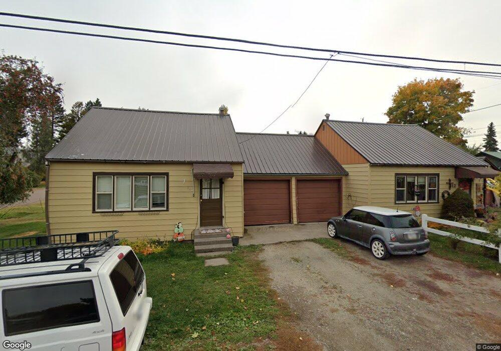
318 6th St W Whitefish, MT 59937
Estimated Value: $530,000 - $818,000
3
Beds
3
Baths
1,550
Sq Ft
$433/Sq Ft
Est. Value
About This Home
This home is located at 318 6th St W, Whitefish, MT 59937 and is currently estimated at $670,901, approximately $432 per square foot. 318 6th St W is a home located in Flathead County with nearby schools including L.A. Muldown School, Whitefish Middle School, and Whitefish High School.
Ownership History
Date
Name
Owned For
Owner Type
Purchase Details
Closed on
Dec 16, 2008
Sold by
Bank Of New York
Bought by
Woods Justin S
Current Estimated Value
Home Financials for this Owner
Home Financials are based on the most recent Mortgage that was taken out on this home.
Original Mortgage
$163,837
Outstanding Balance
$107,725
Interest Rate
6.03%
Mortgage Type
FHA
Estimated Equity
$563,176
Purchase Details
Closed on
Jun 23, 2008
Sold by
Fecontrust Company
Bought by
The Bank Of New York
Purchase Details
Closed on
Feb 7, 2006
Sold by
Rose M Horn Trust and Horn Rose M
Bought by
Horn Rose M
Home Financials for this Owner
Home Financials are based on the most recent Mortgage that was taken out on this home.
Original Mortgage
$59,600
Interest Rate
6.15%
Mortgage Type
Stand Alone Second
Create a Home Valuation Report for This Property
The Home Valuation Report is an in-depth analysis detailing your home's value as well as a comparison with similar homes in the area
Home Values in the Area
Average Home Value in this Area
Purchase History
| Date | Buyer | Sale Price | Title Company |
|---|---|---|---|
| Woods Justin S | -- | First American Title Company | |
| The Bank Of New York | $191,250 | None Available | |
| Horn Rose M | -- | None Available |
Source: Public Records
Mortgage History
| Date | Status | Borrower | Loan Amount |
|---|---|---|---|
| Open | Woods Justin S | $163,837 | |
| Previous Owner | Horn Rose M | $59,600 |
Source: Public Records
Tax History
| Year | Tax Paid | Tax Assessment Tax Assessment Total Assessment is a certain percentage of the fair market value that is determined by local assessors to be the total taxable value of land and additions on the property. | Land | Improvement |
|---|---|---|---|---|
| 2025 | $1,443 | $468,400 | $0 | $0 |
| 2024 | $1,973 | $394,300 | $0 | $0 |
| 2023 | $2,258 | $394,300 | $0 | $0 |
| 2022 | $2,082 | $248,100 | $0 | $0 |
| 2021 | $2,050 | $248,100 | $0 | $0 |
| 2020 | $1,920 | $202,600 | $0 | $0 |
| 2019 | $2,048 | $202,600 | $0 | $0 |
| 2018 | $1,954 | $190,000 | $0 | $0 |
| 2017 | $1,800 | $190,000 | $0 | $0 |
| 2016 | $1,485 | $151,900 | $0 | $0 |
| 2015 | $1,495 | $151,900 | $0 | $0 |
Source: Public Records
Map
Nearby Homes
- 704 Obrien Ave
- 602 Geddes Ave
- 841, 845, 851 Baker Ave
- NHN Baker Ave
- 139 2nd St E Unit 204
- 301 2nd St E Unit 2D
- 252 W 4th St
- 214 2nd St E Unit Suite 302
- 214 2nd St E Unit Suite 201
- 214 2nd St E Unit Suite 301
- 220 2nd St E Unit 204
- 220 2nd St E Unit 202
- 305 Sawtooth Dr
- 300 2nd St E Unit 2
- 138 Miles Ave
- 620 E 6th St
- 104 Obrien Ave Unit A
- 104 Obrien Ave Unit B
- 124 2nd St W Unit A
- 421 4th St W