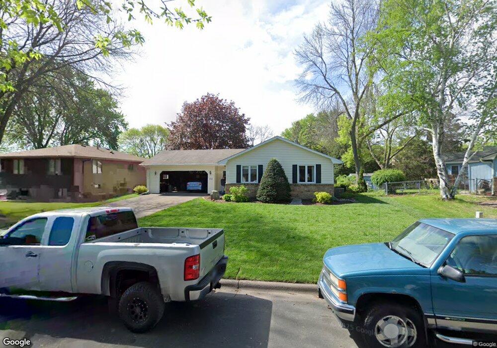
318 Kopp Dr Saint Paul, MN 55118
Estimated Value: $353,528 - $413,000
2
Beds
2
Baths
1,130
Sq Ft
$333/Sq Ft
Est. Value
About This Home
This home is located at 318 Kopp Dr, Saint Paul, MN 55118 and is currently estimated at $376,132, approximately $332 per square foot. 318 Kopp Dr is a home located in Dakota County with nearby schools including Garlough Environmental Magnet, Heritage E-STEM Magnet School, and Two Rivers High School.
Ownership History
Date
Name
Owned For
Owner Type
Purchase Details
Closed on
Nov 11, 2021
Sold by
Martin Mary Louise and William Charies Martin Living
Bought by
Mary Louise Martin Living Trust
Current Estimated Value
Purchase Details
Closed on
Dec 4, 2017
Sold by
Martin William C and Martin Mary L
Bought by
William Charles Martin Living Trust
Create a Home Valuation Report for This Property
The Home Valuation Report is an in-depth analysis detailing your home's value as well as a comparison with similar homes in the area
Home Values in the Area
Average Home Value in this Area
Purchase History
| Date | Buyer | Sale Price | Title Company |
|---|---|---|---|
| Mary Louise Martin Living Trust | -- | None Available | |
| William Charles Martin Living Trust | -- | None Available |
Source: Public Records
Tax History
| Year | Tax Paid | Tax Assessment Tax Assessment Total Assessment is a certain percentage of the fair market value that is determined by local assessors to be the total taxable value of land and additions on the property. | Land | Improvement |
|---|---|---|---|---|
| 2024 | $4,342 | $339,100 | $99,800 | $239,300 |
| 2023 | $3,844 | $355,000 | $105,700 | $249,300 |
| 2022 | $3,602 | $325,800 | $105,400 | $220,400 |
| 2021 | $3,526 | $283,400 | $91,600 | $191,800 |
| 2020 | $3,462 | $276,100 | $87,300 | $188,800 |
| 2019 | $3,197 | $264,400 | $83,100 | $181,300 |
| 2018 | $3,017 | $235,700 | $77,700 | $158,000 |
| 2017 | $2,920 | $232,400 | $74,000 | $158,400 |
| 2016 | $2,758 | $217,500 | $67,300 | $150,200 |
| 2015 | $2,774 | $188,499 | $60,072 | $128,427 |
| 2014 | -- | $183,594 | $55,459 | $128,135 |
| 2013 | -- | $172,476 | $50,649 | $121,827 |
Source: Public Records
Map
Nearby Homes
- 1251 Macarthur Ave
- 272 Butler Ave E
- 150 Westchester Dr
- 155 Conver St
- 1523 Traverse Ln
- 1520 Traverse Ln
- 1522 Traverse Ln
- Bayfield Plan at Thompson Square East
- Capri Plan at Thompson Square East
- 1531 Traverse Ln
- Hayward Plan at Thompson Square East
- Barcelona Plan at Thompson Square East
- Athens II Plan at Thompson Square East
- Athens Plan at Thompson Square East
- 1524 Traverse Ln
- 1290 Livingston Ave
- 1527 Trellis Ln
- 1526 Traverse Ln
- 1530 Trellis Ln
- 1532 Trellis Ln
Your Personal Tour Guide
Ask me questions while you tour the home.